Rezman - Ruš (on southwest ridge)
Starting point: Rezman (1000 m)
Starting point Lat/Lon: 46.3913°N 14.4688°E 
Path name: on southwest ridge
Time of walking: 2 h
Difficulty: partly demanding unmarked way
Difficulty of skiing: no data
Altitude difference: 614 m
Altitude difference (by path): 635 m
Map: Karavanke - osrednji del 1:50.000
Access to starting point:
From the Ljubljana - Jesenice highway we head to the Kranj - east exit and follow the road further in the direction of "Zgornje Jezersko". Just a few 100 m ahead from the Kanonir inn, we will notice on the left side of the main road signposts for Stegovnik, which direct us onto a steep macadam road. We then follow this ascending road past the Rezman farm to the beginning of the footpath to Stegovnik.
We can park already a little lower on one of the parking spots by the road (at the beginning of the footpath there are no appropriate parking spots).
Path description:
Above the Rezman farm, the mountain signposts for Stegovnik direct us right onto a wide ascending cart track, which we then follow past the transmitters to a marked junction. We continue right in the direction of Stegovnik on a somewhat narrower cart track, which further ascends transversely across the northeastern slopes of Bukovec. Higher up the path levels out, then brings us in a gentle descent to a smaller abandoned alpine pasture, on the edge of which stands a hunting hut.
From the hunting hut we continue on the marked path, which beyond the pasture turns gently left and then begins to ascend towards Močnikovo sedlo, which we reach after 15 minutes of further ascent. Here the blazes direct us slightly right, where after a few steps of further walking we arrive at a marked junction.
We continue in the direction of Stegovnik (sharply left Bukovec, straight down Kanonir) on the path which after a few steps of easy descent joins a gently ascending cart track, which we then follow to the point where the blazes direct us right onto a footpath ascending parallel to the cart track. Further on the path approaches a torrent stream, where it turns right and ascends steeply along its right side (left bank). Higher up the path crosses the aforementioned stream and then levels out completely. There follow a few minutes of easy walking through dense forest, after which the path brings us to the saddle named Pri lojtri, where the next marked junction is.
Here we continue sharply right in the direction of Brsnine (left Javornik, straight Stegovnik) on the marked path, which first ascends moderately through dense forest, then levels out and brings us to a cart track, which the marked path merely crosses, while we follow it to the right. Along the cart track we first walk to a smaller panoramic saddle, from there continuing gently left along a poorer path to the nearby southwestern ridge of Ruš. We continue the ascent along a poorer but well-followable path, which proceeds along and beside the aforementioned ridge. Higher up the path climbs over a short very steep slope, where there is especially in wet conditions a risk of slipping. At the top of this steep section we reach a forepeak, from which a short descent is followed by the final ascent to the main summit of Ruš.
On the way: Močnikovo sedlo (1315m), Pri lojtri (1486m)
Pictures:
 1
1 2
2 3
3 4
4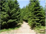 5
5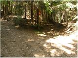 6
6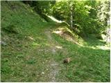 7
7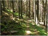 8
8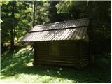 9
9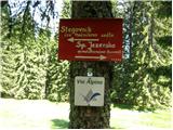 10
10 11
11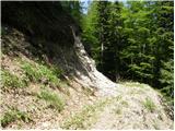 12
12 13
13 14
14 15
15 16
16 17
17 18
18 19
19 20
20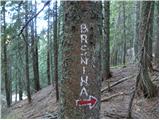 21
21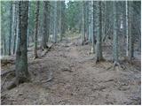 22
22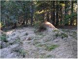 23
23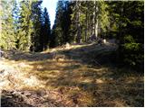 24
24 25
25 26
26 27
27 28
28 29
29 30
30 31
31 32
32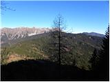 33
33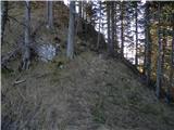 34
34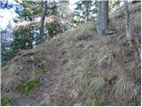 35
35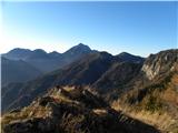 36
36 37
37 38
38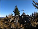 39
39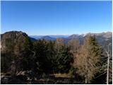 40
40 41
41