Starting point: Rezman (1000 m)
Starting point Lat/Lon: 46.3913°N 14.4688°E 
Time of walking: 2 h 15 min
Difficulty: partly demanding marked way
Difficulty of skiing: more demanding
Altitude difference: 692 m
Altitude difference (by path): 750 m
Map: Karavanke - osrednji del 1:50.000
Access to starting point:
From highway Ljubljana - Jesenice we go to the exit Kranj - east and we follow the road ahead in the direction of "Zgornje Jezersko". Only few 100 meters ahead from inn Kanonir, we will on the left side of the main road notice signposts for Stegovnik, which point us on a steep macadam road. This ascending road, we then follow past the farm Rezman to the beginning of the footpath on Stegovnik.
We can park already a little lower on one of the parking lots by the road (at the beginning of the footpath there aren't any appropriate parking spots).
Path description:
Above the farm Rezman, signposts for Stegovnik point us to the right on a wide ascending cart track which we then follow past transmitters to a marked crossing. We continue right in the direction of Stegovnik on a little narrower cart track which is further ascending diagonally on northeastern slopes of Bukovec. Higher, the path flattens, and then in a gentle descent brings us to a smaller abandoned mountain pasture, by the edge of which there is a hunting cottage.
From the hunting cottage, we continue on a marked path, which after the mountain pasture turns slightly to the left and then starts ascending towards the saddle Močnikovo sedlo, which we reach after 15 minutes of additional ascent. Here blazes point us a little to the right, where after few steps of additional walking, we step at the marked crossing.
We continue in the direction of Stegovnik (sharply left Bukovec, straight downwards Kanonir) on the path which after few steps of easy descent joins slightly ascending cart track which we then follow to the spot, where blazes point us to the right on a footpath which is ascending parallel with the cart track. Further, the path gets closer to a torrent stream, where it turns to the right and steeply ascends on its right side (left bank). Higher, the path crosses the mentioned stream and then it entirely flattens. Follows few minutes of easy walking through a dense forest and then the path brings us to a saddle named Pri Lojtri, where there is also the next marked crossing.
We continue in the direction of Stegovnik (left Javornik, right mountain pasture Brsnina) on the path which starts gradually ascending steeper and steeper. Ahead very steep path (in wet dangerous for slipping), which continues by the decaying wire fence, through a thinner forest soon brings us on the main ridge of Stegovnik. Here the path for a short time avoids the ridge on the right side, where with the help of steel cables we cross an exposed ledge. The path then returns on the ridge, which with increasingly beautiful views we follow to the peak, and we reach it after good 10 minutes of additional walking.
Pictures:
 1
1 2
2 3
3 4
4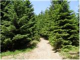 5
5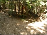 6
6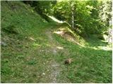 7
7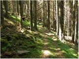 8
8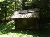 9
9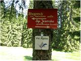 10
10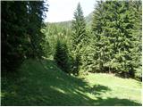 11
11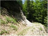 12
12 13
13 14
14 15
15 16
16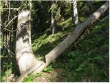 17
17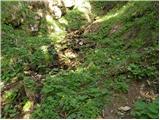 18
18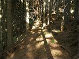 19
19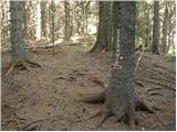 20
20 21
21 22
22 23
23 24
24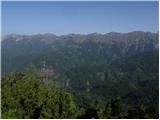 25
25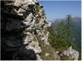 26
26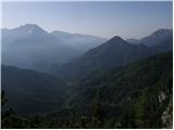 27
27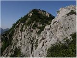 28
28 29
29 30
30 31
31