Ribniška koča - Ostruščica
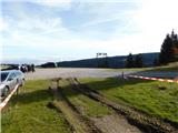
Starting point: Ribniška koča (1507 m)
Starting point Lat/Lon: 46.4974°N 15.2555°E 
Time of walking: 3 h 5 min
Difficulty: easy marked way
Difficulty of skiing: no data
Altitude difference: -9 m
Altitude difference (by path): 340 m
Map: Pohorje 1:50.000
Access to starting point:
A) From the road Maribor - Dravograd, before the settlement Brezno we turn left in the direction of Podvelka, Ribnica na Pohorju and Ribniška koča. After the bridge over the river Drava we get to Podvelka, and the road further we follow in the direction of Ribnica na Pohorju. After approximately 10 km from the bridge over Drava we get to the center of Ribnica na Pohorju, where we go left. Next follows approximately 8 km of ascent, mostly on the macadam road, to the mountain hut Ribniška koča, where we park.
B) From Dravograd we drive towards Maribor, after Radlje ob Dravi at the roundabout we leave the main road towards Maribor and we continue driving in the direction towards Vuhred, Ribnica na Pohorju and Ribniška koča. After the bridge over the river Drava we get to Vuhred, and the road further we follow in the direction of Ribnica na Pohorju. After approximately 10 km from the bridge over Drava we get to the center of Ribnica na Pohorju, where we go right. Next follows approximately 8 km of ascent, mostly on the macadam road, to the mountain hut Ribniška koča, where we park.
Path description:
From Ribniška koča we go on the path in the direction of Jezerski vrh and lake Ribniško jezero and we at first walk on the road, on which we came to the starting point and in a gentle descent leads to the saddle between Mali Črni vrh and Jezerski vrh. On the saddle, where it is also possible to park we leave the road and go on a marked footpath which at first gently and then steeply ascends to the monument on Jezerski vrh, which we reach in approximately 10 minutes of more and more panoramic ascent.
From Jezerski vrh we continue slightly left in the direction of lakes Lovrenška jezera and Rogla (left - Ribniško jezero 5 minutes) and we start descending through a thin forest. Soon from the left joins the path which leads past the lake Ribniško jezero, and we continue with at first a still moderate descent through a thin forest and then we pass into a dense forest, and the path is descending a little steeper. During the descent a short path branches off to the left towards the memorial of pilots, and we continue the descent to the saddle Šiklarica. After the saddle we again start ascending, and at few smaller crossings we follow the blazes. A little further, we go past a well, and after the well we are few minutes quite steeply ascending. Higher, the path flattens and it brings us out of the forest on the meadow Planinka, through which we are mostly gently to moderately ascending with increasingly beautiful views. Higher, the path turns right and only a little further from the left joins the path from Lovrenc na Pohorju. Follows some more of the crossing with nice views, and then the path passes into a thin forest, where it runs below plateau of lakes Lovrenška jezera, and consequently we cross a larger number of smaller streams. After few minutes of crossing, we get to a marked crossing, where we continue slightly right in the direction of Rogla (left - Lovrenška jezera, Koča na Pesku and Rogla via Lovrenška jezera).
Further, we for some time continue without large changes in altitude through the forest and then the forest gets thinner and a nice view opens up, which reaches all the way to Karawanks and Kamnik Savinja Alps. Even a little further, the path returns into the forest and on the saddle Komisija joins the path which leads via Lovrenška jezera.
We continue straight towards Rogla and in a moderate ascent, we ascend on an indistinct peak Ostruščica.
Ribniška koča - Jezerski vrh 0:15, Jezerski vrh - Ostruščica 2:50.
Description refers to a condition in October 2022, and pictures are from various periods.
Pictures:
 1
1 2
2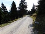 3
3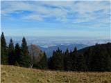 4
4 5
5 6
6 7
7 8
8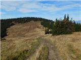 9
9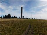 10
10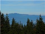 11
11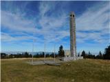 12
12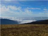 13
13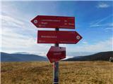 14
14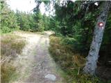 15
15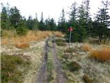 16
16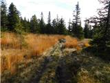 17
17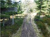 18
18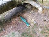 19
19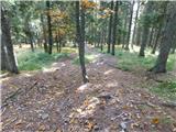 20
20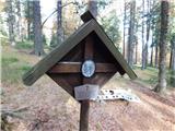 21
21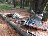 22
22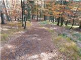 23
23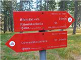 24
24 25
25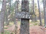 26
26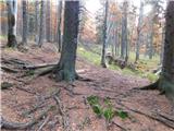 27
27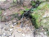 28
28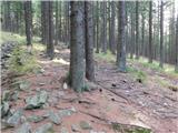 29
29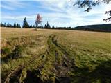 30
30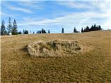 31
31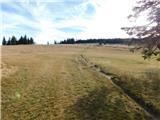 32
32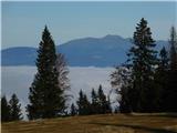 33
33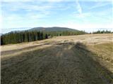 34
34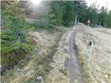 35
35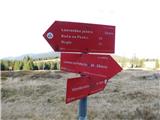 36
36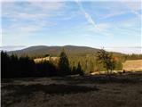 37
37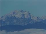 38
38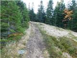 39
39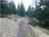 40
40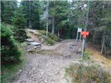 41
41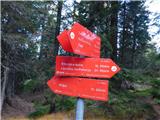 42
42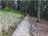 43
43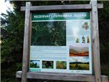 44
44 45
45 46
46 47
47 48
48 49
49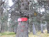 50
50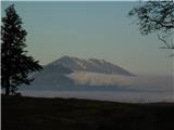 51
51 52
52 53
53 54
54 55
55 56
56