Rifugio Auronzo - Croda Fiscalina di Mezzo / Oberbachernspitze
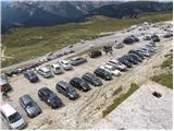
Starting point: Rifugio Auronzo (2320 m)
Starting point Lat/Lon: 46.6122°N 12.2941°E 
Time of walking: 2 h 30 min
Difficulty: easy marked way
Difficulty of skiing: easily
Altitude difference: 355 m
Altitude difference (by path): 500 m
Map: Tabacco 10 1:25.000
Access to starting point:
Access from Gorenjska: Through the border crossing Rateče we drive to Trbiž / Tarvisio, where we head onto the motorway in the direction of Udine. We leave the motorway at the exit for Tolmezzo and follow the road to the mentioned settlement. From Tolmezzo we continue in the direction of the settlement Ampezzo and mountain pass Passo della Mauria. The road then starts descending and brings us into the Cadore valley, where we continue right (left Belluno and Cortina d'Ampezzo) in the direction of the settlement Auronzo. After a few more km of driving we come to the next bigger crossroad, where we go right in the direction of Austria and Tre Cime (left Cortina d'Ampezzo). We leave the road towards Austria after another few 100m, because signs for Tre Cime point us to the right on a toll mountain road which after 7km brings us to a large parking lot near the mountain hut rifugio Auronzo.
From Primorska side: We drive on the motorway which leads over the border crossing Sežana to Trst / Trieste. Further, we drive on Italian motorway in the direction of Padova, but only to a motorway junction, where we continue in the direction of Veneto and Belluno. Near Belluno the motorway ends, and we continue in the direction of Cortina d'Ampezzo and Auronzo. When the road brings us into the Cadore valley we will get to a bigger crossroad, where the road goes towards Cortina d'Ampezzo left, and towards Auronzo right. Here we continue right towards Auronzo. Further, follow the above description.
Path description:
At the mountain hut Auronzo we go on a macadam road which leads towards the mountain hut Lavaredo slightly towards the east. After approximately 20 minutes of walking on a very panoramic road which leads below the mighty mountain walls of Tre Cime we get to the hut Lavaredo.
From the mountain hut we continue on the road, and it quickly brings us to a crossing, where we continue right in the direction of Piani di Lavaredo. The path which ahead runs on a mule track, descends past a smaller lake and then after crossing scree brings us to wide meadows, where we can mainly in the morning and evening time notice numerous marmots. Here a poorly visible path branches off to the left, which leads to Monte Paterno, and we continue on the mule track, that starts ascending and after a short ascent brings us to a nice high mountain lake "Laghi di Cengia". Just a little behind the lake, the path starts ascending steeper and turns a little to the left. During the ascent from the mule track a mountain path branches off to the right in the direction of "bivacco de Toni"; we continue straight on the path which past the ruins and smaller spring brings us to the next meadow, which we walk in a diagonal ascent towards the left. On the top of this ascent the path brings us to a crossing, where we continue right (left Monte Paterno, straight downwards rifugio Locatelli). The panoramic path then past a cross brings us to a slightly exposed, but very wide artificial ledge, behind which the path turns left and after a short descent brings us to the mountain hut Pian di Cengia.
For the ascent towards the summit of Croda Fiscalina di Mezzo we continue on the left side of the mountain hut, namely on a somewhat poorly marked, but still sufficiently visible path. The panoramic path, which ascends only gently, slowly turns to the right and a little higher brings us to a notch, from which on the left side a nice view opens into a mighty gully. The path then retreats from the ridge to the right and brings us to a military tunnel through which the mountain path runs (the tunnel is short, so a lamp is not mandatory but recommended because of the puddle in the tunnel). The path ahead starts ascending steeper and after additional 10 minutes of walking brings us to the precipitous summit.
Pictures:
 1
1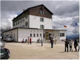 2
2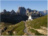 3
3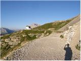 4
4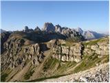 5
5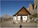 6
6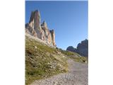 7
7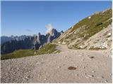 8
8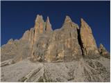 9
9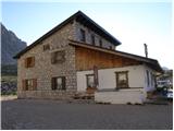 10
10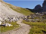 11
11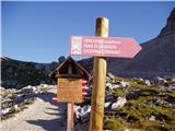 12
12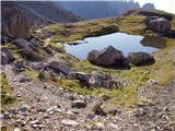 13
13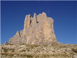 14
14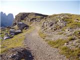 15
15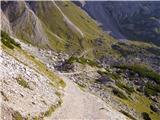 16
16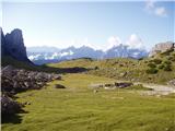 17
17 18
18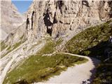 19
19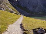 20
20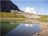 21
21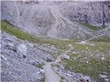 22
22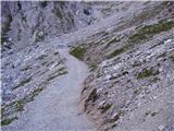 23
23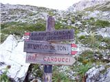 24
24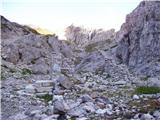 25
25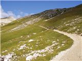 26
26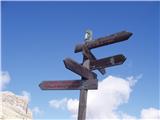 27
27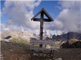 28
28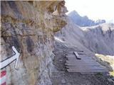 29
29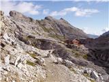 30
30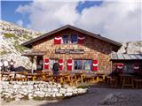 31
31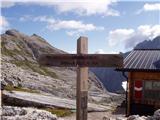 32
32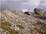 33
33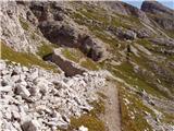 34
34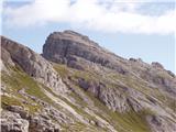 35
35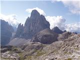 36
36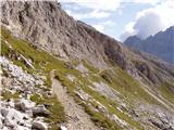 37
37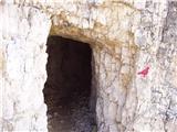 38
38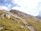 39
39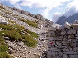 40
40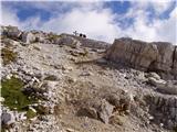 41
41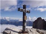 42
42