Rifugio Auronzo - Monte Paterno
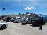
Starting point: Rifugio Auronzo (2320 m)
Starting point Lat/Lon: 46.6122°N 12.2941°E 
Time of walking: 1 h 40 min
Difficulty: very difficult marked way
Difficulty of skiing: no data
Altitude difference: 424 m
Altitude difference (by path): 450 m
Map: Tabacco 10 1:25.000
Access to starting point:
Access from Gorenjska: Via the border crossing at Rateče, we drive to Trbiž / Tarvisio, where we head onto the highway in the direction of Udine. We leave the highway at the Tolmezzo exit and follow the road to the mentioned settlement. From Tolmezzo, we continue in the direction of the settlement Ampezzo and mountain pass Passo della Mauria. The road then starts descending and brings us into the Cadore valley, where we continue right (left Belluno and Cortina d'Ampezzo) in the direction of the settlement Auronzo. After a few additional km of driving, we come to the next bigger intersection, where we turn right towards the Misurina pass and Tre Cime (left Tre Crocci pass). From the Misurina pass, the road starts descending and quickly brings us to an intersection where signs for Tre Cime direct us right onto the toll mountain road, which after 7 km brings us to a large parking lot near the Rifugio Auronzo hut.
From the Primorska side: We drive on the highway towards Venice / Venezia. At Portogruaro, we leave the highway towards Venice and continue right on the highway towards Pordenone. At the next highway junction near Conegliano, we continue right towards Belluno. Near Belluno, the highway ends, and we continue in the direction of Cortina d'Ampezzo and Auronzo. When the road brings us into the Cadore valley, we will come to a bigger intersection, where the road to Cortina d'Ampezzo goes left, and to Auronzo right. Here we continue right towards Auronzo. Further, we follow the above description.
Path description:
At the Auronzo hut, we head onto the gentle macadam road that leads towards the Lavaredo hut slightly to the east. After approximately 20 minutes of walking on a very panoramic road that leads below the mighty walls of Tre Cime, we arrive at the Lavaredo hut.
A little before the hut where there is a junction, we continue left onto the footpath where the signposts direct us. The path here ascends transversely across the scree below the slopes of Tre Cime and brings us to the Forcella Lavaredo notch, where we rejoin the wide gentle path that leads towards the Locatelli hut.
At the notch, we immediately leave the aforementioned wide path and head right upwards (towards the east) onto the path to Monte Paterno. The relatively poorly marked path ascends towards the wall of the Croda Passaporto peak and brings us to the entrance of the military tunnel.
Here we equip ourselves with a helmet and self-belaying kit; we will also need a flashlight. The path then through the aforementioned tunnel, which is quite low, brings us to precipitous ledges from which we have a wonderful view of Tre Cime. After crossing the ledges on the west side of the mountain, the path brings us again into a tunnel through which we reach the eastern side. Here too, we cross steep slopes towards the north for some time, then the path brings us to somewhat less steep slopes. The path then turns slightly to the left and begins to ascend more steeply. Continuing, we ascend through the gully all the way to the Forcella del Camoscio notch, where secured paths from the north and east also join.
At the notch, we go left and with the aid of cables ascend over an almost vertical wall. This section of the path is short but demanding, so the use of self-belaying is highly recommended. The path then becomes less demanding and via nice passages along the summit slope of the mountain, we soon reach the very panoramic summit.
On the way: Rifugio Lavaredo (2344m), Forcella Lavaredo (2454m), Forcella Passaporto (2530m), Forcella del Camoscio (2650m)
Pictures:
 1
1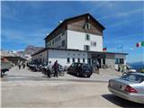 2
2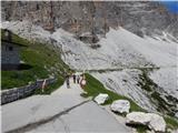 3
3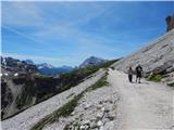 4
4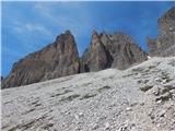 5
5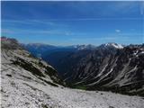 6
6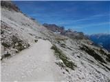 7
7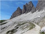 8
8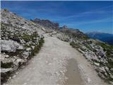 9
9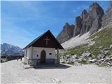 10
10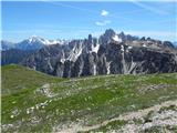 11
11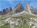 12
12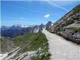 13
13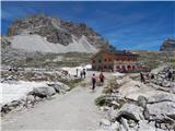 14
14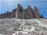 15
15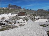 16
16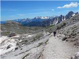 17
17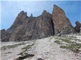 18
18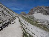 19
19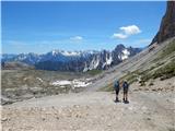 20
20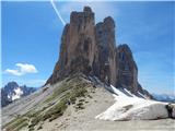 21
21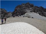 22
22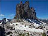 23
23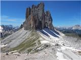 24
24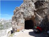 25
25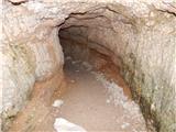 26
26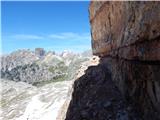 27
27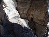 28
28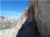 29
29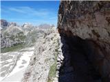 30
30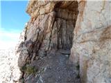 31
31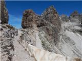 32
32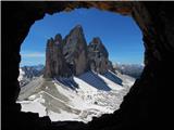 33
33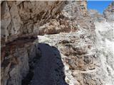 34
34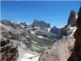 35
35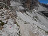 36
36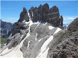 37
37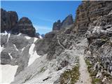 38
38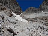 39
39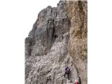 40
40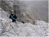 41
41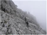 42
42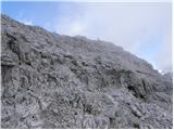 43
43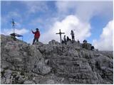 44
44 45
45