Rifugio Gardeccia - Cima Scalieret (via north ridge)
Starting point: Rifugio Gardeccia (1950 m)
Starting point Lat/Lon: 46.43832°N 11.69319°E 
Path name: via north ridge
Time of walking: 3 h
Difficulty: partly demanding unmarked way
Difficulty of skiing: no data
Altitude difference: 937 m
Altitude difference (by path): 950 m
Map: Tabacco 06 1:25.000
Access to starting point:
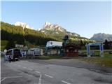
Access from Gorenjska: Through the Karawanks Tunnel, we drive to Austria, and then we continue driving towards Spittal and forward towards Lienz (a little after Spittal highway ends). Further, we drive on a relatively nice and wide road through Drau valley, which brings us in Italy. The road further leads past Dobbiaco / Toblach and Brunico / Bruneck. Only a little after the last-mentioned town, past which leads a bypass road, we turn left into a valley Val Badia. Further, we drive through the mentioned valley past settlements La Vila and Corvara. Next follows an ascent over the mountain pass Passo Campolongo and Passo Pordoi. From the mountain pass Passo Pordoi we then descend on the west side into a valley Val di Fassa. We continue to the settlement Pera di Fassa where we park on a large parking lot at the bottom station of the chairlift »Pera Vajolet 1«.
From here is then organized transport with minibus to the mountain hut Rifugio Gardeccia. The price of return ticket is 10€ (July 2015). Minibus starts driving by 7:00, last last drive from the mountain hut Gardeccia is at 19:00. The road to the hut is otherwise closed for public traffic.
From Primorska side: From Nova Gorica, we drive to Italy and drive forward on the highway towards Venice / Venezia. At town Portogruaro we leave the highway towards Venice and continue right on the highway towards Pordenone. At the next highway junction near Conegliano, we continue right towards Belluno. We follow the highway to exit for Belluno. When we leave the highway we come to bigger roundabout, which we leave at exit for Belluno and settlement Feltre. In smaller roundabout in the settlement Belluno we then continue right towards the settlement Agordo. We follow this road all the way to the settlement Moena into a valley Val di Fassa. In the settlement Moena we then continue right towards the settlement Canazei, but only to the settlement Pera di Fassa where we park on a large parking lot at the bottom station of the chairlift »Pera Vajolet 1«.
From here is then organized transport with minibus to the mountain hut Rifugio Gardeccia. The price of return ticket is 10€ (July 2015). Minibus starts driving by 7:00, last last drive from the mountain hut Gardeccia is at 19:00. The road to the hut is otherwise closed for public traffic.
Path description:
From the mountain hut Rifugio Gardeccia we go on a macadam road towards the mountain hut Vajolet. The road at first leads us past the mountain hut Rifugio Stella Alpina and brings us in thin forest. Here the road ascends a little, and thin forest quickly ends and a view opens up towards the mountain hut Rifugio Preuss, which is clearly visible on the top of the cliff. By mentioned mountain hut is also situated a mountain hut Rifugio Vajolet. Panoramic road then for some time becomes less steep, and then turns left below the slopes of the peak Cima Catinaccio and starts ascending a little steeper. The road is then ascending all the way to the mountain hut Rifugio Vajolet from where it is a very nice view towards towers Torri del Vajolet.
A little after mountain hut path Sentiero Don Guido branches off to the right towards the summit Cima Scalieret, and we continue on a relatively wide path towards the mountain hut Rifugio Passo Principe. The path then soon brings us to another marked crossing. This time path branches off to the left upwards towards huts Rifugio Re Alberto and Rifugio Passo Santner. And we still continue on quite gentle path 584 towards the mountain hut Rifugio Passo Principe. The path here all the time runs towards the north through the valley Val di Vajolet and also increasingly beautiful view starts opening up towards the highest summit in the mountain group Catinaccio d'Antermoia (Kesselkogel). At the end of the valley the slope becomes slightly steeper, but ascent isn't difficult. On the wide path we then soon reach the mountain hut Passo Principe, which is situated on the eponymous saddle on the western side of the peak Catinaccio d'Antermoia.
From the mountain hut, we continue on the path 584 towards the saddle Passo di Antermoia. The path from the mountain hut at first crosses scree below the mountain walls of the peak Catinaccio d'Antermoia and then starts quite steeply ascending. On the path is here quite a lot of gravel and also otherwise on this part, the path is in a little worse condition. When we come on an indistinct saddle on the south side of the peak steepness decreases a little and further we then in a gentle ascent cross the slopes towards the saddle Passo di Antermoia. A little before the saddle, the path brings us to an unmarked crossing.
Here we leave the marked path towards the saddle Passo di Antermoia and we go right on an unmarked path. The path from the crossing at first crosses quite steep slope and also slightly descends. The slope then becomes less steep, and the path turns slightly to the right and then follows a short little steeper ascent to a saddle Passo Scalieret. On the saddle, we continue right and after a short crossing of a steep slope brings us on less steep slopes on the eastern side of the ridge. The path is then slightly ascending and later brings us on a ridge. The path on the ridge is at first still easy, and few ten meters below the summit, the ridge becomes quite steep. Here the path avoids the ridge on the right side and crosses a steep slope. The slope is here quite steep, there's also some crumbly gravel on the path. Therefore at the crossing quite some caution is needed. More demanding crossing is relatively short and we soon come again on the ridge on which we without problems reach the peak.
We descend on the ascent route or on the path named Sentiero Don Guido, that runs on southwestern slopes of the mountain over saddle Passo Pope.
Pictures:
 1
1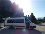 2
2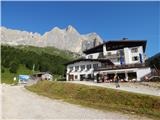 3
3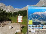 4
4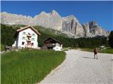 5
5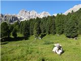 6
6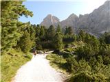 7
7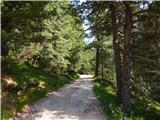 8
8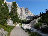 9
9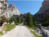 10
10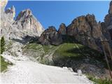 11
11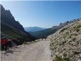 12
12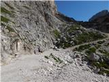 13
13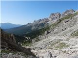 14
14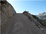 15
15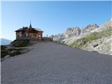 16
16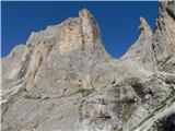 17
17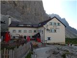 18
18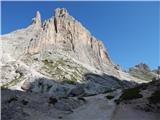 19
19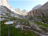 20
20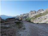 21
21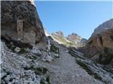 22
22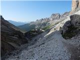 23
23 24
24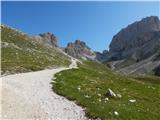 25
25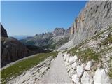 26
26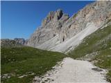 27
27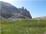 28
28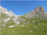 29
29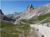 30
30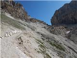 31
31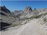 32
32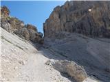 33
33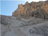 34
34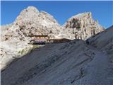 35
35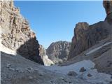 36
36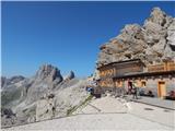 37
37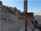 38
38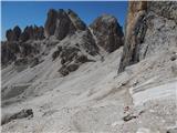 39
39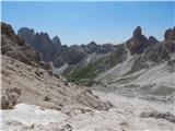 40
40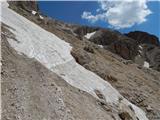 41
41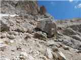 42
42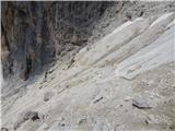 43
43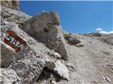 44
44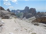 45
45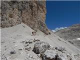 46
46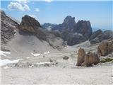 47
47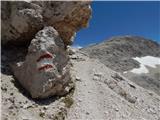 48
48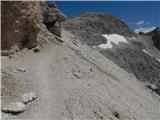 49
49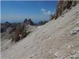 50
50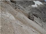 51
51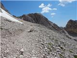 52
52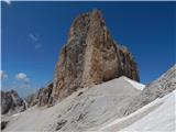 53
53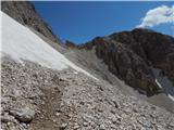 54
54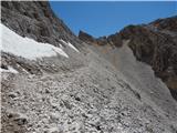 55
55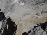 56
56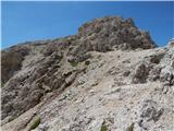 57
57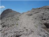 58
58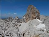 59
59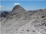 60
60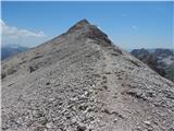 61
61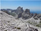 62
62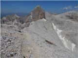 63
63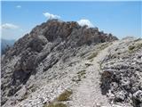 64
64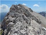 65
65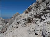 66
66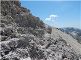 67
67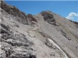 68
68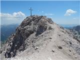 69
69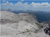 70
70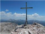 71
71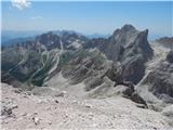 72
72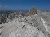 73
73 74
74