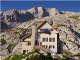
Rifugio Gilberti - Speleological bivouac Modonutti - Savoia
Starting point: Rifugio Gilberti (1850 m)
Starting point Lat/Lon: 46.3874°N 13.4734°E 
Time of walking: 2 h
Difficulty: easy marked way
Difficulty of skiing: no data
Altitude difference: 58 m
Altitude difference (by path): 220 m
Map: Julijske Alpe - zahodni del 1:50.000
Access to starting point:
From Kranjska Gora via the border crossing Rateče we drive to Trbiž / Tarvisio. In Trbiž we continue left in the direction of Bovec and we follow the road to the crossroad near Rabeljsko jezero. Here we continue right in the direction of Medvejski preval / Sella Nevea. This road, which is mostly ascending, we follow to a large parking lot at the bottom station of the cableway, which runs to the hut Gilberti.
Then we buy a ticket and take the cableway to the upper cableway station.
From Bovec we drive to the border crossing Predel, from which we descend to the Italian side. A little after Rabeljsko jezero we come to the crossroad, where we continue left in the direction of Nevejski preval / Sella Nevea. Further, we follow the description above.
Path description:
From the hut Gilberti we walk to the nearby chapel, then we continue the path towards the east. First we descend along the transport-rescue road, then, when it turns left, we continue straight in the direction of Nevejski preval / Sella Nevea and saddle Vrh Laških brežičev / Sella Robon. The path further crosses slopes towards the east and continues without major changes in altitude. After approximately 30 minutes of walking from the hut Gilberti, we come to a marked junction, where the path branches off to the left downwards towards Nevejski preval.
We continue straight on an increasingly panoramic path, which quickly brings us to the next junction. This time too we continue straight on the path in the direction of "Sella Robon" (right slightly upwards Prevala).
The still relatively easy path continues over an extensive plateau-like karst terrain, over which an excellently preserved mule track leads us. This is followed by approximately 20 minutes of easy walking on the path, from which beautiful views open up on the Montaževa and Viševa groups on the left and on the right towards Lopa, Hudi vršič and later also Velika Črnelska špica. After some time the path brings us to an indistinct saddle, from which the path begins to descend for a longer time. After the descent we are 150 meters lower in altitude, and the path brings us to the edge of a high mountain cirque, where another path from Nevejski preval joins from the left.
The path ahead begins to ascend moderately and brings us in a few hairpin turns to the panoramic saddle Vrh Laških brežičev (in Italian Sella Robon), where there is an information board and next to it a table with two benches.
On the saddle we continue left (straight Jerebica 6 hours) and continue the ascent on an easy-to-follow but further unmarked path. The path ahead ascends transversely over a fairly steep slope, then levels out and brings us to numerous military fortifications. We bypass the mentioned fortifications on the left side along a wide artificial ledge, then only a short ascent follows and the path brings us to the caving bivouac Modonutti - Savoia.
On the way: Vrh Laških brežičev (1884m)
Pictures:
 1
1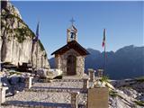 2
2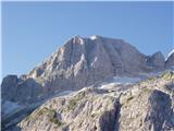 3
3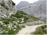 4
4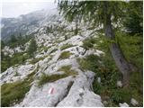 5
5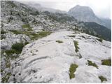 6
6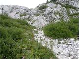 7
7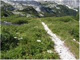 8
8 9
9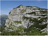 10
10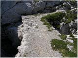 11
11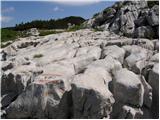 12
12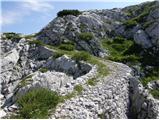 13
13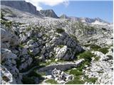 14
14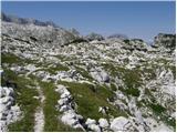 15
15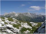 16
16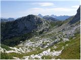 17
17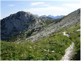 18
18 19
19 20
20 21
21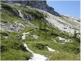 22
22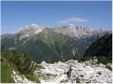 23
23 24
24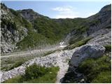 25
25 26
26 27
27 28
28 29
29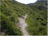 30
30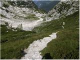 31
31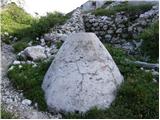 32
32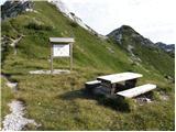 33
33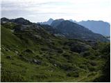 34
34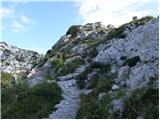 35
35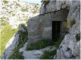 36
36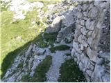 37
37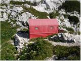 38
38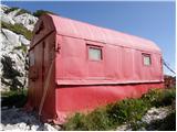 39
39