Rifugio Pederü - Croda del Beco / Seekofel
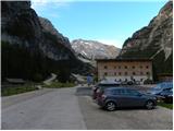
Starting point: Rifugio Pederü (1548 m)
Starting point Lat/Lon: 46.63867°N 12.0414°E 
Time of walking: 3 h 45 min
Difficulty: difficult marked way
Difficulty of skiing: no data
Altitude difference: 1262 m
Altitude difference (by path): 1310 m
Map: Tabacco 03 1:25.000
Access to starting point:
A) From Kranjska Gora over Korensko sedlo to Austria, where at the first larger crossroad, we continue left towards Podklošter / Arnoldstein and Trbiž / Tarvisio. At the end of the settlement Podklošter signs for Šmohor / Hermagor point us to the right on a regional road, on which past the mentioned settlement we drive to the end of the valley Gailtal, or more precisely to the settlement Kötschach-Mauthen, where we turn right towards the settlement Oberdrauburg. The path ahead leads us over the Alpine pass Gailbergsattel (982 m), after which we descend into the mentioned settlement. After we cross the bridge over the river Drau, we continue left towards the settlement Lienz. In the main roundabout in Lienz we continue "left" in the direction of the settlement Sillian and Italy. Further, we cross the border between Austria and Italy, and we follow the main road past settlements Dobbiaco / Toblach, Villabassa / Niederdorf, Monguelfo - Tesido / Welsberg - Taisten, Brunico / Bruneck. Only a little after the last-mentioned town, past which leads a bypass road, we turn left into the valley Val Badia. Further, we drive through the mentioned valley and in the settlement Longega we turn left towards the settlement San Vigilio. In San Vigilio then at the crossroad we turn left following the signs »Pederü«. After approximately 200 meters we then turn right also following the signs »Pederü«. We follow this road all the way to a large parking lot in front of the mountain hut Rifugio Pederü.
B) From Nova Gorica, we drive to Italy and continue on the highway towards Venice / Venezia. Near the town Portogruaro we leave the highway towards Venice and continue right on the highway towards Pordenone. At the next highway junction near Conegliano, we continue right towards Belluno. Near Belluno the highway ends and at the next crossroads we continue in the direction of Cortina d'Ampezzo. When we arrive in Cortina d'Ampezzo, we follow the signs for the Alpine pass Passo Falzarego. At the pass Passo Falzarego (2105 m) we turn right in the direction of the pass Valparola and further towards Alta Badia. In the settlement La Villa we turn right towards the settlement Brunico. We then follow the road to the settlement Longega where we turn right towards the settlement San Vigilio. In San Vigilio then at the crossroad we turn left following the signs »Pederü«. After approximately 200 meters we then turn right also following the signs »Pederü«. We follow this road all the way to a large parking lot in front of the mountain hut Rifugio Pederü.
Path description:
From the mountain hut Rifugio Pederü we continue left on a macadam road where signposts for the mountain hut direct us. The road, which is closed to traffic, at the beginning starts very steeply ascending in zig-zags and beautiful views of the surrounding peaks begin to open up. Further on, the road becomes slightly less steep and runs mostly through the forest. After a good half hour of walking from the starting point, the road brings us to a marked junction.
Straight ahead the road leads towards the mountain hut Fodara, while we continue left following the signs »Rif. Sennes Hütte«. At the junction we slightly descend and cross a stream. The path here is quite level for some time, then turns left and crosses steep slopes in ascent towards the northwest. Higher up, the path turns right and soon we join the road from the mountain hut Fodara.
Further, we walk along the road, which steadily ascends gently, and gradually even more beautiful views begin to open up. The forest along the road is replaced by scree and from the right a footpath from the mountain hut Fodara joins us.
The road further becomes somewhat flatter and soon we reach a junction where the road to the huts Rifugio Ra Stua and Rifugio Biella branches off to the right. At the junction we continue left and to the hut Rifugio Sennes there is only a short walk along the level road left.
From the hut we continue on the macadam road following the signs »Munt de Sennes, Seekofelhütte«. The road ascends somewhat more steeply and soon brings us to a marked junction. At the junction we continue right onto the footpath following the signs »Rif. Biella, Seekofelhütte«. The path then ascends for some time more and a beautiful view opens up towards the summit Muntejela de Sennes and the mountain group Tofana. Further on, the path becomes flatter and runs across grassy slopes below the summit Croda del Beco (Seekofel). Later the path begins to descend gently and takes us from the natural park Fanes Sennes Prags into the nature park Ampezzo. After a gentle descent we reach a marked junction where we rejoin the macadam road.
At the junction we continue left on the macadam road and a gentle ascent follows along the scenic road to the hut.
At the hut we continue left following the signs »Croda del Beco«. After a short ascent the path quickly brings us to the notch Forcella Sora Forno where there is a junction.
At the junction, where there is also a small chapel, we continue left towards the summit Croda del Beco. Here the path begins to ascend steeply along the rocky ridge. Higher up, on a short section, some fixed protections in the form of a chain assist us. Further on, the slope becomes less steep and the path runs along the left side of the ridge. The path ascends diagonally for some time and then we soon reach the summit from which there is a wonderful view in all directions.
Pictures:
 1
1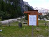 2
2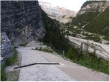 3
3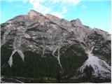 4
4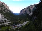 5
5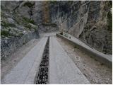 6
6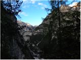 7
7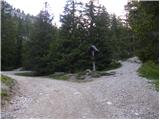 8
8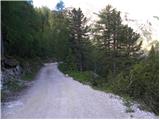 9
9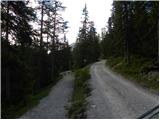 10
10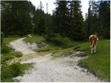 11
11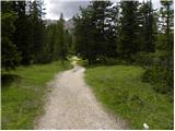 12
12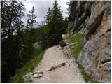 13
13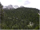 14
14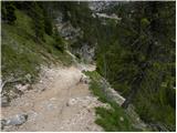 15
15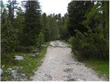 16
16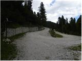 17
17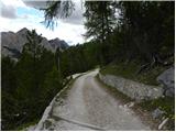 18
18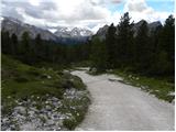 19
19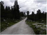 20
20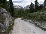 21
21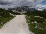 22
22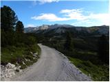 23
23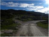 24
24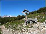 25
25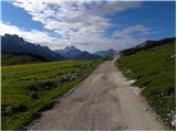 26
26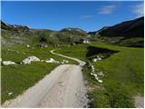 27
27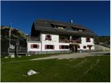 28
28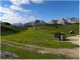 29
29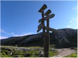 30
30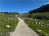 31
31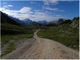 32
32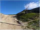 33
33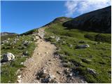 34
34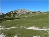 35
35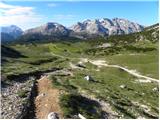 36
36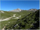 37
37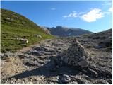 38
38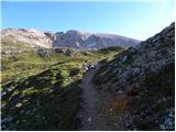 39
39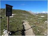 40
40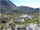 41
41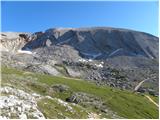 42
42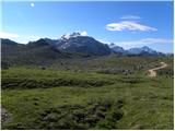 43
43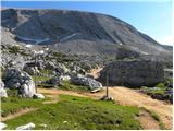 44
44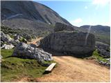 45
45 46
46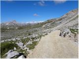 47
47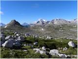 48
48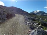 49
49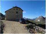 50
50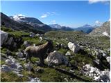 51
51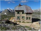 52
52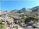 53
53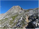 54
54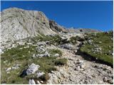 55
55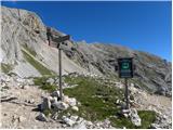 56
56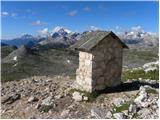 57
57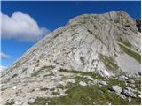 58
58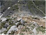 59
59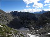 60
60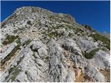 61
61 62
62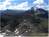 63
63 64
64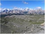 65
65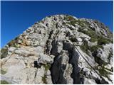 66
66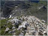 67
67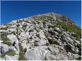 68
68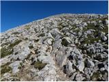 69
69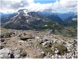 70
70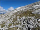 71
71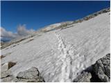 72
72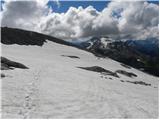 73
73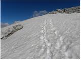 74
74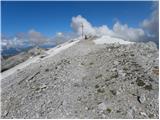 75
75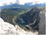 76
76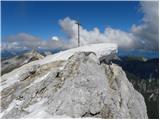 77
77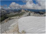 78
78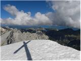 79
79