Rimske Toplice - Koča na Kopitniku (via Ogeški potok)
Starting point: Rimske Toplice (213 m)
Starting point Lat/Lon: 46.1208°N 15.2007°E 
Path name: via Ogeški potok
Time of walking: 1 h 40 min
Difficulty: easy marked way
Difficulty of skiing: no data
Altitude difference: 652 m
Altitude difference (by path): 652 m
Map: Posavsko hribovje - zahodni del 1:50.000
Access to starting point:
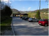
A) From highway Ljubljana - Maribor we go to the exit Celje - center, and then we continue driving in the direction of Laško and later Rimske Toplice. At the end of the settlement Rimske Toplice (immediately after the crossroad, where left over the bridge, the road branches off towards the village Globoko and railway station Rimske Toplice) we turn sharply right in the direction of thermal spa Rimske terme. Further, we drive for few 10 meters and then we get to the next crossroad, by which we park (near the starting point, there is store Tuš).
B) From Zasavje we at first drive in Hrastnik, and then we continue driving towards Celje. When we get to Rimske Toplice we will in the main crossroad turn right in the direction of Zidani Most. At the end of the settlement Rimske Toplice (immediately after the crossroad, where left over the bridge, the road branches off towards the village Globoko and railway station Rimske Toplice) we turn sharply right in the direction of thermal spa Rimske terme. Further, we drive for few 10 meters and then we get to the next crossroad, by which we park (near the starting point, there is store Tuš).
C) From the direction Posavje we at first drive to Zidani Most, and then we continue driving towards Celje. When we get to Rimske Toplice, we need to pay attention, because at the beginning of the settlement, we will turn left in the direction of thermal spa Rimske terme (we leave the main road only few meters before the spot, where to the right over a bridge, the road branches off towards the village Globoko). Further, we drive for few 10 meters and then we get to the next crossroad, by which we park (near the starting point, there is store Tuš).
Path description:
From the starting point, we go on the road which continues along a smaller stream (direction Kopitnik). The road quickly brings us to the near residential houses, behind which it changes into a moderately steep mountain path. We short time still continue along the small stream and then blazes point us to the right on a slope, on which we start ascending steeper. A little higher, the path brings us out of the forest and then past a cross and next residential house brings us to an asphalt road. We follow the road uphill, and then at the next crossroad right in the direction of Kopitnik. Few minutes we still continue on the road, and then we get to a marked crossing.
At the crossing, we leave the asphalt road and we continue right on a footpath in the direction of "Kopitnik - koča (mountain hut)" (straight Kopitnik and Stražnik). The path ahead ascends diagonally towards the right, soon flattens and joins the worse forest road which we follow to its end.
From the end of the road, we continue on a well-beaten path which starts moderately to occasionally steeply ascending through the forest. Higher, the path leads us by the "site" of wild garlic, and then it joins the cart track which we follow to the right. The cart track soon turns quite to the right and it ascends diagonally on a less steep slope, where we get to the edge of the forest. Here the path turns to the left and gradually widens into a macadam road. Even a little further, from the right the path from Šmarjeta joins, and we continue straight to the nearby homestead Pri Izeri.
At the homestead, the road becomes asphalted, and we walk there only few meters and then the caption on a tree "koča" (hut) points us left into the forest. Further, we are for a short time ascending through the forest and then we join the path from the village Marno and Turje. From the crossing ahead, we step out of the forest, and a gently sloping path which continues through a larger meadow in few minutes brings us to the mountain hut Koča na Kopitniku.
Pictures:
 1
1 2
2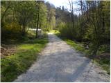 3
3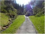 4
4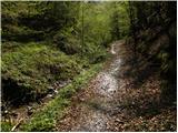 5
5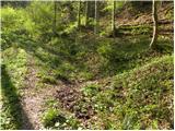 6
6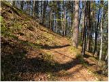 7
7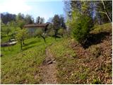 8
8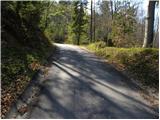 9
9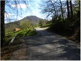 10
10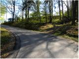 11
11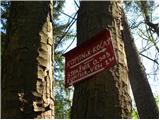 12
12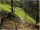 13
13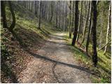 14
14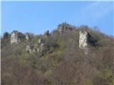 15
15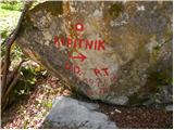 16
16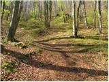 17
17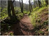 18
18 19
19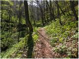 20
20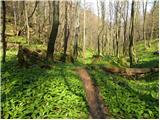 21
21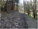 22
22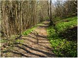 23
23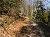 24
24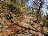 25
25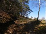 26
26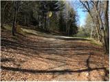 27
27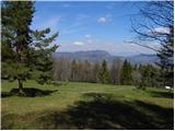 28
28 29
29 30
30 31
31 32
32 33
33 34
34 35
35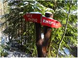 36
36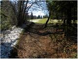 37
37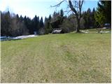 38
38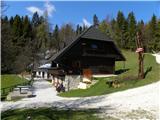 39
39