Rio Bianco - Viš/Jof Fuart (Sentiero del Centenario)
Starting point: Rio Bianco (980 m)
Starting point Lat/Lon: 46.4095°N 13.536°E 
Path name: Sentiero del Centenario
Time of walking: 6 h
Difficulty: very difficult marked way
Ferrata: B/C
Difficulty of skiing: no data
Altitude difference: 1686 m
Altitude difference (by path): 1900 m
Map: Julijske Alpe - zahodni del 1:50.000
Access to starting point:
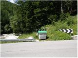
From Kranjska Gora over the border crossing Rateče we drive to Trbiž / Tarvisio. In Trbiž we continue left in the direction of Bovec and we follow the road to the crossroad near the lake Rabeljsko jezero. Here we continue right in the direction of Nevejski preval / Sella Nevea. This road which is mostly ascending we follow to the bridge, where at the left turn road crosses the stream Bele vode / Rio Bianco. On the left side of the road, we will notice few smaller parking spots.
From Bovec, we drive to the border crossing Predel, from which we descend to italian side. Only a little after the lake Rabeljsko jezero we come to the crossroad, where we continue left in the direction of Nevejski preval / Sella Nevea. Further, follow the upper description.
Path description:
From the signposts at the beginning of the path (before the bridge on the right side of the road) we continue through the forest on the right side of the stream Rio Bianco by which we are slightly ascending for quite some time. After the stream valley Bele vode (italian Riobianco) also got the name. The path then turns to the left and few times crosses smaller streams. Later, the path again turns a little to the right and shorter hairpin ascent follows to abandoned mountain hut Brunner where because of the forest there isn't any view. At the mountain hut where there is also a crossing we continue straight on the path 625 in the direction of bivouac Gorizia. After that, the path soon comes out of the forest and is ascending by the stream through dwarf pines. Later, the path turns to the left and it brings us to a crossing. We continue on the left path towards the bivouac Gorizia and to the right the path towards the notch Bele vode (italian Forca di Rio Bianco) branches off. Dwarf pines then soon ends, and the path starts ascending a little steeper. When the path again flattens a little, sign on the rock point us to the left towards the bivouac to which we have approximately 50 meters, and right runs direct path towards the notch Krniška škrbina (italian Forcella part of Vallone).
From the bivouac, we continue towards the south and we start quite steeply ascending on a gravel slope towards the notch Alta di Rio Bianco (2150 meters). On the notch path turns to the right and is a short time still ascending on a slightly crumbly gravel terrain and then it brings us to steel cables by which we quite steeply ascend. Next follows the hardest part of the path, where we have to vertically descend into a narrow notch. On this part it is highly recommended to self belay. From the notch, we then ascend on vertical ladder and then a little less steep slopes take us to narrow ridge. The path on the ridge is secured with a steel cable. Later, the path turns to the left and a short descent follows on gravel terrain and then by the steel cable to the entrance into a tunnel. On the path through the tunnel are also turns and descends on a ladder, so it is mandatory to use lamp. When we come out of the tunnel follows a short crossing of a steep slope to the notch Krniška škrbina, where from the right side joins also an easier path from the bivouac Gorizia. From the notch follows a descent on the scree and then on the more and more grassy terrain, which brings us to a crossroad. We go right on the path 627, and left runs the path towards the mountain hut Corsi to which is approximately 15 minutes of descent. After a short ascent, we come again to a crossroad, where we go left (direction Jof Fuart), and right leads the path 627 towards the notch Trbiška škrbinica (Forcella di Riofreddo). After that, the path turns slightly to the left and it brings us to the entrance of a little more demanding part of the path. Here the path turns right upward and also some easy climbing on rocky terrain is needed. After that, the path turns slightly to the right and it brings us to again a little harder part of the path. Here the path turns left upwards and starts ascending by the steel cable. Next follows a little low passage through a window and then again the ascent by the steel cable. The path then brings us to a crossroad, where from the right side from precipitous ledges joins the path Anita Goitan. After a short ascent, we come again to a crossroad where we go right, left path Anita Goitan branches off. Next follows moderately steep ascent on a rocky and a little more gravel terrain. A little below the summit from the right also joins northeastern path Gola Nordest. From here follows only a shorter ascent towards a very panoramic summit.
On the way: Rifugio Brunner (1432m),
Bivouac Gorizia (1950m), Alta di Rio Bianco (2150m), Krniška škrbina/Forcella del Vallone (2180m)
Pictures:
 1
1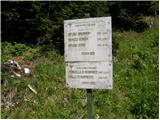 2
2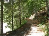 3
3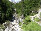 4
4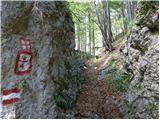 5
5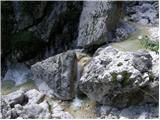 6
6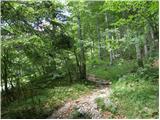 7
7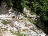 8
8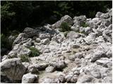 9
9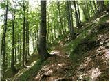 10
10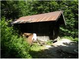 11
11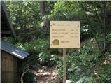 12
12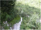 13
13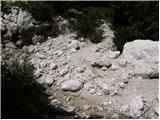 14
14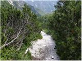 15
15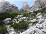 16
16 17
17 18
18 19
19 20
20 21
21 22
22 23
23 24
24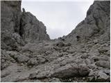 25
25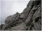 26
26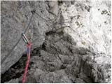 27
27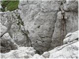 28
28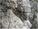 29
29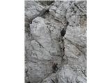 30
30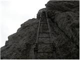 31
31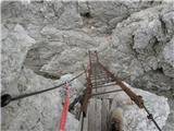 32
32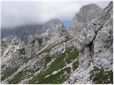 33
33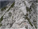 34
34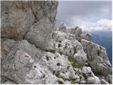 35
35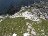 36
36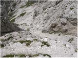 37
37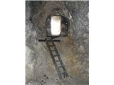 38
38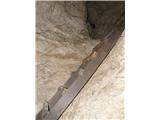 39
39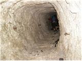 40
40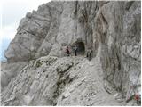 41
41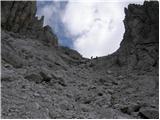 42
42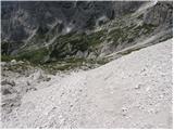 43
43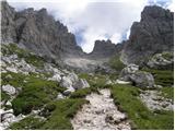 44
44 45
45 46
46 47
47 48
48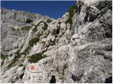 49
49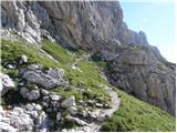 50
50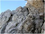 51
51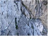 52
52 53
53 54
54 55
55 56
56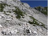 57
57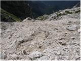 58
58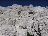 59
59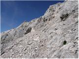 60
60 61
61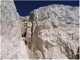 62
62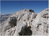 63
63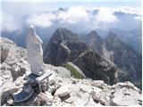 64
64 65
65