Starting point: Rosstratte (1732 m)
Starting point Lat/Lon: 46.5929°N 13.7113°E 
Time of walking: 45 min
Difficulty: easy marked way
Difficulty of skiing: no data
Altitude difference: 224 m
Altitude difference (by path): 224 m
Map:
Access to starting point:
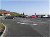
At first, we drive to Kranjska Gora, and then we continue driving towards Rateče. When we get to Podkoren we leave the main road and we continue driving right towards the saddle Korensko sedlo. From the saddle, we descend on the Austrian side, where into a valley we turn right towards Beljak / Villach. Further, we drive through the village Ločilo / Hart to Beljak, where signs for Spittal point us on bypass road past the town. The road then soon brings us in Judendorf (area of Beljak), and only a little further we notice signs for Beljak alpine road / Villacher Alpenstrasse. Here we turn right and we follow the road to a parking lot, which is located at an altitude 1732 meters (road is payable 14 eur personal car and 8 eur motor bike, July 2012).
From Korensko sedlo to the top of Beljak road is approximately 32 km.
Path description:
From the parking lot, we continue on a narrower asphalt road which is with a traffic sign closed for public traffic. Asphalt soon ends and the road past a grazing fence brings us to a marked crossing, where the marked path branches off to the right towards Plajberk pri Beljaku / Bad Bleiberg, and we go left and we continue on an ascending macadam road which leads towards the summit of Dobrač. After a short ascent, we get to the sharp right turn, in the middle of which unmarked path branches off, which leads towards Dobrač, and for a short time, we still continue on a relatively steep and more and more panoramic road. Higher, where the slope flattens a little, we get to a marked crossing. At the mentioned crossing, we leave the road and we continue slightly left on a marked footpath which starts ascending steeper on a grassy slope. Not very steep path, then past a bench quickly brings us to the summit of Zehnernock, which we recognize by the cottage on the summit.
Pictures:
 1
1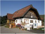 2
2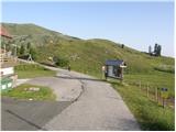 3
3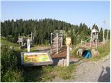 4
4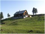 5
5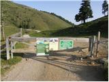 6
6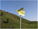 7
7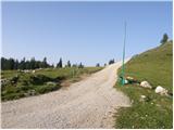 8
8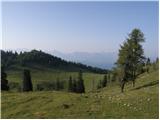 9
9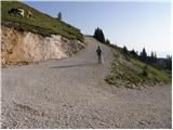 10
10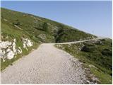 11
11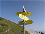 12
12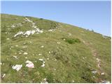 13
13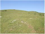 14
14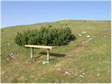 15
15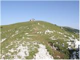 16
16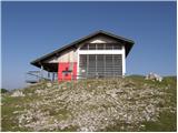 17
17 18
18 19
19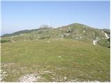 20
20