Starting point: Rudno polje (1347 m)
Starting point Lat/Lon: 46.3458°N 13.9236°E 
Time of walking: 4 h 10 min
Difficulty: difficult pathless terrain
Difficulty of skiing: very demanding
Altitude difference: 751 m
Altitude difference (by path): 1000 m
Map: Triglav 1:25.000
Access to starting point:
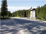
From highway Ljubljana - Jesenice we go to the exit Lesce and follow the road ahead towards Bled. In Bled at the traffic lights, the signs for Pokljuka point us to the right. Ahead we drive through Gorje and past the abandoned ski slope Zatrnik to Rudno polje on Pokljuka (large parking lot, barracks and shooting range).
Path description:
At the end of the parking lot a macadam road by which there are signposts for Triglav branches off to the right. We go on this road which is slightly ascending and after ten minutes brings us to the ski slope. Further, we continue on the road from which a marked path towards Triglav soon branches off to the left. After few minutes of a moderate ascent, the path brings us on the forest road which we follow only few meters (to here we can come with a car which shortens our path for 20 minutes). The marked path then goes right and is ascending steeply for a short time. After ten minutes, the steepness decreases and the path slowly passes on steep slopes. Over those steep slopes the path is mostly slightly descending and is turning more and more to the right. A little further, we will notice left below us the mountain pasture Konjščica. Our path then stops descending and passes out of the forest into dwarf pines. The path which is again ascending then runs below the steep rocky cliffs and soon after that, it brings us to a crossing, where we join the path from the mountain pasture Planina Konjščica.. Next follows a shorter ascent and the path brings us into a nice small valley named Jezerce. Here the path turns left and after few steps it brings us into central area of Triglav national park. Next, we ascend by a well towards Studorski preval. A little higher we cross a torrent and the path turns a little to the right into grassy slopes surrounded by dwarf pines. The path then ascends diagonally to Studorski preval from which a nice view opens up to Bohinj side. The path ahead at first descends a little and then crosses slopes of Veliki Draški vrh and Tosc with few gentle ascents and descends. Eventually, the path brings us to a grassy south slope of Tosc. Here the path on Tosc branches off to the right, and only few meters ahead, the path from Uskovnica joins from the left. We continue straight, and the path ahead continues crossing slopes of Tosc. The path then in a gentle descent crosses a shorter lane of thin forest and then it brings us on steep slopes. A little further ahead, the path on a carved wide ledge in a gentle descent crosses precipitous slopes of Tosc. Since the path is quite wide it doesn't cause problems (carefully because of falling stones, rockfall in the year 2008). The path then again slightly ascends and it brings us to a crossing, where we continue right in the direction of Vodnikov dom. Next follows approximately ten minutes of walking without large ascents or descents to Vodnikov dom.
From the hut, we continue straight in the direction of Triglav (right upward Bohinjska vratca). The path ahead is moderately ascending and crosses slopes below Vernar. Soon we run into the first steel cable, which helps us pass the short ledge. The path ahead is ascending on the scree and then brings us to a steep rocky jump. A well-secured path on steep stairs brings us to the top of that jump. Next follows few meters of crossing on a steep slope, and then the path brings us on ample slopes near the saddle Konjski preval. We reach it after a short descent. At Konjsko sedlo, that we recognize by a crossing of the paths we leave the marked path on Triglav. We go right on a poorly visible footpath which takes us on a meadow, where the footpath vanishes completely. Further, we continue on a meadow towards the south. When on the left side dwarf pines end we go on the ridge, which we follow right to the upper rocky slope of the mountain. Next follows some easy climbing on rugged rocks of the upper part of the mountain. The last meters are slightly exposed.
Orientation in the last part is difficult, in fog very difficult. There's approximately 15 minutes of pathless terrain.
Rudno polje - Vodnikov dom 3:20, Vodnikov dom - Cesar 50 minutes.
Pictures:
 1
1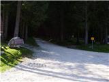 2
2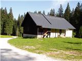 3
3 4
4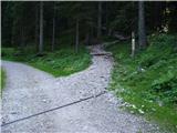 5
5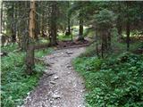 6
6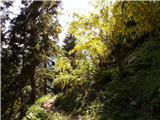 7
7 8
8 9
9 10
10 11
11 12
12 13
13 14
14 15
15 16
16 17
17 18
18 19
19 20
20 21
21 22
22 23
23 24
24 25
25 26
26 27
27 28
28 29
29 30
30 31
31 32
32 33
33 34
34 35
35 36
36 37
37 38
38 39
39 40
40 41
41 42
42 43
43 44
44 45
45 46
46 47
47 48
48 49
49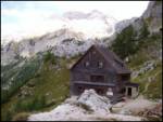 50
50 51
51 52
52 53
53 54
54 55
55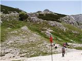 56
56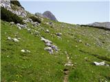 57
57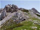 58
58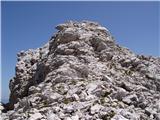 59
59 60
60