Ruše - Koča na Klopnem vrhu
Starting point: Ruše (308 m)
Starting point Lat/Lon: 46.53717°N 15.50194°E 
Time of walking: 3 h 40 min
Difficulty: easy marked way
Difficulty of skiing: no data
Altitude difference: 952 m
Altitude difference (by path): 1035 m
Map: Pohorje 1:50.000
Access to starting point:
From Maribor or Selnica ob Dravi we drive to Ruše, where we follow the signs for the cemetery, where in the parking lot by the cemetery we park. We can also park in any other parking lot in Ruše.
Path description:
From the cemetery we continue on the road, or sidewalk, which continues towards the west, and from the road the first path through the Lobnica valley soon branches off to the left, but we continue on the main road to the next marked crossroad, where at the company Ecom we turn left onto a side road, by which there are signs for the path along Lobnica, Šumik, and Bajgot.
We bypass the company area on the right side, walking along the fence, and a little further, we cross the stream Lobnica over a small bridge.
After the small bridge, we reach an asphalt road, and the marked path splits.
To the left continues the path along the stream Lobnica, but we go right and then immediately left in the direction towards Zgornji Smolnik and Šumik. Next follows a short ascent on the macadam road, which we quickly leave as the signs for Šumik and Pesek direct us left onto an overgrown cart track, which further ascends diagonally towards the right. A little further, we join another path, along which we quickly reach the NOB monument. Above the monument, the path begins to ascend more steeply and in a few minutes brings us to a saddle west of the peak Kluže.
Here we continue right (left an unmarked path to Kluže - five minutes) and initially proceed along a forested ridge, then bypass an unnamed peak on maps on the right side. Further on, at several crossings, we continue straight, and when we reach the asphalt road, we continue upwards. The asphalt road higher up brings us to a scenic saddle at the farm Globokar, and we continue straight to the next farm Harič. Behind the mentioned farm, the road turns sharply to the right, but we continue straight on a marked cart track that leads through the forest. Through the forest, at several crossings, we follow the blazes, and when we return to the road higher up, we follow it to the left. The road soon leads us out of the forest and splits into three branches.
We continue on the rightmost road, along which the blazes continue and where there are signs for the church. Just a little further, we reach the next crossroad, where we turn left towards the cottage Koča na Klopnem vrhu and the waterfall Šumik (straight leads to a nearby homestead). After a few more dozen steps, we arrive at the church of St. Mary.
At the church, the path splits, and we continue right in the direction of cottage Koča na Klopnem vrhu (straight to Šumik) and proceed along a poorer macadam road. A little further, from the road at a right turn, an unmarked cart track branches off straight ahead, but we continue right, then go left at the next crossing. The path ahead, through the forested northern ridge of Prodnarjev vrh, leads us from the northeastern to the northwestern slopes. Next follows a longer crossing, initially of northwestern, then mostly northern slopes, where the path, with some shorter ascents and descents, also leads us over a few streams and springs.
When we reach a wider macadam road, where we join the marked path from the settlement Činžat or Puščava, we go left and continue alongside stream Lamprehtov potok, then go straight at the next crossroad (left to Areh and Šumik). Next follows some ascent by the stream and the path brings us to sawmill Fišerjeva žaga, where we go again on the other side of the stream.
A few tens of meters beyond the stream, we leave the road and continue left, following the signs for cottage Koča na Klopnem vrhu, where we first cross a fence, then pass a private cottage in the forest, and continue the ascent along a cart track. Cart track has higher few crossings, where we follow the blazes, and we are mainly ascending through the forest. When we higher reach a grazing fence, the marked footpath leads right from the fence. We few minutes continue by the fence, and then we return on the macadam road, where we join the path from Lovrenc na Pohorju.
We continue left (straight across the road - northern path on Klopni vrh) and after few 10 meters we get to Koča na Klopnem vrhu, which we have noticed already on the part where we were walking along the grazing fence.
Ruše - Sveta Marija 2:05, Sveta Marija - Koča na Klopnem vrhu 1:35.
Description and pictures refer to the condition in September 2021 and June 2023.
Pictures:
 1
1 2
2 3
3 4
4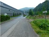 5
5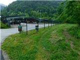 6
6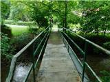 7
7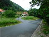 8
8 9
9 10
10 11
11 12
12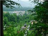 13
13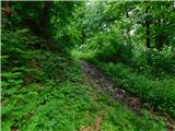 14
14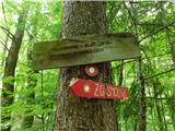 15
15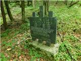 16
16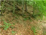 17
17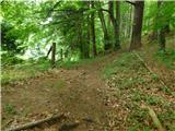 18
18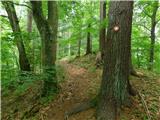 19
19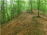 20
20 21
21 22
22 23
23 24
24 25
25 26
26 27
27 28
28 29
29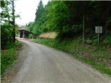 30
30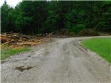 31
31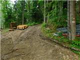 32
32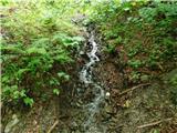 33
33 34
34 35
35 36
36 37
37 38
38 39
39 40
40 41
41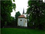 42
42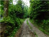 43
43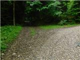 44
44 45
45 46
46 47
47 48
48 49
49 50
50 51
51 52
52 53
53 54
54 55
55 56
56 57
57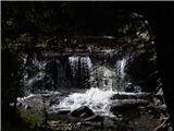 58
58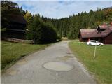 59
59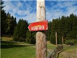 60
60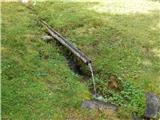 61
61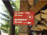 62
62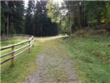 63
63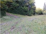 64
64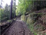 65
65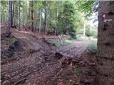 66
66 67
67 68
68 69
69 70
70 71
71 72
72 73
73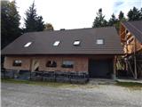 74
74