Ruski križ - Škrlatica (via Kriška stena)
Starting point: Ruski križ (1036 m)
Starting point Lat/Lon: 46.4444°N 13.7746°E 
Path name: via Kriška stena
Time of walking: 7 h 45 min
Difficulty: very difficult marked way
Difficulty of skiing: very demanding
Altitude difference: 1704 m
Altitude difference (by path): 2240 m
Map: Triglav 1.25.000
Access to starting point:
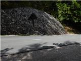
First we drive to Kranjska Gora, then continue driving towards the Vršič pass. Just a little before the 3rd hairpin bend of the Russian or Vršič road, we will notice the Ruski križ on the right side, and a smaller parking lot on the left, where we park. Because the parking lot is relatively small and fills up quickly, we can also park a little higher at the larger parking lot just above the 4th hairpin bend (in this case we have to descend a bit to our starting point at the Ruski križ).
We can also reach the starting point from the Primorska side, namely via the Vršič pass.
Path description:
A little before the 3rd hairpin bend of the Russian road, we will notice the mountain signs for Koča v Krnici along the road, which direct us slightly left onto a wide cart track that immediately begins to descend moderately. After a few minutes of descent through the forest, the path levels out and brings us to the bed of Suha Pišnica. Shortly after crossing the mentioned stream, the path turns slightly to the left and leads us out of the forest onto the spacious grassy slopes of Planina v Klinu, where we notice an isolated hut on the right and a smaller memorial park Mali Tamar on the left. The path ahead completely levels out, then joins the forest road that comes from the former hotel Erika or the bridge over Velika Pišnica. Here we continue right and follow the relatively steep forest road all the way to Koča v Krnici, which we reach after approximately 20 minutes of further walking.
From the hut, where there is pleasant shade, we continue straight in the direction of Kriška stena through the Krnica valley, initially gently, then increasingly steeply upwards. The path soon comes out of the forest, where a beautiful view of the nearby rock walls opens up to us. Next we cross scree that storms bring from the surrounding gullies. The path ahead becomes steeper and still leads us in the same direction. Behind us are already the last trees and we slowly transition to the scree under the walls of Kriška stena. In the upper part of the scree the path slightly turns left to the entrance into Kriška stena. Here the climbing part of the path begins, where we put on the helmet.
The path at the beginning of the wall turns left and climbs steeply. In the wall the path is led mostly along natural passages, sometimes helped by fixed safety equipment. On this part we also take care not to dislodge stones! After about an hour of climbing the wall, which is in places quite difficult, we step out of it. This is followed by a few steps of walking to a junction, where we continue left downwards in the direction of Škrlatica (right Križ, Razor and Pogačnikov dom).
We continue in the direction of Škrlatica and the Vrata valley along the path that leads us further through the world of slabs. The relatively gentle path then soon branches into two parts, we continue on the left in the direction of Škrlatica. The path ahead crosses the slopes of Gubna (2403 m) and later also the hardly accessible Dovški Gamsovec (2440 m). After about 30 minutes of easy walking, the path begins to climb steeply again. This time our goal is the approximately 2500 m high Rdeča škrbina, which we can already see well in front of us, to which we climb via a moderately steep scree.
At the Rdeča škrbina, where there is a marked junction, we continue straight (right Dolkova špica 15 minutes) along the path that with the help of a steel cable bypasses a rock rib, then leads us into a steep gully on the eastern side of the previously mentioned notch. The path ahead begins to descend steeply along a poorly trodden path, which is dangerous for slipping due to the considerable steepness and rubble on the path. After a few minutes of steep descent the path transitions to scree, along which we then descend in a few minutes into Zadnji Dolek, where we join the path from Vrata.
In Zadnji Dolek we continue left and continue the ascent along the steep scree, which we follow for a good 20 minutes, then the markings direct us right into the western or southwest wall of Škrlatica. The path, which further acquires the character of a climbing path, leads us with the help of fixed aids to probably the most demanding part of the path. Next, with the help of numerous pitons and a steel cable we cross a smooth and precipitous belly rock, then the path enters fragmented rock, where it then climbs very steeply. The well-protected and always dangerous for slipping path then leads us past a window in Škrlatica to the main ridge, where the path levels out. We continue the ascent along a somewhat less steep path, which further leads us on and along a very scenic ridge. We follow this path, from which beautiful views of the nearby Rokavi open, all the way to the summit of the 2740 m high Škrlatica, which we reach after a few minutes of further walking.
Starting point - Planina v Klinu 0:20, Planina v Klinu - Koča v Krnici 0:25, Koča v Krnici - Vrh Kriške stene 3:30, Vrh Kriške stene - Na rušju 0:10, Na rušju - Rdeča škrbina 1:15, Rdeča škrbina - Zadnji Dolek 0:35, Zadnji Dolek - Škrlatica
On the way: Mali Tamar (996m), Planina v Klinu (980m),
Koča v Krnici (1113m), Pod Kriško steno (1945m), Rob Kriške stene (2300m), Na rušju (2218m), Rdeča škrbina (2521m), Zadnji Dolek (2332m), Pod steno Škrlatice (2403m), Na grebenu Škrlatice (2624m)
Pictures:
 1
1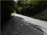 2
2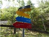 3
3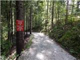 4
4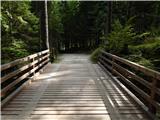 5
5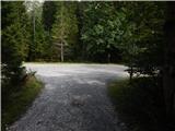 6
6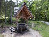 7
7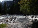 8
8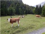 9
9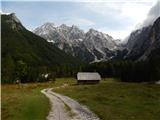 10
10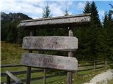 11
11 12
12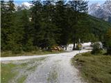 13
13 14
14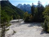 15
15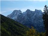 16
16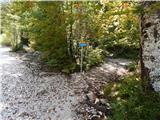 17
17 18
18 19
19 20
20 21
21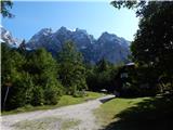 22
22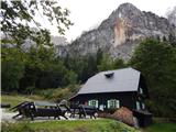 23
23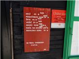 24
24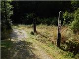 25
25 26
26 27
27 28
28 29
29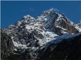 30
30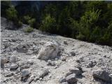 31
31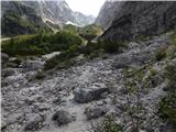 32
32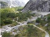 33
33 34
34 35
35 36
36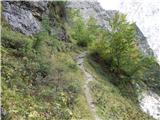 37
37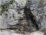 38
38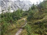 39
39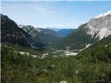 40
40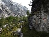 41
41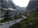 42
42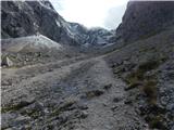 43
43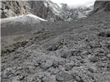 44
44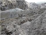 45
45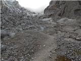 46
46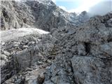 47
47 48
48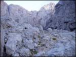 49
49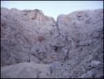 50
50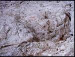 51
51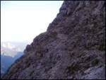 52
52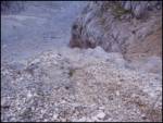 53
53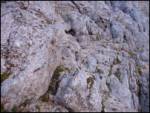 54
54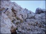 55
55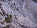 56
56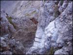 57
57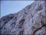 58
58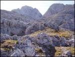 59
59 60
60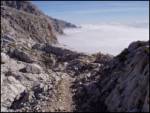 61
61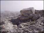 62
62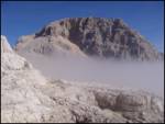 63
63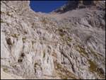 64
64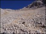 65
65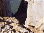 66
66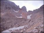 67
67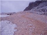 68
68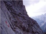 69
69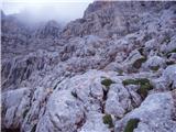 70
70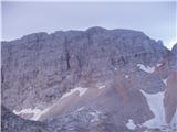 71
71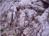 72
72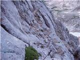 73
73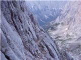 74
74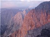 75
75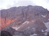 76
76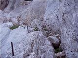 77
77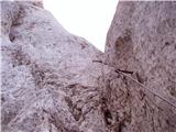 78
78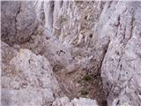 79
79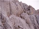 80
80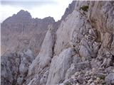 81
81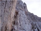 82
82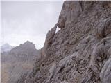 83
83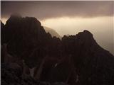 84
84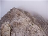 85
85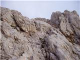 86
86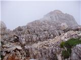 87
87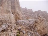 88
88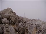 89
89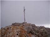 90
90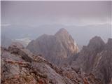 91
91