Rutarski gozd - Jehlc (Špičasta kupa)
Starting point: Rutarski gozd (1030 m)
Starting point Lat/Lon: 46.2156°N 13.8895°E 
Time of walking: 2 h
Difficulty: easy unmarked way
Difficulty of skiing: partly demanding
Altitude difference: 632 m
Altitude difference (by path): 700 m
Map: TNP 1:50.000
Access to starting point:
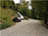
From Podbrdo we drive towards Tolmin or vice versa, but only to the village Koritnica. In Koritnica we will notice a sign for village Rut, which points us right (from Tolmin sharply left). Mostly ascending road we then follow to the mentioned village, where there is also a smaller crossroad. We continue straight (left village Grunt) on the road which soon loses an asphalt covering. Wide macadam road quickly ascends above the village and turns right. Follow three zig-zags, at third or second left from the right joins also the marked path from Stržišče, and from here ahead we need to pay attention to possible parking by the road, because driving from the next crossroad ahead is forbidden.
Path description:
From the parking lot, we continue on a macadam road, and then we quickly get to an unmarked crossroad, where we continue on the upper right road, by which there is a gate and a traffic sign, that prohibits further driving. Further, we are steeply ascending and worse road slowly changes into a wide mostly rocky cart track which past a hunting observatory soon brings us to a crossing, where we continue right in the direction of Rodica (straight mountain pasture Razor). Further, we are ascending on a relatively well-preserved mule track at first through the forest and then through dwarf pines. Moderately steep and more and more scenic path, then crosses some gullies and is getting closer to the summit (Jehlc), which for some time we already see in front of us. After approximately hour and a half of walking, a marked path gets very close to the ridge. Here at an altitude of approximately 1700m, where by the path, we notice a cairn and bad footpath which ascends left on the ridge we leave the marked path which leads on Rodica.
Further, in few steps we ascend on the mentioned ridge and we follow it to the left, where we quickly step on panoramic top (Peči or Greben 1727 meters). From the top, a nice view opens up towards Jehlc to which we have a short steep descent and then a gentle ascent on a panoramic ridge. From the point, when we left the marked path, to the top of Jehlc we follow a worse footpath which runs on and partly by the ridge.
The path isn't hard, in fog the orientation can be difficult.
Pictures:
 1
1 2
2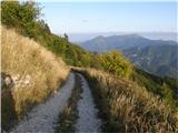 3
3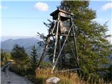 4
4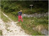 5
5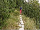 6
6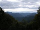 7
7 8
8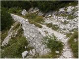 9
9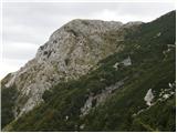 10
10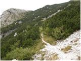 11
11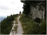 12
12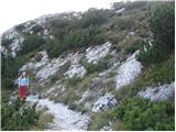 13
13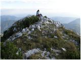 14
14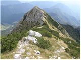 15
15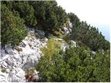 16
16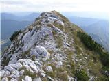 17
17 18
18