Sass de Pordoi - Sass de Forcia di Mezzo
Starting point: Sass de Pordoi (2950 m)
Starting point Lat/Lon: 46.488°N 11.8113°E 
Time of walking: 30 min
Difficulty: easy pathless terrain
Difficulty of skiing: no data
Altitude difference: -33 m
Altitude difference (by path): 75 m
Map:
Access to starting point:
First, we drive to Cortina d'Ampezzo (to here possible over a border crossing Rateče or Predel to Trbiž / Tarvisio and then on a highway in the direction of Videm / Udine to exit Tolmezzo. From Tolmezzo we follow the road in the direction of village Ampezzo and mountain pass Passo Mauria. The road then descends and it brings us to a crossroad, where we continue left (possible also right) in the direction of Cortina d'Ampezzo. At all next crossroads, we follow the signs for Cortina d'Ampezzo.
In Cortina d'Ampezzo then we follow the signs for Alpine mountain pass Passo di Falzarego. On the mentioned mountain pass we come to a crossroad, where we continue on the left road in the direction of Marmolada and settlement Arabba (right Alta Badia). The road ahead is for quite some time descending, and then it brings us to a crossroad, where we continue right in the direction of the mountain pass Passo Pordoi (left Marmolada). Relatively wide and the ascending road we follow all the way to the mentioned mountain pass, where we park on a large parking lot. Then we buy a ticket for a cableway, with which we go to our starting point on 2950 meters.
Access from Primorska: We drive on a highway in the direction of Padova, but only to a highway junction, where we continue in the direction of Veneto and Belluno. Near Belluno the highway ends, and we follow the road ahead in the direction of Belluno, where at the larger crossroad we continue right in the direction of the town Agordo. From the mentioned town ahead we follow the signs for settlement Arabba and Alpine mountain pass Passo Pordoi, which is also a starting point for our tour. Then we buy a ticket for a cableway, with which we go to our starting point on 2950 meters.
Path description:
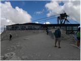
From the upper cableway station on Sass de Pordoi, we go on a path in the direction of the mountain hut Rifugio Forcella Pordoi. A wide and quite well visited path starts considerably descending and after approximately 15 minutes of walking, it brings us to the mentioned mountain hut, where from the right side joins the path from the mountain pass Passo Pordoi.
From the mountain hut, we continue straight in the direction of the summit and mountain hut Piz Boe. Further, a very wide and gently sloping path, then for some time crosses slopes towards the east, whereupon it brings us on more plateau terrain, where we come to a marked crossing. Straight slightly right leads the path in the direction of the summit Piz Boe, and left path towards the mountain hut Piz Boe. At the marked crossing we leave the marked path and we go sharply right on pathless terrain (towards the south). After a short ascent, we turn a little to the right and then follows a shorter ascent on undemanding terrain to the top on which stands a cairn.
Sass de Pordoi - Rifugio Forcella Pordoi 0:15, Rifugio Forcella Pordoi - Sass de Forcia di Mezzo 0:15.
On the way: Rifugio Forcella Pordoi (2848m)
Pictures:
 1
1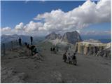 2
2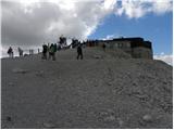 3
3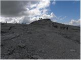 4
4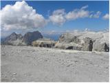 5
5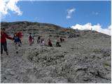 6
6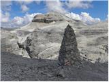 7
7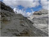 8
8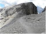 9
9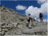 10
10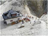 11
11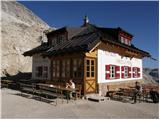 12
12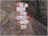 13
13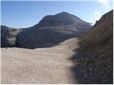 14
14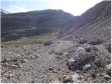 15
15 16
16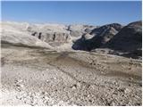 17
17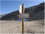 18
18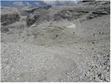 19
19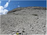 20
20 21
21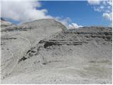 22
22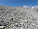 23
23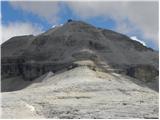 24
24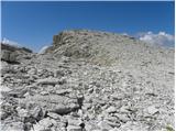 25
25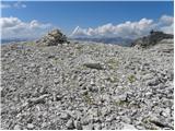 26
26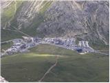 27
27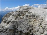 28
28 29
29