Sele-Zvrhnji Kot (Male) / Zell-Oberwinkel (Male) - Hajnžev Praprotnik / Zeller Prapotnik
Starting point: Sele-Zvrhnji Kot (Male) / Zell-Oberwinkel (Male) (666 m)
| Latitude/Longitude: | 46,47230°N 14,33340°E |
| |
Walking time: 3 h 55 min
Difficulty: easy unmarked way
Elevation gain: 1061 m
Elevation difference along the route: 1100 m
Map: Karavanke - osrednji del 1:50.000
Recommended equipment (summer):
Recommended equipment (winter): ice axe, crampons
Views: 462
 | 2 people like this post |
Access to starting point:
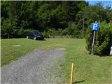
From the Ljubljana-Jesenice highway, we take the Ljubelj (Tržič) exit, then continue driving in the direction of Celovec / Klagenfurt. After the Ljubelj tunnel, the road starts descending, and we follow it to the settlement Podljubelj / Unterloibl, where we continue right in the direction of Borovlje / Ferlach (by the crossroad there are also signs for the Hofer store). Lower down, we cross the railway track, then at the next somewhat larger crossroad we go right in the direction of the settlement Sele / Zell. The road then leads us past the Eurospar store, after which Borovlje slowly ends. Further on, the road leads us through the settlement Bajdiše / Waidisch. A little further from the mentioned settlement, we leave the main road which leads towards the settlement Sele-pri Cerkvi / Zell-Pfarre and continue driving right in the direction of the settlement Sele-Zvrhnji Kot / Zell-Oberwinkel. The road then leads us past individual houses, then we arrive at a crossroad by which yellow hiking signposts are located (the described path starts by the signposts), and we drive a good 100 meters further to the marked parking lot by the Ljudska šola / Volksschule.
Route description:
From the marked parking lot, we return along the asphalt road to the marked crossroad, from there we continue in the direction of Košutica (Ljubeljske babe) / Loibler Baba. The path ahead leads us along a macadam road which is closed to public traffic by a traffic sign. The road a little further ahead crosses the Hajnžev graben stream over a bridge, then leads us past a few houses. A little higher, the blazes from the road direct us slightly left onto a footpath, which then over a small wooden bridge once again crosses the mentioned stream. The path continues along the scenic stream, for some time on the right bank and for some time on the left bank, in between the path also leads us past a smaller but usually quite watery waterfall. Above the waterfall, the stream becomes less rapid for some time, the path rather flat. Later the path leads over some small bridges, the stream again becomes more scenic. When after some time we reach the macadam road, we follow it left, along it we quickly arrive at the marked junction.
From the junction we continue right (left Koča pod Košuto / Koschutahaus), past the mill and over the bridge. The path ahead leads through the forest, then we arrive at a scree field where the trail temporarily disappears. Some 10 meters further we step onto another macadam road, along it we walk to the nearby crossroad, from which we go left in the direction of Košutica (straight to farm Hajnž).
The path ahead leads us along a macadam road, along which we walk to a small meadow. In the middle of the meadow, where the road turns slightly right, we continue slightly left onto a cart track, from the cart track a little further slightly right onto a footpath. The path ahead climbs more steeply for the first time, after a few minutes it returns to the road. We follow the road left, after the nearby right bend we leave it and continue left into the forest. A few minutes of ascent through the forest follow, then the path flattens again and brings us to a marked junction.
From the junction we continue right in the direction of Ljubelj along path no. 650 (left Hajnževo sedlo, path no. 651). Initially still flat path, in the forest it becomes steeper and after a small spring turns left. Some traverse ascent to the left follows, then after the warning sign that we are entering the grazing area, the path turns slightly right and starts to disappear. Through sparse forest, higher pasture, we follow the occasionally sparse blazes, the increasingly panoramic path higher brings us to a small ridge where there is a grazing fence.
On the ridge the marked path turns left, we continue straight across the grazing fence and then right, initially slightly downhill in the direction towards the northeast. On this section the trail completely disappears, we continue across the gentle terrain to the cairn, behind which a poorer trail appears on the slope (if here we continue left downhill we arrive at Lokovnikova planina, if we stick right along the ridge, the passage is blocked by dwarf pines).
Further on, it is very good to stick to the poorer trail as it leads us through the steep section without major difficulties. Above the steep slope the path enters the dwarf pines, occasionally still steeply ascending. Higher we reach the ridge of Hajnžev Praprotnik, the path continues for some time through occasionally quite overgrown dwarf pines. Despite occasional greater overgrowth, the trail through the dwarf pines is quite easy to follow.
On the ridge the path flattens, separating us from the main summit are still a few short ascents and descents. Before the ascent to the summit the dwarf pines end, we first steeply ascend to the ridge, along which then in a few 10 steps we reach the panoramic summit.
Description and pictures refer to the condition in 2017 (July and October).

Along the route: Slap v Hajnževem grabnu (720m)
Photos:
 1
1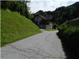 2
2 3
3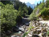 4
4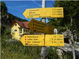 5
5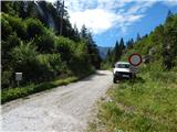 6
6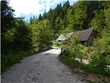 7
7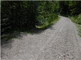 8
8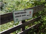 9
9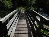 10
10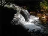 11
11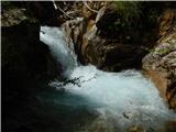 12
12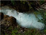 13
13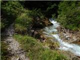 14
14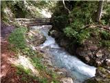 15
15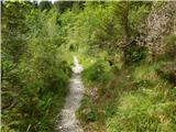 16
16 17
17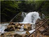 18
18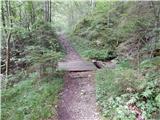 19
19 20
20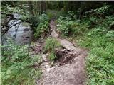 21
21 22
22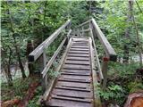 23
23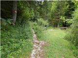 24
24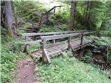 25
25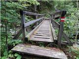 26
26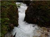 27
27 28
28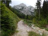 29
29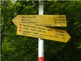 30
30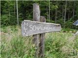 31
31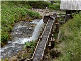 32
32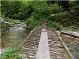 33
33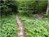 34
34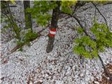 35
35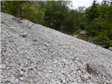 36
36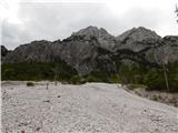 37
37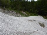 38
38 39
39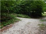 40
40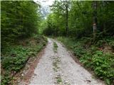 41
41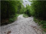 42
42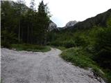 43
43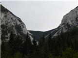 44
44 45
45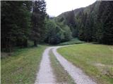 46
46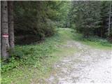 47
47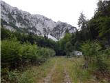 48
48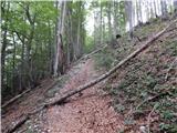 49
49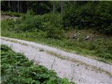 50
50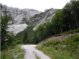 51
51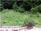 52
52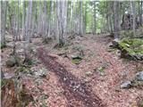 53
53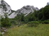 54
54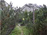 55
55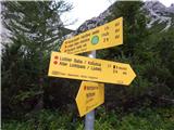 56
56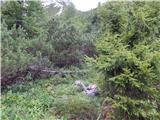 57
57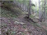 58
58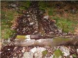 59
59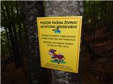 60
60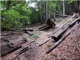 61
61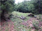 62
62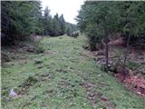 63
63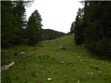 64
64 65
65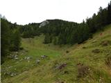 66
66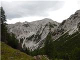 67
67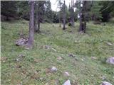 68
68 69
69 70
70 71
71 72
72 73
73 74
74 75
75 76
76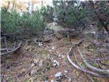 77
77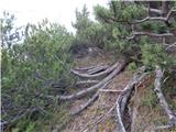 78
78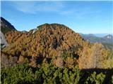 79
79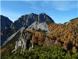 80
80 81
81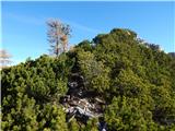 82
82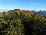 83
83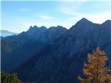 84
84 85
85 86
86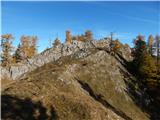 87
87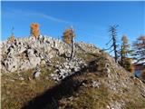 88
88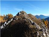 89
89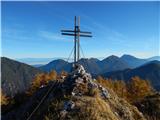 90
90 91
91
Discussion about the trip Sele-Zvrhnji Kot (Male) / Zell-Oberwinkel (Male) - Hajnžev Praprotnik / Zeller Prapotnik
To post a comment you must log in:
If you do not yet have a username, you must first
register.