Šentvid pri Planini - Plešivec (Bohor)
Starting point: Šentvid pri Planini (614 m)
Starting point Lat/Lon: 46.09426°N 15.43268°E 
Time of walking: 1 h 35 min
Difficulty: easy marked way, easy unmarked way
Difficulty of skiing: no data
Altitude difference: 301 m
Altitude difference (by path): 385 m
Map:
Access to starting point:
A) We drive to Sevnica (to here from Radeče, Mokronog or Krško), and then we go on the road in the direction of Planina pri Sevnici. A little before Planina pri Sevnici we turn right into Doropolje, and a little higher we turn right and continue driving towards Šentvid pri Planini. After the church of St. Vid we turn right and then park in the parking lot by the Cultural Hall Šentvid pri Planini, or the cemetery.
B) We drive to Šentjur (to here from Celje, Štajerska highway exit Dramlje or Šmarje pri Jelšah), and then we follow the signs for Kozje and Planina pri Sevnici. At the end of Šentjur we go right in the direction of Planina pri Sevnici (slightly left - Kozje and Podsreda). Further, we mostly ascend, and when the road flattens and we notice the Petrol gas station on the right side, located in close proximity to Planina pri Sevnici, we turn left at the nearby crossroad towards Sevnica (right to Planina pri Sevnici). Towards Sevnica we drive only a short time before turning left in the direction of Šentvid pri Planini. When we arrive in the settlement of Šentvid pri Planini, after the church of St. Vid we turn right and then park in the parking lot by the Cultural Hall Šentvid pri Planini, or the cemetery.
Path description:
From the starting point, we continue on the road which descends from the starting point towards the south, and lower we reach the saddle, which separates the streams Sevnična and Leniška, or the saddle, which separates Pečine from Bohor.
Here the road turns left, and before a smaller structure, which is situated near the house, we continue right on a cart track which passes into the forest. In the forest, after the first crossing, the first blazes appear, and at several subsequent crossings we follow the blazes, in the first part mostly ascending diagonally towards the right. Higher, the path turns slightly to the left and flattens, from the slope it temporarily brings us onto more level terrain, on which we walk to a small metal hunting observatory, where blazes direct us left onto a cart track which quickly passes onto a slope and then starts ascending diagonally towards the left. Next follows some diagonal ascent, and then the path flattens and brings us onto a poorer road, on which we continue to "Netopir", or Bohorska konjenica, where there is a marked crossing.
Here, to the left, the road leads towards the eastern part of Bohor, but we continue straight on the marked road in the direction of the cottage Koča na Bohorju (sharply right Žaga and Planina pri Sevnici). We continue on the macadam road, walking along it to the first right turn, where we leave the road and proceed slightly left onto a footpath (it is also possible to continue along the road, which can lead to cottage Lovski dom Bohor and the saddle between Veliki and Mali Javornik), then follow the blazes at a few smaller crossings. Higher up, we also cross a cart track, then return to the macadam road. When we reach the saddle between Koprivnik on the left and Veliki Javornik on the right a little further ahead, we arrive at a marked crossing.
We go straight in the direction of Koča na Bohorju (left - Koprivnik, right - Veliki Javornik) and we still continue on the road which starts descending, and after few minutes from the left joins the path which leads over the peak Koprivnik. Here we continue straight as well and on the road to which from the left joins also the path from Senovo and Podsreda, and from which a path branches off to the right towards Petrova skala and a window, we continue to the nearby mountain hut Koča na Bohorju which is situated on the right side of the road.
Left from the hut, at the end of the parking lot, we notice a grassy cart track, on which we in few minutes ascend on 915 meters high peak.
The starting point - Koča na Bohorju 1:30, Koča na Bohorju - Plešivec 0:05.
Description and pictures refer to the condition in March 2022 and March 2025.
Pictures:
 1
1 2
2 3
3 4
4 5
5 6
6 7
7 8
8 9
9 10
10 11
11 12
12 13
13 14
14 15
15 16
16 17
17 18
18 19
19 20
20 21
21 22
22 23
23 24
24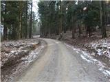 25
25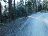 26
26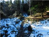 27
27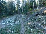 28
28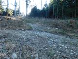 29
29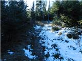 30
30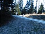 31
31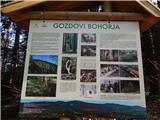 32
32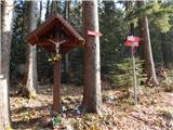 33
33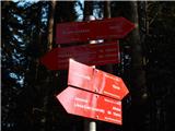 34
34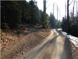 35
35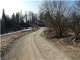 36
36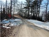 37
37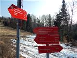 38
38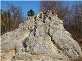 39
39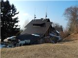 40
40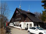 41
41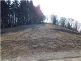 42
42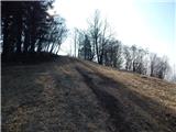 43
43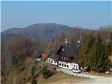 44
44 45
45 46
46 47
47