Skadanščina - Slavnik (via planina Jegno)
Starting point: Skadanščina (550 m)
Starting point Lat/Lon: 45.54791°N 14.01324°E 
Path name: via planina Jegno
Time of walking: 2 h 25 min
Difficulty: easy marked way
Difficulty of skiing: no data
Altitude difference: 478 m
Altitude difference (by path): 545 m
Map: Slovenska Istra - Čičarija, Brkini in Kras 1:50.000
Access to starting point:
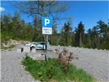
We leave the Primorska highway at the Kozina exit, and then follow the road towards Ilirska Bistrica and Reka. After the settlement of Materija, we stay alert, as the road soon branches off to the right towards Skadanščina. We continue on this road, following it to a marked parking lot located shortly before the settlement of Skadanščina.
Path description:
From the parking lot, we head onto a marked footpath toward Skadanščina and Slavnik, which ascends through a strip of forest, and when the forest ends, we quickly reach the church of St. Rok, located on the outskirts of the settlement Skadanščina.
We bypass the church on the right side, then begin descending through the village, following the trail markers. Lower down, we reach a marked crossroad in the center of the village, choose the right path, and soon leave the settlement area. The path ahead leads us along a gravel road, which quickly brings us to a small triangular crossroad. At this crossroad, we continue straight, proceeding uphill on a rougher gravel road that leads to a larger turning area. We continue on a wide cart track which at first moderately descends, and then it continues without large changes in altitude. After about half an hour of walking, we arrive at a large watering place for animals, where we also step onto a poorer gravel road.
Here, we turn left (right leads to Povžane) and ascend diagonally to a junction where a path branches left toward Slavnik, bypassing the mountain pasture Jegno, while we continue straight toward the mentioned mountain pasture. A few minutes later, we continue ascending through the forest, following the blazes at several junctions, then a short descent follows, and we emerge from the forest onto the edge of the mountain pasture Jegno, where a few buildings stand.
We bypass the buildings on the mountain pasture by the left side and continue walking along a cart track that gently ascends to a junction, where a path from Hrpelje joins from the right.
Here we continue slightly left towards Slavnik and proceed uphill along a poorer macadam road, where, in the spring months, we can observe numerous blooming daffodils. Higher up, we leave the spacious area of the mountain pasture Jegno and enter the forest, continuing briefly along a marked cart track, then turning left onto a footpath. A little further on, the forest thins out, and we reach a strip of sparse shrubbery, where a beautiful view opens up, stretching all the way to the Alps, where we can also see the highest peak of Slovenia, Triglav. The path ahead returns to the forest, where we cross a road and continue along a cart track that leads us to a junction, where a marked path from Prešnica also joins.
We continue left towards Slavnik, and just a few steps further, we reach the protected area of the natural monument Slavnik.
Next follows a shorter, steeper ascent, and the path then flattens and brings us to the road.
We follow the road straight ahead and on the left side bypass the less distinct peak Cigan (998 meters), after which a path from Povžane or Skadanščina joins from the left (a path that doesn’t lead over the mountain pasture Jegno).
We continue in the direction of Slavnik and, a little further on, leave the road to walk across an increasingly panoramic meadow, reaching Tumova koča on Slavnik after a few minutes of additional walking.
Behind the cottage, we go left and, in a minute of further walking, ascend to a panoramic peak, from which a beautiful view opens up, stretching from the sea to the Alps.
The starting point - Sveti Rok 0:05, Sveti Rok - mountain pasture Jegno 1:05, mountain pasture Jegno - Slavnik 1:15.
Pictures:
 1
1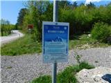 2
2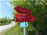 3
3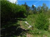 4
4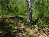 5
5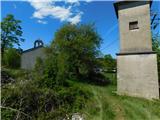 6
6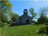 7
7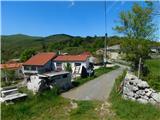 8
8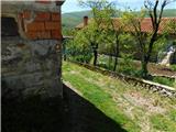 9
9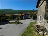 10
10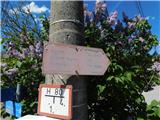 11
11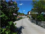 12
12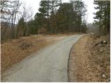 13
13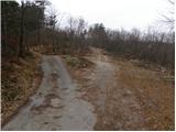 14
14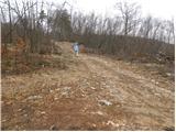 15
15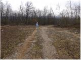 16
16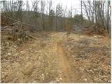 17
17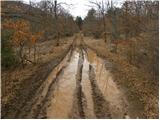 18
18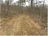 19
19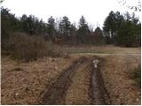 20
20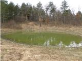 21
21 22
22 23
23 24
24 25
25 26
26 27
27 28
28 29
29 30
30 31
31 32
32 33
33 34
34 35
35 36
36 37
37 38
38 39
39 40
40 41
41 42
42 43
43 44
44 45
45 46
46 47
47 48
48 49
49 50
50 51
51 52
52 53
53 54
54 55
55 56
56 57
57 58
58 59
59 60
60 61
61 62
62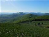 63
63