Skadanščina - Velika Plešivica
Starting point: Skadanščina (550 m)
Starting point Lat/Lon: 45.5468°N 14.0119°E 
Time of walking: 2 h 15 min
Difficulty: easy marked way
Difficulty of skiing: no data
Altitude difference: 358 m
Altitude difference (by path): 405 m
Map: Slovenska Istra - Čičarija, Brkini in Kras 1:50.000
Access to starting point:
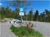
We leave the Primorska highway at the Kozina exit, and then follow the road towards Ilirska Bistrica and Reka. After the settlement of Materija, we stay alert, as the road soon branches off to the right towards Skadanščina. We continue on this road, following it to a marked parking lot located shortly before the settlement of Skadanščina.
Path description:
From the parking lot, we head onto a marked footpath toward Skadanščina and Slavnik, which ascends through a strip of forest, and when the forest ends, we quickly reach the church of St. Rok, located on the outskirts of the settlement Skadanščina.
We bypass the church on the right side, then begin descending through the village, following the trail markers. Lower, we reach a marked crossroads in the middle of the village, and we choose the road with signs for Slavnik SPP, Mala Vrata, and Plešivec (to the right, Jegno pasture). The road after the village loses an asphalt covering and after few minutes of walking splits into two parts.
We choose the slightly left, lower path, by which there are signs for Mala Vrata, Plešivica, and Slavnik (slightly to the right, the normal, shorter path from Skadanščina to Slavnik) and along which we initially descend a little. Next follow a few smaller crossings, where we follow the blazes, and then we gradually enter a denser forest, where the path continues along various cart tracks, and at the crossings, we still carefully follow the blazes. After some time, we leave the cart track, which continues with a few shorter ascents and occasional descents, turning left onto a footpath that initially ascends mostly gently; higher up, when we reach a small, indistinct valley, it ascends moderately. Through the forest, we then reach the saddle Mala Vrata, where we arrive at the national border with neighboring Croatia, a marked crossing, and a barbed wire fence within the Schengen area.
Here we continue left towards Velika Plešivica, Velika Vrata, and Ostrič (right Slavnik) and begin ascending alongside a barbed wire fence, where caution is needed, especially during the descent, to avoid getting cut. The path ahead leads us along the western to northwestern ridge of Plešivica, where we initially ascend quite steeply through the forest, and higher up, as the path levels out, across an increasingly panoramic, partly grassy slope. This path, which is occasionally somewhat harder to follow but marked, we follow to the registration box on Velika Plešivica.
Starting point - Sveti Rok 0:05, Sveti Rok - Mala Vrata 1:30, Mala Vrata - Velika Plešivica 0:40.
Description and pictures refer to conditions in April 2024.
Pictures:
 1
1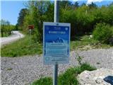 2
2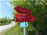 3
3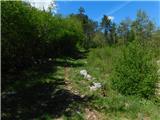 4
4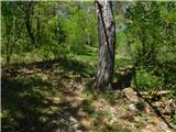 5
5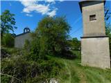 6
6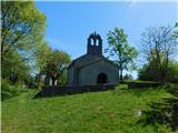 7
7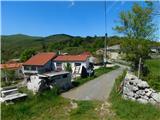 8
8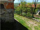 9
9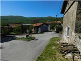 10
10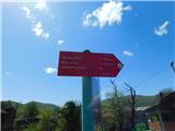 11
11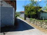 12
12 13
13 14
14 15
15 16
16 17
17 18
18 19
19 20
20 21
21 22
22 23
23 24
24 25
25 26
26 27
27 28
28 29
29 30
30 31
31 32
32 33
33 34
34 35
35 36
36 37
37 38
38 39
39 40
40 41
41 42
42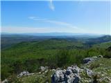 43
43