Starting point: Slačka baba (100 m)
Starting point Lat/Lon: 45.52°N 13.8958°E 
Time of walking: 1 h 5 min
Difficulty: easy unmarked way, partly demanding marked way
Difficulty of skiing: no data
Altitude difference: 349 m
Altitude difference (by path): 355 m
Map: Slovenska Istra - Čičarija, Brkini in Kras 1:50.000
Access to starting point:
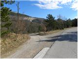
From the highway Ljubljana - Koper, we take the exit Črni Kal. From Črni Kal, we continue driving on the old road towards the coast, but we drive along it only to the next somewhat larger crossroads, where we turn left in the direction of the border crossing Sočerga. Further on, we drive towards the mentioned border crossing, but we follow the road only for a few km, as then the signs for the village Hrastovlje direct us left onto a local road. After a few km of further driving, we pay attention because opposite the nearby pig farm, a macadam road branches off to the left beside which we park (the road turn-off is exactly below the power lines).
Path description:
From the starting point, we descend along the macadam road to the nearby water tank, where we continue sharply left onto a somewhat narrower macadam road. The macadam road further gently ascends and takes us through the underpass under the railway track to a smaller unmarked junction, where we continue right. Further on, we ascend parallel to the railway track for a short time, then the road turns slightly left and begins to ascend moderately towards the village Podpeč. Higher up, a marked path from Hrastovlje joins us from the right, but we continue along the poorer macadam road, along which we reach the aforementioned village in a few minutes of further walking.
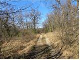
When in Podpeč we step onto the asphalt road, we follow it to the right, walking along it almost to the end of the picturesque little village, through which a narrow road winds. Just before the sign marking the end of Podpeč, the marks direct us left into the forest, through which we begin to ascend steeply. The steep path soon flattens temporarily and turns left, crossing fairly steep and slippery-dangerous slopes. At the end of the crossing, the path turns right and, with the aid of a chain fence, ascends steeply towards the 11th-century defensive tower. The tower, which is usually closed, we bypass on the right side and continue ascending on a somewhat less steep slope. After a few minutes of walking from the tower, the path flattens and brings us to expansive karst meadows above the steep step of the Kraški rob. Here we continue left and ascend along the edge of the cliffs to the indistinct but very panoramic Zjat.
On the way: Podpeč (312m), Obrambni stolp nad Podpečjo (385m)
Pictures:
 1
1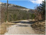 2
2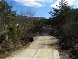 3
34
 5
5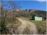 6
6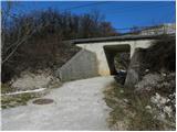 7
7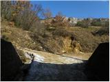 8
8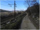 9
9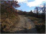 10
10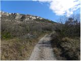 11
11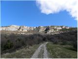 12
12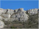 13
13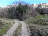 14
14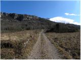 15
15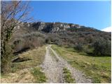 16
16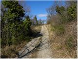 17
17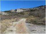 18
18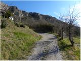 19
19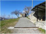 20
20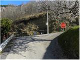 21
21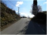 22
22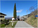 23
23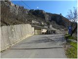 24
24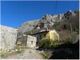 25
25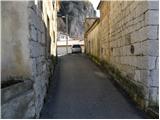 26
26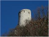 27
27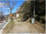 28
28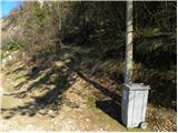 29
29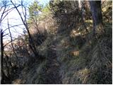 30
30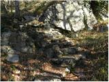 31
31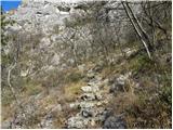 32
32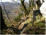 33
33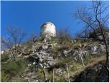 34
34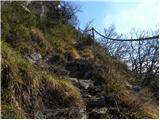 35
35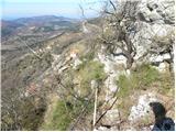 36
36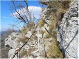 37
37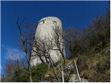 38
38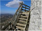 39
39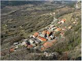 40
40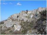 41
41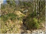 42
42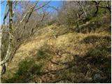 43
43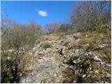 44
44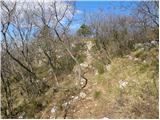 45
45 46
46 47
47 48
48 49
49 50
50 51
51