Slovenske Konjice - Skala (steep path)
Starting point: Slovenske Konjice (333 m)
Starting point Lat/Lon: 46.3372°N 15.4204°E 
Path name: steep path
Time of walking: 1 h 10 min
Difficulty: very difficult marked way
Difficulty of skiing: very demanding
Altitude difference: 417 m
Altitude difference (by path): 417 m
Map:
Access to starting point:
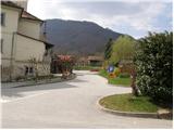
From the highway Ljubljana - Maribor, we go to the exit Slovenske Konjice and follow the road to the mentioned town. In the center of Slovenske Konjice, we leave the main road (we continue left) and go towards the church, near which we park on a large marked parking lot.
Path description:
From the parking lot, we walk to the eastern side of the church, where we notice the hiking markers for Skala. The path first leads along the street Cesta pod Goro, which we soon leave, as the markers at the triangular junction direct us onto a poorer road, which gently ascends along the large field upwards. We soon leave the poorer road as well, as the path continues along the field upwards (the road turns slightly to the right). The path then goes into the forest, where after a few dozen steps we step again onto a cart track, which we follow to the left. Initially, the gently sloping cart track makes a right turn and then ascends more steeply and gradually turns into a footpath. The path, which runs through the forest, continues to ascend moderately. After a few minutes of further walking, it brings us to a road, which we only cross. The path, which from here begins to ascend steeper and steeper, brings us after some time to a path junction, where we have two options for continuing.
We continue slightly left in the direction of the climbing path (right easier path), which after a few more steps brings us to the entrance to the wall. The path ahead, with the help of steel cables, steeply ascends along the foot of the wall. When we overcome this part, the most difficult part of the path lies ahead of us. With the help of a steel cable and pegs, we ascend a steep diagonal gully, after which the path brings us to the other side of the rocky spur. Here a few more pegs await us, after which the difficulties ease and the path brings us to Skala, from where a beautiful view opens up.
The climbing part is only 5 minutes long.
Pictures:
 1
1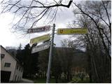 2
2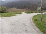 3
3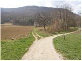 4
4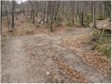 5
5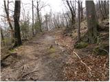 6
6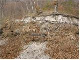 7
7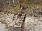 8
8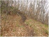 9
9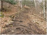 10
10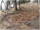 11
11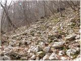 12
12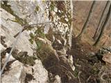 13
13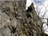 14
14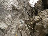 15
15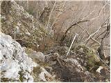 16
16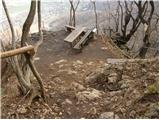 17
17 18
18