Solkan - Sabotin (northern way)
Starting point: Solkan (100 m)
Starting point Lat/Lon: 45.9751°N 13.6484°E 
Path name: northern way
Time of walking: 2 h
Difficulty: partly demanding marked way
Difficulty of skiing: no data
Altitude difference: 509 m
Altitude difference (by path): 509 m
Map: Goriška 1:50.000
Access to starting point:
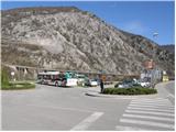
First, we drive to Nova Gorica and then we continue driving towards Tolmin. At the end of the village Solkan, we turn left on a large parking lot, which is located before Solkan bridge.
From Tolmin we drive towards Nova Gorica, but only to the village Solkan. At the beginning of the village, we turn right and we park on a large parking lot, which is located after Solkan bridge.
The starting point is on the parking lot at the end of the Solkan, to where we can drive with city bus from Nova Gorica or Šempeter.
Path description:
From the parking lot, we cross Solkan bridge and then on its other side we notice signposts for Sabotin (south and north path). To ascent on Sabotin on the northern path we at first descend below the bridge, and then we walk on the path which runs by the river Soča and railway upwards. Gentle, or horizontal path, then runs past HE Solkan and after approximately half an hour of walking from the starting point brings us to mountain signposts, where we continue left upwards. The path ahead is moderately ascending, on an old military mule track to a nice viewpoint with a bench. Here the path turns left and after additional few minutes of ascent brings us to a crossing, where we have two options to continue. We continue right in the direction of Sabotin (left Sabotin, past the ruins of St. Valentin), on the path which starts gradually ascending steeper and steeper. Steeper and steeper path, brings us below the cliffs of the upper slope of Sabotin. After that, the path with the help of steel cables in a moderate ascent crosses a steep slope (undemanding) and then it ascends to numerous caverns (it is good to have a lamp with you, to walk through tunnels). Before caverns path turns left and again with the help of steel cables ascends on stairs. Next follows a steep ascent through military tunnels and the path brings us to the mountain hut Dom na Sabotinu. From the hut, we continue in the direction of the peak and moderately steep and a more panoramic path after 15 minutes of walking from the hut, brings us on a panoramic peak.
Pictures:
 1
1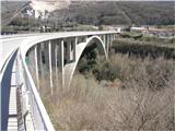 2
2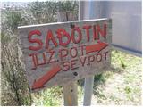 3
3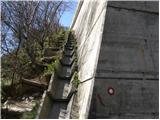 4
4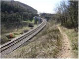 5
5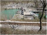 6
6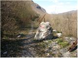 7
7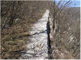 8
8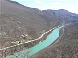 9
9 10
10 11
11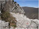 12
12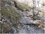 13
13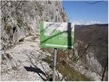 14
14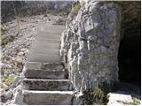 15
15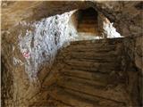 16
16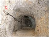 17
17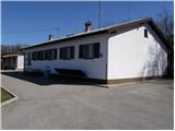 18
18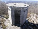 19
19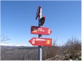 20
20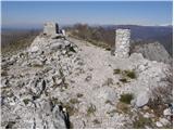 21
21