Sovodenj - Ermanovec (razgledna pot)
Starting point: Sovodenj (592 m)
| Latitude/Longitude: | 46,08500°N 14,03860°E |
| |
Route name: razgledna pot
Walking time: 2 h
Difficulty: easy marked way
Elevation gain: 434 m
Elevation difference along the route: 470 m
Map: Škofjeloško in Cerljansko hribovje 1:50.000
Recommended equipment (summer):
Recommended equipment (winter):
Views: 28.704
 | 3 people like this post |
Access to starting point:
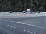
A) From Ljubljana or Kranj we drive to Škofja Loka, from where we continue towards Gorenja vas. In Gorenja vas we continue right in the direction of Cerkno and Žiri. The road then runs past the village of Trebija, after which we turn right in the direction of Cerkno (left Žiri). We follow this road to the village of Sovodenj, where we park on the parking lot between the store and the fire station.
B) From Tolmin we drive to Cerkno and follow the road ahead towards Škofja Loka. When we come to the village of Sovodenj we park on the parking lot between the store and the fire station.
Route description:
From the parking lot, we continue on the asphalt road in the direction of Ermanovec and Cerkno. After a few minutes of ascent on the main road, we arrive at a marked intersection, where the road to Ermanovec branches off to the right. We head onto this road, which runs along a scenic stream and brings us to the next intersection after a few minutes of further walking.
We continue straight ahead (right Ermanovec by road) on the road, which continues to run along the previously mentioned stream. The road then crosses the stream over a small bridge and brings us past a small hamlet to a marked junction.
We continue sharply left in the direction of Ermanovec on the scenic path (straight Ermanovec through Miklavževa grapa). Further on, we ascend along a cart track, which soon emerges from the forest onto panoramic grassy slopes. A little higher up, the path brings us to a small hamlet, where we also step onto the road, along which we continue the ascent. The road then brings us past a small cross to an intersection, where we continue right in the direction of Ermanovec. The road, which continues to ascend gently, quickly brings us to the next intersection, where we continue straight ahead (direction Ermanovec).
From the increasingly poor road, a marked cart track branches off a little further to the right, crossing a short stretch of forest. The cart track, which merely crosses the slopes, then leads to a somewhat larger clearing, after which it brings us into dense forest. The cart track then begins to ascend, and higher up it emerges from the forest and brings us to an asphalt road, along which we then ascend.
Here, the path through Miklavževa grapa soon joins us from the right. The road then brings us past a small hamlet to an intersection near the mountain hut on Ermanovec.
Here we continue right (left to the mountain hut on Ermanovec 1 minute) along the road, which after 5 minutes of further walking brings us to a chapel next to which there is a larger bell. There is also a junction at the chapel, where we continue along the cart track in the direction of Ermanovec, which is still 15 minutes away. The path ahead ascends gently along the cart track, which brings us with fine views in 10 minutes to the other side of this panoramic slope. Here the path turns left and ascends more steeply. We then follow this cart track path all the way to the top of Ermanovec.
Just a few steps before the summit, we will notice a fine vantage point on the left side, from which a beautiful view opens up.

The trip can be extended to the following destinations: Štor
Photos:
 1
1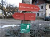 2
2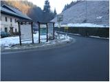 3
3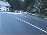 4
4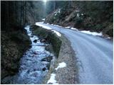 5
5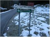 6
6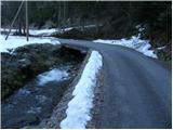 7
7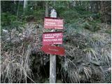 8
8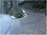 9
9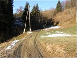 10
10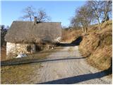 11
11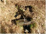 12
12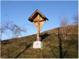 13
13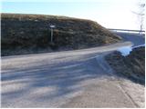 14
14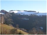 15
15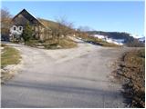 16
16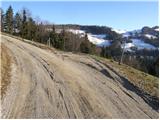 17
17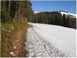 18
18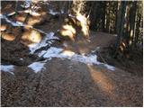 19
19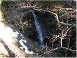 20
20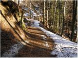 21
21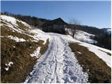 22
22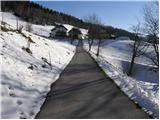 23
23 24
24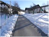 25
25 26
26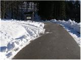 27
27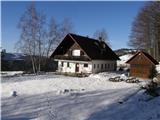 28
28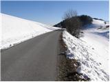 29
29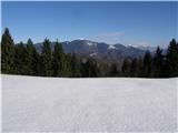 30
30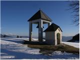 31
31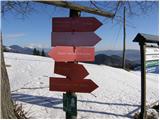 32
32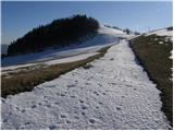 33
33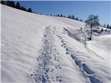 34
34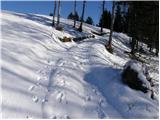 35
35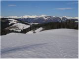 36
36 37
37
Discussion about the trip Sovodenj - Ermanovec (razgledna pot)
|
| Tadej23. 12. 2008 |
Ermanovec offers a nice view despite its modest altitude in good weather. Since the path is easy, it is also suitable for small children.
|
|
|
|
| niki27. 12. 2008 |
I'm interested in the circular path from Sovodenj to Ermanovec and then via Bevkova vrh back to the starting point. Is the path trodden and approximately how long does it take to walk it? LP, niki
|
|
|
|
| Kokta7. 04. 2012 |
From Sovodenj to the hut at Čaj then to Štor. Also a visit to the top of Ermanovec and back. Below the summit of Ermanovec logbook and stamp. It was lightly raining the whole way 
|
|
|
|
| Lisica30. 04. 2012 |
I went to Ermanovec via the scenic path, which I don't recommend, better go up the gully. The scenic path is mostly asphalt...
Very few people on the path, considering it's SPP on Sunday with nice weather I expected more visitors, same on the path to Bevkov vrh and Sivko.
|
|
|
|
| slavkovoda15. 06. 2014 |
Today visited Koča na Ermanovcu via this scenic path - path along Miklavžev greben CLOSED - FALLEN TREES (ice storm)!! Nice weather, nice view, lots of blueberries, exceptional dry sausage with sauerkraut.
|
|
|
To post a comment you must log in:
If you do not yet have a username, you must first
register.