Spodnja Kokra - Potoška gora
Starting point: Spodnja Kokra (530 m)
Starting point Lat/Lon: 46.3027°N 14.4754°E 
Time of walking: 2 h 5 min
Difficulty: easy marked way
Difficulty of skiing: partly demanding
Altitude difference: 753 m
Altitude difference (by path): 753 m
Map: Karavanke - osrednji del 1:50.000
Access to starting point:
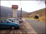
From highway Ljubljana - Jesenice we go to the exit Kranj - vzhod and follow the road ahead in the direction of Jezersko. Only few kilometers after the turn-off for Preddvor we will on the right side of the road notice transformer and by it parking lot, where we park. Here are also signposts for mountain hut Dom Čemšenik.
Path description:
From the parking lot at first we carefully cross the road, and then we go on a footpath in the direction of the mountain hut Dom Čemšenik. A wide path lightly ascends to the homestead Polajnar, where we step on the road which we follow to the right.
The road just after the house steeply ascends, which a little higher loses an asphalt covering. Further, the road flattens and turns a little towards the left, where it gets very close to the stream Čemšeniški potok. Even a little further, we cross the mentioned stream and right after it we come at the marked crossroad, where we continue on the left road in the direction of mountian hut Dom Čemšenik. The road then again starts ascending steeper and in less than 30 minutes of additional walking brings us to the mountain hut Dom Čemšenik.
From the hut Dom Čemšenik we continue in the direction of Javorov vrh (on a sign Javorjev vrh) on the path which after few meters goes into the forest. At first moderately steep path soon brings us to a torrent ditch, by which there is then for some time ascending. Higher, the path turns to the right and it ascends even steeper. This relatively steep path, which all the time runs through a dense forest, we follow all the way to a crossing on the saddle between Potoška gora on the left and Javorov vrh on the right.
We continue left in the direction of Potoška gora (slightly left St. Jakob - path, which avoids the summit of Potoška gora, right Javorov or Javorjev vrh, Cjanovca, cottage Zavetišče v Hudičevem borštu, Cjanovca, Srednji vrh, Kališče and Storžič) and we continue the ascent on the upper with a forest covered slope of Potoška gora. After approximately 15 minutes of walking from the last crossing we step on a forested peak.
Spodnja Kokra - Čemšenik 50 minutes, Čemšenik - Potoška gora 1:15.
Pictures:
 1
1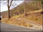 2
2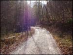 3
3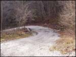 4
4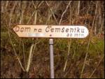 5
5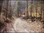 6
6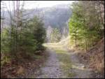 7
7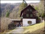 8
8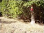 9
9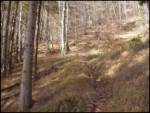 10
10 11
11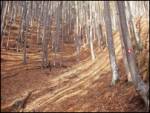 12
12 13
13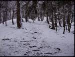 14
14 15
15