Spodnje Radvanje - Žigartov vrh (via Ledinekov kogel)
Starting point: Spodnje Radvanje (279 m)
Starting point Lat/Lon: 46.53234°N 15.62835°E 
Path name: via Ledinekov kogel
Time of walking: 4 h 15 min
Difficulty: easy marked way
Difficulty of skiing: no data
Altitude difference: 1067 m
Altitude difference (by path): 1175 m
Map: Pohorje 1:50.000
Access to starting point:
We drive to Maribor, more precisely on road Tržaška cesta, where at the industrial zone or shopping centers at the traffic light intersection we turn toward the settlement Razvanje. Further, we drive on road Papeževa cesta, then turn right toward Pohorje (left for Razvanje). When we reach the next intersection a little further, we continue "straight" (second exit), then at the following roundabout we turn "left" (third exit) and park a few tens of meters further in the parking lot in front of the information board at the start of the Slovenian mountain trail.
Path description:
From the parking lot, we continue on the street Pot na okope, and behind the houses, the road passes into the forest, where it splits into a few cart tracks. We continue on the slightly right cart track, by which the blazes continue, and we start gently ascending on the path that leads us between blackberry bushes and below the route of a high-voltage power line. The path ahead passes into a dense forest and gradually starts ascending steeply, and at a few crossings, we follow the blazes. Higher up, we reach a macadam road, which we follow to the left, and it quickly brings us to an asphalt road, on which we ascend to a marked crossing.
From the crossing, we go right in the direction of Mariborska koča on the SPP (straight southern path to Mariborska koča) and start ascending on a wider logging trail. The logging trail brings us in a few minutes to the Poštela archaeological site, where we pass by a few information boards, and at the crossings, we continue to follow the blazes.
When we leave the area of the Poštela archaeological site, we start ascending more steeply; higher up, where the path flattens, a larger number of crossings follow, where we carefully follow the blazes. A little higher, we come out of the forest onto the route of the ski slope, where the path continues along the edge of the forest and partly on the ski slope.
While walking on or beside the ski slope, the southern path, or the path that leads past the hunting lodge LD Hoče, joins from the left, and we continue to follow the signs for Bolfenk and Hotel Bellevue. Next follows approximately 20 minutes of ascent, and past some apartments and a catering facility, we reach the upper station of the Maribor funicular, Hotel Bellevue, and a few restaurants.
At the upper station of the funicular we notice hiking signposts, and we go right in the direction of Mariborska koča and Ruška koča na Arehu. A little further a short path branches off to the right towards the nearby church of St. Bolfenk, and we continue on a marked path which continues parallel with an asphalt road. On the mentioned path we are gently to moderately ascending, and after a smaller statue of Mary the path splits.
Slightly to the left the first path towards Mariborska koča branches off, and we continue straight in the direction of the path towards a lookout tower. The path which runs on the macadam road then out of the forest brings us to a ski track, and a little ahead it splits. We continue on the steeper right ski track, by which continue rare blazes, and on a ski slope we continue to a lookout tower on Mariborski razglednik.
We bypass the tower on the left side and we continue on a cart track which passes into the forest. In the forest, the path splits, and we continue slightly left in the direction of Mariborska koča and Ruška koča na Arehu (slightly right - Pečke) and we continue with the mostly easy ascent. Only a little further slightly to the left also the second path towards Mariborska koča branches off, and we again continue straight and in few minutes of a light ascent we get to indistinct Ledinekov kogel, where we notice radar tower.
From Ledinekov kogel follows some descent on a macadam road, and then we arrive at a marked crossing.
We continue straight in the direction of Ruška koča na Arehu (sharply left a fenced area below Ledinekov kogel, left Mariborska koča, right Pečke and Log) and proceed along a slightly narrower macadam road, from which we soon turn left onto a marked path. A little further, we cross a wider macadam road (left Mariborska koča, right Ruše and Glažuta), and then continue along a wider cart track that leads through the forest. A little further, a path branches off to the left towards hotel Zarja, but we continue straight in the direction of Ruška koča. This is followed by some diagonal ascent on the slopes of the peak Sedovec, and then we descend to a small saddle, where a path from the settlement Fram joins us.
We continue straight, mainly gently ascending along a macadam road that leads us past some burial sites. After some time, we reach the main road towards Areh, continue briefly alongside it, and then turn slightly left onto a footpath, which quickly leads us to the church of St. Areh.
From the church, we cross a meadow and we are already at Ruška koča na Arehu.
From the mountain hut, we continue right towards Žigartov vrh and we walk to an asphalt road, where we go left and then we continue on the road towards Šumik, Cojzerica and Žigartov vrh. At first the path also leads by large parking lot, and then the road goes into the forest and is lightly ascending. After approximately 10 minutes of additional walking, we get to a marked crossing, where the path branches off to the left towards the waterfall Šumik and Bajgot. We continue straight on a wider macadam road, and from which we go left about a minute ahead, because signs for Žigartov vrh point us to the left on a bad forest road, on which we ascend to the nearby ski slope. We continue by the edge of the ski slope, and higher the path goes slightly left and passes into the forest. We continue through the forest, where we follow the blazes, and such a path we follow all to a few minutes distant peak.
The starting point - Poštela 0:40, Poštela - Bellevue 1:20, Bellevue - Mariborski razglednik 0:25, Mariborski razglednik - Ledinekov kogel 0:15, Ledinekov kogel - Ruška koča 1:05, Ruška koča - Žigartov vrh 0:30.
Description and pictures refer to the condition in March, May and November 2022 and July 2024.
Pictures:
 1
1 2
2 3
3 4
4 5
5 6
6 7
7 8
8 9
9 10
10 11
11 12
12 13
13 14
14 15
15 16
16 17
17 18
18 19
19 20
20 21
21 22
22 23
23 24
24 25
25 26
26 27
27 28
28 29
29 30
30 31
31 32
32 33
33 34
34 35
35 36
36 37
37 38
38 39
39 40
40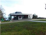 41
41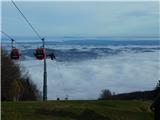 42
42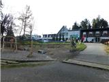 43
43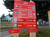 44
44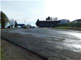 45
45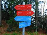 46
46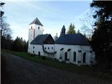 47
47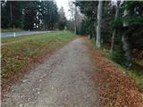 48
48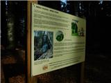 49
49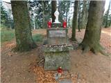 50
50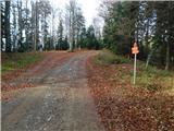 51
51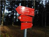 52
52 53
53 54
54 55
55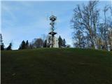 56
56 57
57 58
58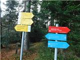 59
59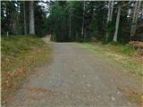 60
60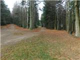 61
61 62
62 63
63 64
64 65
65 66
66 67
67 68
68 69
69 70
70 71
71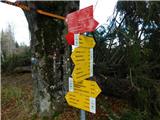 72
72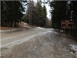 73
73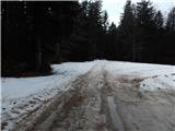 74
74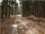 75
75 76
76 77
77 78
78 79
79 80
80 81
81 82
82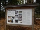 83
83 84
84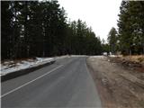 85
85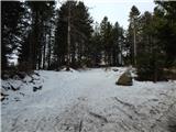 86
86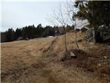 87
87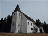 88
88 89
89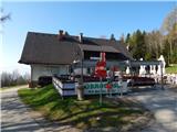 90
90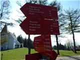 91
91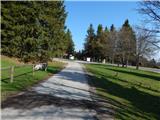 92
92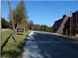 93
93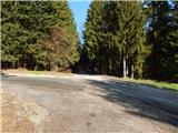 94
94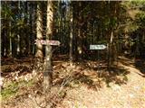 95
95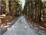 96
96 97
97 98
98 99
99 100
100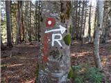 101
101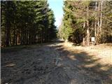 102
102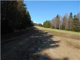 103
103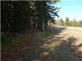 104
104 105
105 106
106 107
107 108
108 109
109 110
110 111
111