Srednji Vrh - Techantinger Mittagskogel (Trupejevo poldne) (via Blekova planina)
Starting point: Srednji Vrh (960 m)
Starting point Lat/Lon: 46.4894°N 13.8371°E 
Path name: via Blekova planina
Time of walking: 3 h 10 min
Difficulty: difficult unmarked way
Difficulty of skiing: no data
Altitude difference: 971 m
Altitude difference (by path): 1020 m
Map: Kranjska Gora 1:30.000
Access to starting point:
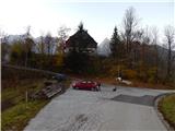
A) From highway Ljubljana - Jesenice we go to the exit Jesenice - west (Hrušica) and we continue driving in the direction of Kranjska Gora. When we come in Gozd Martuljek we turn right in the direction of Srednji Vrh and on a narrow and steep road we drive to the mentioned settlement. When the road flattens a little, we will come to a crossroad of multiple roads and turning point. We park on a marked parking lot by turning point.
B) We drive into Kranjska Gora, and then we continue driving in the direction of Jesenice. When we get to Gozd Martuljek, at first over the bridge we cross river Sava Dolinka, and then we need to pay attention to the left turn-offs, because the road soon branches off to the left towards Srednji Vrh. We continue on the mentioned road which leads us past few more houses, and then starts ascending steeply on a relatively narrow road which leads us past waterfalls of the stream Jerman. When higher road flattens we get to Srednji Vrh, where we park on a marked parking lot by turning point.
Path description:
From the starting point, we continue on the left road which immediately splits. We choose the left road (right road leads above the stream Hladnik towards the hunting cottage Za Lepim vrhom, which past the farm Hlebanja (at mentioned farm it is possible to buy milk products) and chapel brings us to the spot, where signs for Trupejevo poldne (on a sign Trupijevo poldne) point us to the right on a cart track which at first crosses electric fence. Cart track, from which a nice view opens up on Martuljek mountain group soon turns right, and then before it passes into the forest it splits into two parts. We continue on the lower cart track, by which we notice signs for Alpe Adria Trail, and the cart track after a shorter crossing brings us to a stream Jerman, by which we are then ascending. Further, we are for quite some time ascending by the mentioned stream, which we several times cross with the help of wider wooden bridge. Higher, the forest starts to get thinner, so that when we look back a nice view opens up towards Špik, and the path leads also past two cottages, which we notice on the left side of the path. During the ascent path together with the valley of the stream Jerman is turning more and more to the right and is becoming less steep. When the path flattens even more, we quickly reach the macadam road which leads from Korensko sedlo, and we follow it to the left (right Trupejevo poldne normal path).
On the mentioned road, we walk few minutes, and then we notice a footpath which from the road branches off slightly to the right. We can continue on the mentioned footpath which is diagonally ascending on occasionally panoramic slope, or on the road. In case that we continue on the road, then at the first crossroad we continue right, and when we come out of the forest both paths join.
From the spot, where paths join we continue on the road, to the spot, where it turns left, and on the mentioned turn we continue slightly right, on a footpath which ascends by the edge of the mountain pasture Blekova planina. Higher, the path flattens and in few steps we get to the shepherd hut.
Behind the hut path goes into the forest and continues on the border ridge. At first the path leads us through spruce, occasionally also partly larch forest. After approximately 30 minutes of light to moderate ascent, with some shorter descends, the path brings us to only technically more demanding part on the path, where we have to ascend over short jump. With some help of hands we quickly ascend for approximately 10 altitude meters. After jump, which we can bypass on the Slovenian side, the path flattens and then continues on a more and more panoramic ridge, where thinner forest is slowly replaced by dwarf pines. With a view on Austria, Slovenia, when we look back also Italy, we are getting closer to Trupejevo poldne, peak of which we already clearly see in front of us. Next follows few minutes of ascent, after that also dwarf pine starts vanishing, which is replaced by grass. A little below the summit, the path leads past mouth of torrent gully, where on the Austrian side path is slightly exposed, otherwise technically undemanding. From the gully to the top we have only few 10 strides of a little steeper walking.
The starting point - Blekova planina 1:50, Blekova planina - Trupejevo poldne 1:20.
Description and pictures refer to a condition in the year 2015 (November).
Pictures:
 1
1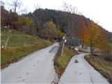 2
2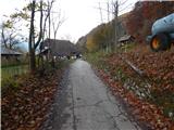 3
3 4
4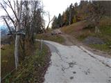 5
5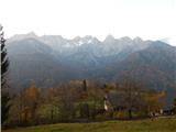 6
6 7
7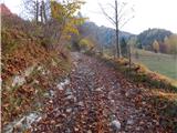 8
8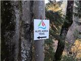 9
9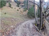 10
10 11
11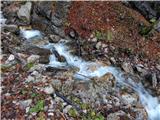 12
12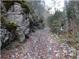 13
13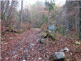 14
14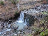 15
15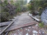 16
16 17
17 18
18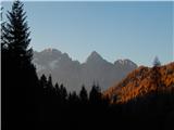 19
19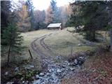 20
20 21
21 22
22 23
23 24
24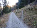 25
25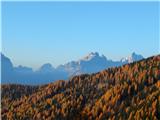 26
26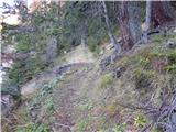 27
27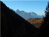 28
28 29
29 30
30 31
31 32
32 33
33 34
34 35
35 36
36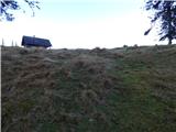 37
37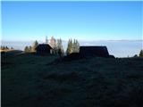 38
38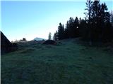 39
39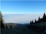 40
40 41
41 42
42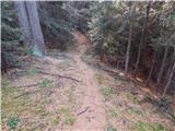 43
43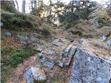 44
44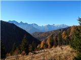 45
45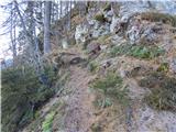 46
46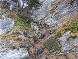 47
47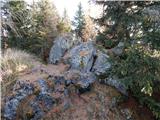 48
48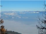 49
49 50
50 51
51 52
52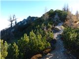 53
53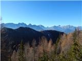 54
54 55
55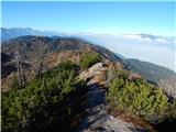 56
56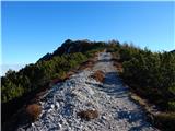 57
57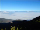 58
58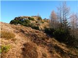 59
59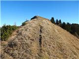 60
60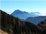 61
61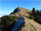 62
62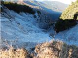 63
63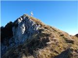 64
64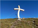 65
65 66
66