Stara Fužina - Mostnice waterfall (via Mostnica gorge)
Starting point: Stara Fužina (600 m)
Starting point Lat/Lon: 46.2903°N 13.8868°E 
Path name: via Mostnica gorge
Time of walking: 1 h 20 min
Difficulty: easy marked way
Difficulty of skiing: no data
Altitude difference: 173 m
Altitude difference (by path): 188 m
Map: TNP 1:50.000
Access to starting point:
We drive to Bohinjska Bistrica, then continue driving in the direction of Bohinj Lake. In Ribčev Laz, from the intersection at the beginning of Bohinj Lake, we continue right in the direction of Srednja vas, Studor and Stara Fužina. The road then leads us over a bridge and past the church of St. John the Baptist; a few hundred meters further, we already arrive in Stara Fužina. In Stara Fužina, we first drive past the pension Lipa, apartments Triglav, bus station, Mercator store, then arrive at the intersection by the chapel, where we continue on the left road in the direction of the parking lot, Korita Mostnice, Hudičev most and mountain paths to the mountain pastures Blato and Vogar and the path to Voje Valley. From the intersection, there follows still some ascent; when the settlement ends, we arrive at the paid parking lot, where we park.
Path description:
At the beginning of the parking lot, the signs for the gorges and waterfall Mostnice direct us right onto a wide path, along which in a few minutes we arrive at Hudičev most. We continue straight (right over the Uskovnica bridge through mountain pasture Blatce and Stara Fužina), a little further, at the information board for Korita Mostnice, we go slightly right. At the next junction, we go slightly right again (left Vogar, possible also to Voje), then we arrive at the place where the fee for maintaining the path through Korita Mostnice is collected (entrance fee for adults was in June 2018, 3 euros).
At the mentioned spot, the path splits, and we choose left or right. Both paths continue near the gorges (by the right path there is a turn-off to see the elephant rock formation), later they merge into one path, along which we ascend to the macadam road. We follow the road to the right, along it quickly arriving at the Planinska koča na Vojah.
We continue along the road, which continues through Voje Valley, following the signs for Mostnice waterfall. A little further, the road splits, and we choose the right path in the direction toward Uskovnica, Mostnice waterfall and refreshment hut Slap (left Triglav, Velo polje and also Mostnice waterfall).
The path ahead leads us over a small bridge and past a marker, then we already arrive in the upper part of Voje Valley, where the path leads across meadows and past a few huts. The valley then begins to narrow, and the path brings us to the refreshment hut Slap Voje, from where we continue straight toward the waterfall. A few steps ahead, another path leading toward the waterfall joins from the left, and we continue straight to the next junction.
We continue straight again (right Uskovnica) and past the last hut return to the forest. There follows only a short ascent, and the path brings us to Mostnice waterfall.
Starting point - Koča na Vojah 45 minutes, Koča na Vojah - refreshment hut Slap Voje 30 minutes, refreshment hut Slap Voje - Mostnice waterfall 5 minutes.
The description refers to the situation in 2018 (June), and the pictures are from various periods.
Pictures:
 1
1 2
2 3
3 4
4 5
5 6
6 7
7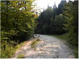 8
8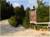 9
9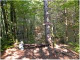 10
10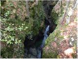 11
11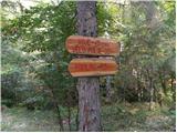 12
12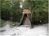 13
13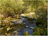 14
14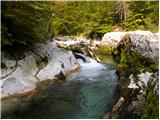 15
15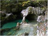 16
16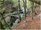 17
17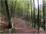 18
18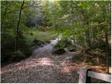 19
19 20
20 21
21 22
22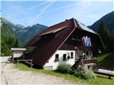 23
23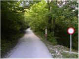 24
24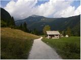 25
25 26
26 27
27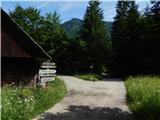 28
28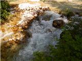 29
29 30
30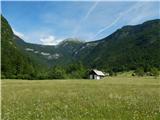 31
31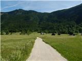 32
32 33
33 34
34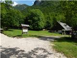 35
35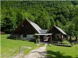 36
36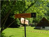 37
37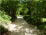 38
38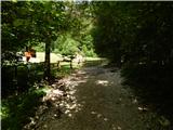 39
39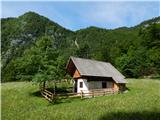 40
40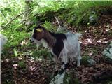 41
41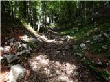 42
42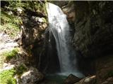 43
43