Stara Fužina - Planina Vodični vrh
Starting point: Stara Fužina (600 m)
Starting point Lat/Lon: 46.2903°N 13.8868°E 
Time of walking: 2 h 45 min
Difficulty: easy marked way
Difficulty of skiing: no data
Altitude difference: 886 m
Altitude difference (by path): 915 m
Map: Triglav 1:25.000
Access to starting point:
From highway Ljubljana - Jesenice we go to the exit Lesce and follow the road towards Bled and forward towards Bohinjska Bistrica. We continue driving towards the Lake Bohinj (Ribčev laz), where we come to the crossroad, where we continue right in the direction of Stara Fužina. In Stara Fužina at the crossroad at the chapel, we turn sharply left on an ascending road in the direction of the mountain pasture Blato, mountain pasture Vogar and valley Voje. We follow this road to a parking lot, where a road toll or a parking fee has to be paid. Parking fee is 1 €/h.
Path description:
From the parking lot, we continue on the asphalt road which continues towards the mountain pasture Blato, mountain pasture Vogar and valley Voje. At first relatively steep road quickly flattens, and then it brings us to religious symbol, by which there is marked crossing.
At the religious symbol, we leave the asphalt road and we continue left in the direction of Vogar and Pršivec. Further, we at first diagonally ascend over panoramic pasture, and then the path passes into the forest, through which it is ascending on a rocky cart track. In some long zig-zags we ascend a level higher, where the path flattens a little. Only a little further, we notice signs for NOB monument, which is situated by nice viewpoint and paragliding airfield, from which a nice view opens up on Lake Bohinj, Rudnica and mountain chain Spodnje Bohinjske gore.
From the viewpoint, we return on a marked path, and it quickly brings us on the eastern edge of the mountain pasture Spodnji Vogar. The path ahead is mostly ascending gently through meadows, and we notice by the path larger number of former shepherd huts, which are today mostly converted into a holiday cottages. This path which continues to ascend gently, we follow to the mountain hut Kosijev dom na Vogarju, which we reach after few minutes of additional walking.
From the hut, we continue right in the direction of Pršivec and Planina pri Jezeru, and the path leads on a wide cart track which past a smaller cross brings us to a marked crossing.
At the crossing, we continue left in the direction of the mountain pasture Vodični vrh, lake Črno jezero and Pršivec (right Planina pri Jezeru). The path soon after the crossing goes into the forest and is further ascending diagonally. The path towards Pršivec we follow for approximately 5 minutes, after that marked path branches off to the right, which leads on the mountain pasture Vodični vrh (turn-off isn't specifically marked, but the path is marked). We continue on the mentioned path, which ascends steeply to the nearby macadam road. When we step on the road, we follow it to the left, and we walk there only few 10 strides, and then we continue right on a relatively steep cart track. A short time we walk on a cart track, after that already quite faded blazes point us slightly to the left on a marked footpath. On the path we are steeper ascending through the forest and then the footpath flattens and crosses old cart track. Few minutes we are still gently ascending, and then the path passes on a steep slope, on which we start steeply ascending towards the left. Higher, the footpath from slopes passes into a smaller valley, where becomes a little hard to follow. Even a little further forest gets thinner and the path turns at first a little to the left and then right into a dense forest, where entirely flattens. After few minutes of easy walking path again starts ascending and brings us on otherwise marked, but less noticeable crossing.
Here we leave the marked path which leads further towards Planina pri Jezeru and we continue left on also a marked path, on which in a minute of additional walking, we descend to the mountain pasture Vodični vrh.
Pictures:
 1
1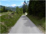 2
2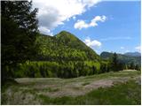 3
3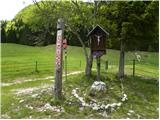 4
4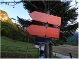 5
5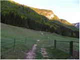 6
6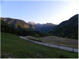 7
7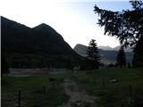 8
8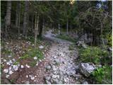 9
9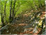 10
10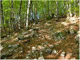 11
11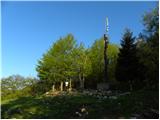 12
12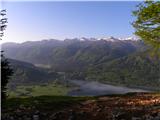 13
13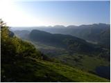 14
14 15
15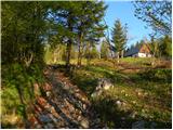 16
16 17
17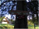 18
18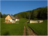 19
19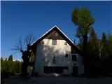 20
20 21
21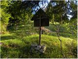 22
22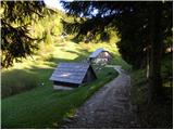 23
23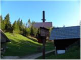 24
24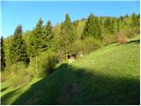 25
25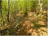 26
26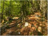 27
27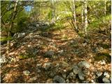 28
28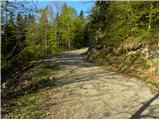 29
29 30
30 31
31 32
32 33
33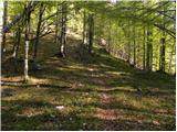 34
34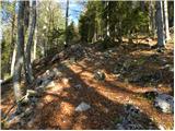 35
35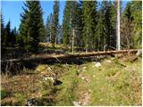 36
36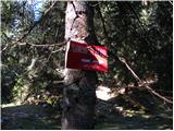 37
37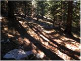 38
38 39
39 40
40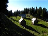 41
41