Stara Fužina - Studor (via planina Blatce)
Starting point: Stara Fužina (600 m)
Starting point Lat/Lon: 46.2903°N 13.8868°E 
Path name: via planina Blatce
Time of walking: 1 h 30 min
Difficulty: easy unmarked way, easy pathless terrain
Difficulty of skiing: no data
Altitude difference: 402 m
Altitude difference (by path): 430 m
Map: TNP 1:50.000
Access to starting point:
We drive to Bohinjska Bistrica, then continue driving in the direction of Lake Bohinj. In Ribčev Laz, from the intersection at the beginning of Lake Bohinj, we continue right in the direction of Srednja vas, Studor and Stara Fužina. The road then leads us over a bridge and past the church of St. John the Baptist; a few hundred meters further, we already arrive in Stara Fužina. In Stara Fužina, we first drive past the guesthouse Lipa, apartments Triglav, bus station, Mercator store, then arrive at the intersection by the chapel, where we continue on the left road in the direction of the parking lot, Korita Mostnice, Hudičev most and mountain paths to the mountain pasture Blato and Vogar and the path into Voje Valley. From the intersection, a short ascent follows; when the settlement ends, we arrive at the paid parking lot, where we park.
Path description:
At the beginning of the parking lot, the signs for the gorges and waterfall Mostnice direct us right onto a wide path, along which in a few minutes we arrive at Hudičev most. We continue right (straight to Korita Mostnice and Voje) over the bridge; after the bridge, we go left onto the footpath in the direction of Uskovnica. Already immediately when we leave the road, the path begins to ascend steeply through the forest. After a few minutes, we cross a newer cart track, then continue ascending relatively steeply. Higher up, the steepness begins to decrease gradually, and the path brings us into a small valley, where the path flattens completely and brings us out of the forest onto the upper edge of the mountain pasture Blatce.
Here, a marked path continues left towards Uskovnica; we continue straight to the nearby hut on the mountain pasture.
At the mentioned hut, we go right and ascend across the meadow to the edge of the forest, where we find the cart track that ascends diagonally through the forest to the right. The cart track ascends in a few hairpin turns and quickly turns into a forest path, which higher up due to leaves is somewhat harder to follow. The path soon flattens and brings us to the south side of the ridge, where in a few dozen steps we arrive at the take-off site Studor.
From the take-off site, where there are a few benches and from which a wonderful view opens up, we continue slightly left so that we return to the forest, continuing the walk on easier pathless terrain. A few shorter ascents and descents follow, and we walk until we reach the peak marked with a metal rod, which is approximately 15 minutes from the take-off site.
Stara Fužina - Planina Blatce 0:55, Planina Blatce - Studor 0:35.
On the way: Hudičev most (610m), Preval (893m), Planina Blatce (888m)
Pictures:
 1
1 2
2 3
3 4
4 5
5 6
6 7
7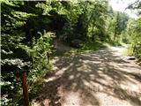 8
8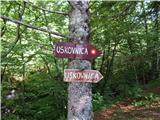 9
9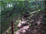 10
10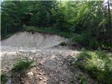 11
11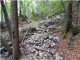 12
12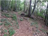 13
13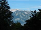 14
14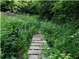 15
15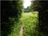 16
16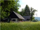 17
17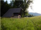 18
18 19
19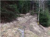 20
20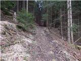 21
21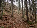 22
22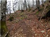 23
23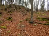 24
24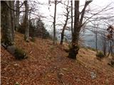 25
25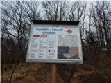 26
26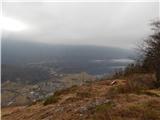 27
27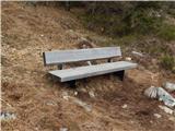 28
28 29
29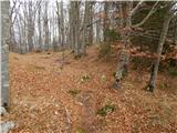 30
30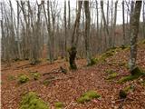 31
31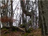 32
32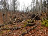 33
33 34
34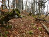 35
35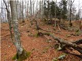 36
36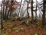 37
37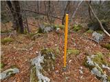 38
38