Stoakoglhütte - Plankogel
Starting point: Stoakoglhütte (1372 m)
Starting point Lat/Lon: 47.35582°N 15.56864°E 
Time of walking: 30 min
Difficulty: easy marked way
Difficulty of skiing: no data
Altitude difference: 159 m
Altitude difference (by path): 159 m
Map:
Access to starting point:
Highway A2 Graz - Vienna / Wien we leave at the exit for Gleisdorf West, and then we follow the signs for Hartberg and Weiz, and later only Weiz. Through Weiz, we follow the signs for Passail. For the gorge Weizklamm, we turn right from the main road towards Sommeralm and surrounding settlements (straight for Passail). We gradually start ascending more noticeably, and we follow the signs for Sommeralm. Before reaching the alpine meadow or settlement Sommeralm, we arrive at the mountain cottage Stoakoglhütte, where we park in a parking lot near the cottage.
Path description:
From the parking lot, we walk to the cottage Stoakoglhütte, bypass it on the left side, and continue slightly to the right toward Sommeralm and Plankogel. The path ahead leads us along a grassy cart track, which brings us to a crossroads on a small saddle in about five minutes.
We continue along the slightly right path toward Plankogel (slightly left toward Sommeralm) and begin ascending more steeply beside a wire fence. The increasingly scenic path levels out higher up and quickly leads us to the cross on a panoramic summit.
Description and pictures refer to the condition in November 2023.
Pictures:
 1
1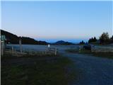 2
2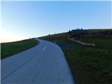 3
3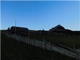 4
4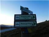 5
5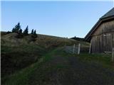 6
6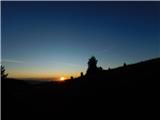 7
7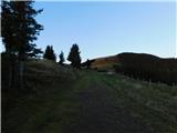 8
8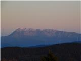 9
9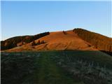 10
10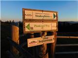 11
11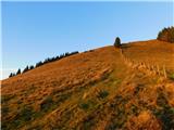 12
12 13
13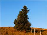 14
14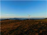 15
15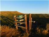 16
16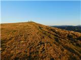 17
17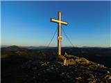 18
18 19
19