Straža - Želin - Veliki vrh (Lajše)
Starting point: Straža - Želin (247 m)
Starting point Lat/Lon: 46.1022°N 13.9483°E 
Time of walking: 2 h
Difficulty: easy unmarked way
Difficulty of skiing: no data
Altitude difference: 634 m
Altitude difference (by path): 650 m
Map:
Access to starting point:
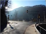
A) We drive to Idrija, then continue driving in the direction of Tolmin and Cerkno. When we arrive at the traffic-light intersection in the settlement Straža - Želin, where the road to Cerkno branches off to the right, the described path begins. There are no arranged parking spaces at the starting point.
B) From Podbrdo or Most na Soči we drive to Bača pri Modreju, then continue driving in the direction of Idrija. When we arrive at the traffic-light intersection in the settlement Straža - Želin, where the road to Cerkno branches off to the left, the described path begins. There are no arranged parking spaces at the starting point.
C) We drive to Cerkno, then continue driving in the direction of Tolmin and Idrija. When we arrive at the traffic-light intersection in the settlement Straža - Želin, where the road continues to the right towards Tolmin and to the left towards Idrija, the described path begins. There are no arranged parking spaces at the starting point.
Path description:
From the intersection, we head onto the road in the direction of Idrija, along the road we walk some 10 meters, then on a concrete retaining wall we notice the mountaineering markers for Bevkov vrh, which direct us sharply left onto the road that ascends to the nearby homestead. At the homestead, we continue through the yard, behind the house we go right and ascend to the nearby hayrack, where we go slightly left, so that subsequently we ascend diagonally to the right across the hay meadow. Higher up, we arrive in a belt of forest, then we also go past the house to which no road leads. Above the house, the path returns to the forest and begins to ascend more steeply. For some time we ascend steeply through the forest, then we reach an asphalt road, which we follow to the left. The road soon becomes macadam, from it we go slightly right and ascend to the church of St. Paul, which is located on a panoramic rise.
From the church, we descend along the ridge to the nearby homestead, which we bypass on the left side, behind the house the markers direct us right and we ascend across the hay meadow. The path quickly enters the forest, where on the left side we bypass Straža (548 m), on the other side of the hill we reach a wider cart track, which we follow toward the northeast and subsequently walk along an occasionally panoramic ridge. When after some time the cart track forks into several branches, we leave the marked path, which turns right from the ridge and continues toward Bevkov vrh, and continue straight upward with the path, so that we continue the ascent along the ridge (left somewhat longer path). After a shorter steep ascent, the cart track levels out and soon the previously mentioned somewhat longer path joins us from the left.
We continue straight, a little further we bypass the nearby house on the left side, a few more steps further the path from Cerkno also joins us from the left.
We continue walking on the macadam road, which leads us under the power line route. Somewhat further, we arrive in a small valley, through which we ascend to a small saddle, where there is a junction.
We continue sharply left onto the road that leads past the Lajše shrine (straight pass Kladje, right Bevkov vrh).
If we leave the road, we can walk to the nearby shrine with a chapel, Way of the Cross, and memorial plaque; otherwise, we continue along the road to the nearby quarry, where the path turns left and turns into a cart track. Here the path enters the forest, at the small junction we go right and walk past the transmitters to the nearby summit.
Želin - St. Paul 0:35, St. Paul - Veliki vrh 1:25.
Description and pictures refer to the state in January 2020.
On the way: Sveti Pavel (Straža) (451m)
Pictures:
 1
1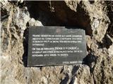 2
2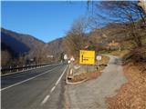 3
3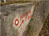 4
4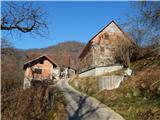 5
5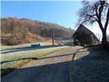 6
6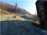 7
7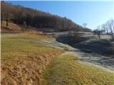 8
8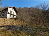 9
9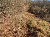 10
10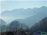 11
11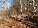 12
12 13
13 14
14 15
15 16
16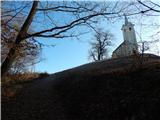 17
17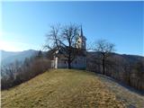 18
18 19
19 20
20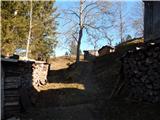 21
21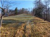 22
22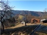 23
23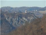 24
24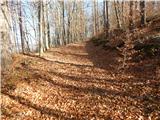 25
25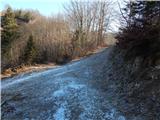 26
26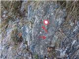 27
27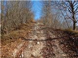 28
28 29
29 30
30 31
31 32
32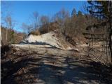 33
33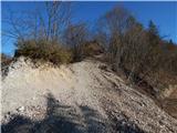 34
34 35
35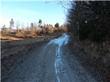 36
36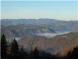 37
37 38
38 39
39 40
40 41
41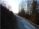 42
42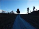 43
43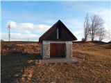 44
44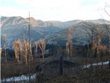 45
45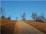 46
46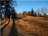 47
47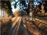 48
48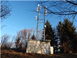 49
49 50
50 51
51