Starting point: Štufna (830 m)
Starting point Lat/Lon: 45.6807°N 15.0082°E 
Time of walking: 50 min
Difficulty: easy marked way
Difficulty of skiing: easily
Altitude difference: 269 m
Altitude difference (by path): 269 m
Map: Dolenjska 1:50.000
Access to starting point:
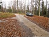
From highway Ljubljana - Zagreb we go to the exit Ivančna Gorica and we follow the road ahead in the direction of Črnomelj. Soon after the village Obrh (which is located 1km before the village Podturn pri Dolenjskih toplicah) the road branches off to the right, which will lead us towards our starting point (direction Rog). Further, we are ascending on an asphalt road to the next crossroad, where signs for Rog, Podstenice, graveyard and Pogorelec and Primož point us to the right on a macadam road (straight Resa, Baza 20). The macadam road which has ahead few more crossroads, we follow in the direction of Rog. When we will on the left side of the road notice a forestry cottage and next to it a sign for Štufna we need to pay attention to signposts. Only a little further, we come to a crossroad, where we notice signposts for Rog 1h. Here we park on a parking lot by the road.
From Novo mesto, we through Dolenjska toplice drive to the village Podturn. Here we continue right towards Žužemberk, and then soon behind the village Podturn we turn sharply left in the direction of Rog. Further, follow the upper description.
Access is possible also from Kočevje on forest roads.
Path description:
From the parking lot, we go on a worse road in the direction of Rog - vrh (peak). And we follow this road only a short time because blazes point us left on a cart track which starts ascending steeply through the forest. We follow the cart track approximately 15 minutes, and then blazes point us to the left upwards on a poorly visible footpath which higher joins the path from Skavtski dom (Žaga Rog). Here we go right and we continue the ascent on a cart track which is barely ascending. Ahead we will beside the usual blazes notice also the blazes in the shape of a bear's paw. After few minutes of a gentle walk, the cart track steeply ascends and brings us below the upper slope of Veliki Rog. Here the blazes again point us to the left on a footpath which ascends steeply and after 5 minutes of additional walking brings us on the highest peak of the ample forests of Kočevski Rog. From the top, we can ascend also on a lookout tower, from which a nice view opens up on the nearby and distant surroundings.
The ascent on the wooden tower is on our own responsibility.
Pictures:
 1
1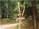 2
2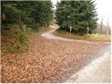 3
3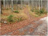 4
4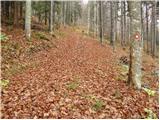 5
5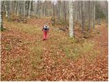 6
6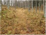 7
7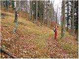 8
8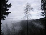 9
9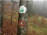 10
10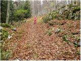 11
11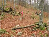 12
12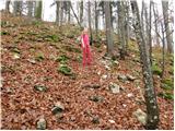 13
13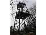 14
14