Suhadolnik - Štruca (via Kokrsko sedlo)
Starting point: Suhadolnik (901 m)
Starting point Lat/Lon: 46.3352°N 14.5102°E 
Path name: via Kokrsko sedlo
Time of walking: 5 h 25 min
Difficulty: difficult marked way, easy pathless terrain
Difficulty of skiing: very demanding
Altitude difference: 1556 m
Altitude difference (by path): 1700 m
Map: Kamniške in Savinjske Alpe 1:50.000
Access to starting point:
From highway Ljubljana - Jesenice we go to the exit Kranj - vzhod and follow the road ahead in the direction of Jezersko, but only to the village Kokra. In the mentioned village, we will only few meters before the road crosses a bridge over the river Kokra, notice a road which runs towards Suhadolnik. The turn-off of the road is located, when we are on the right side of the river (left bank), the road sign is approximately 7 km. We follow this road to a parking lot, which is located approximately 300 meters before a farm Suhadolnik.
Path description:
At the beginning of the parking lot, we notice hiking signposts, which point us on a road, on which in less than 5 minutes of walking, we get to a smaller crossroad at the farm Suhadolnik. Here we continue on the right road, and we follow it for approximately 5 minutes, or to the spot, where blazes lead on an ascending cart track. Further, for a short time, we are ascending on a cart track, and then blazes point us to the right on a footpath which is moderately ascending through the forest. Higher, we return on a cart track, and which only few meters ahead brings us to a forest road which we then follow to its end (to here we need approximately half an hour).
At the end of the road marked path splits into two parts. We continue on the left path (right a little easier "Old path"), which is further ascending on a gentle cart track. A little further blazes point us slightly right on a torrent deposits of sand, and the path on the other side continues through the forest, where it starts ascending steeper and steeper. Higher, we come to a smaller cave, and the path behind it becomes technically demanding. With the help of steel cables we ascend a level higher, and the path then continues on a steep slope, where occasionally we get a help from some iron spikes. Higher, the path turns to the right, ascends diagonally over a steep and mainly in wet for slipping dangerous slopes and then brings us to well-secured passage. With the help of wooden stairs or a ladder and a help from a steel cable, we ascend on the steep slope, which without mentioned fixed safety gear would be very dangerous. Higher, we get some help from some more iron spikes, and the path after that flattens and crosses a short exposed slope, where we get help from a fence. Only a little further, we come to the next ladder, by which there aren't any steel cables, but the passage isn't that difficult. Next follows a short descent into a smaller gully and then we also cross it. On the other side of the gully, we steeply ascend (we get help from some stemples), after that the path slowly flattens and in few 10 strides of additional walking brings us to the spot, where joins a little easier "old path".
Next follows a short diagonal ascent and the path brings us to a larger plain, where used to be "stara koča" (old mountain hut). Over a high grass we walk on the other side of the plain, where we get to a marked crossing.
We continue straight (left Kočna over Grdi graben) on a moderately steep path, which further ascends through a lane of bushes. Higher, the path for some time entirely flattens, and then it brings us into dwarf pines, where it starts ascending steeper. This a little steeper path, from which increasingly beautiful views are opening up, we follow all the way to the mountain hut Cojzova koča na Kokrskem sedlu.
From a saddle we continue left in the direction of Grintovec, Kočna and Skuta. The path immediately above the saddle steeply ascends and a little higher brings us to a crossing, where a path towards the bivouac Bivak pod Grintovcem and Skuta branches off to the right (straight Grintovec over Streha and Kočna). We go on this at first a little poorly visible footpath which in a moderate ascent brings us to scenic passage over Mala vratca. After the narrow passage Mala vratca, the path starts descending on a steep and occasionally slightly exposed slope. By the end of the descent, which takes approximately 100 altitude meters there are some iron spikes for help. Next follows crossing of the gully and then ascent on high mountain terrain to bivouac below Grintovec.
From the bivouac, we continue on a marked path, which quickly brings us to a crossing. We continue straight in the direction of Skuta and Grintovec (right saddle Kamniško sedlo, Rinke and Turska gora) on a relatively gently sloping path, which soon brings us to the next crossing. We continue right in the direction of Skuta (straight saddle Mlinarsko sedlo) on the path which over karst terrain of Veliki podi brings us to the foot of moderately steep wall. Here the path becomes much steeper and with the help of natural holds we get over a shorter wall between Dolgi hrbet and Štruca (in wet great risk of slipping). On the top of the ascent from the left joins the path from Dolgi hrbet. We continue right on a marked path, which only a little further we leave. At the spot, where the marked path starts descending, we continue right (direction south) and we continue the ascent on easier pathless terrain. Pathless terrain is short and in good weather orientationally undemanding.
Suhadolnik - Cojzova koča 2:30, Cojzova koča - Bivak pod Grintovcem 1:15, Bivak pod Grintovcem - Štruca 1:40.
Pictures:
 1
1 2
2 3
3 4
4 5
5 6
6 7
7 8
8 9
9 10
10 11
11 12
12 13
13 14
14 15
15 16
16 17
17 18
18 19
19 20
20 21
21 22
22 23
23 24
24 25
25 26
26 27
27 28
28 29
29 30
30 31
31 32
32 33
33 34
34 35
35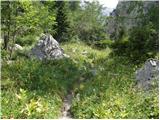 36
36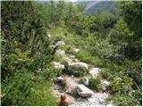 37
37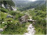 38
38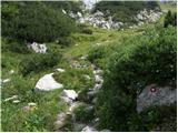 39
39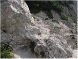 40
40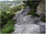 41
41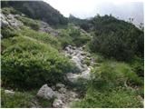 42
42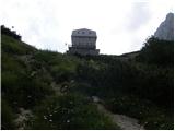 43
43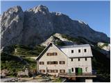 44
44 45
45 46
46 47
47 48
48 49
49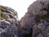 50
50 51
51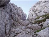 52
52 53
53 54
54 55
55 56
56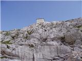 57
57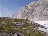 58
58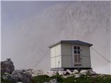 59
59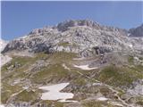 60
60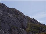 61
61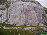 62
62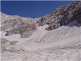 63
63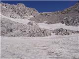 64
64 65
65 66
66 67
67 68
68 69
69 70
70 71
71