Sv. Andrej - Sveti Ožbolt (above Zminec)
Starting point: Sv. Andrej (610 m)
Starting point Lat/Lon: 46.1373°N 14.3034°E 
Time of walking: 1 h
Difficulty: easy marked way
Difficulty of skiing: easily
Altitude difference: 249 m
Altitude difference (by path): 249 m
Map: Škofjeloško in Cerkljansko hribovje, Kod-Kam, Izletniška karta, 1:50.000
Access to starting point:
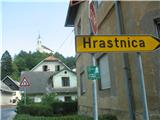
We drive towards Škofja Loka and at its beginning at the traffic-light intersection we turn left downhill in the direction of Poljanska dolina (on signpost Gorenja vas, Žiri) and through the old part of Škofja Loka we drive only to the intersection, where right uphill the road ascends towards Loški grad and the further road to Poljanska dolina, but we in that intersection turn left in the direction of Puštal. We drive over a bridge and soon behind it we see a turn-off with a signpost with inscription Hrastnica. We turn right in this direction and for some time we drive on a narrower asphalt road along the stream Hrastnica through settlements, until on our right we see the turn-off of an asphalt road, which ascends somewhat more steeply towards Sv. Andrej (turn-off currently not marked with signpost). On the narrower asphalt road, which moderately ascends, we then drive less than 2 km and arrive at Sv. Andrej, where we look for a space where we will park. Quite a lot of space is right by the road, and if you will visit also the guesthouse Pri Ruparju, they have quite a lot of arranged parking space for their guests.
Path description:
We head left uphill past the guesthouse Pri Ruparju, slightly right uphill across the meadow, and on our right we will see the chapel of Sv. Andrej a few meters above us. The marked path then leads us in moderate ascent mostly on forest road or cart track, part of the path also on trail through the forest. When we step out of the forest, the trail blaze on the tree directs us sharply left onto the cart track, and straight ahead we already see our goal – the chapel of Sv. Ožbolt on the eponymous hill. We walk a few minutes on this cart track, then the blazes direct us slightly left uphill across the yard of a farm, then we again come onto the cart track. Already after a few meters we can decide to continue the path on this cart track, which moderately ascends to the top of the hill, or to head slightly left onto the steep, narrow trail, which brings us to the goal more directly.
From the top a beautiful view opens towards Škofja Loka and surrounding villages, Lubnik, Stari vrh and Blegoš, and of course higher mountains behind them.
Pictures:
 1
1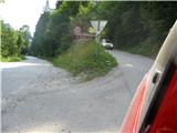 2
2 3
3 4
4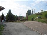 5
5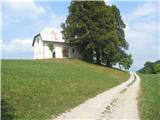 6
6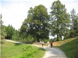 7
7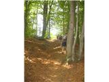 8
8 9
9 10
10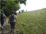 11
11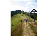 12
12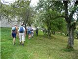 13
13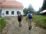 14
14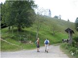 15
15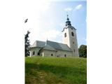 16
16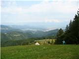 17
17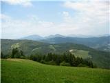 18
18 19
19