Sveta Katarina (Zgornja Kapla) - Sveti Pankracij (Radelca) (Austrian way)
Starting point: Sveta Katarina (Zgornja Kapla) (777 m)
Starting point Lat/Lon: 46.63627°N 15.37496°E 
Path name: Austrian way
Time of walking: 2 h 45 min
Difficulty: easy marked way
Difficulty of skiing: no data
Altitude difference: 123 m
Altitude difference (by path): 260 m
Map: Pohorje 1:50.000
Access to starting point:
A) From the road Maribor - Dravograd we drive almost to the settlement Ožbalt (from the direction Dravograd a little after the settlement). Few 100 meters before (from the direction Dravograd after the settlement) the mentioned settlement to the right (from the direction Dravograd left) a road branches off towards Gradišče and Kapla, and then at the crossroads we go towards Kapla. On the road, we drive to the settlement Zgornja Kapla, where in the center of the settlement, below the church of St. Katarina Aleksandrijska we park on a parking lot at the cemetery. From the main road to the starting point, there is a little less than 15 km.
B) From the road Dravograd - Maribor we drive to the settlement Ožbalt, where at the parish church we turn left (from the direction Maribor right) on a side road which continues by the succursal primary school and then it is ascending by the stream Ožbaltski potok. Higher at the crossroads we go in the direction of Kapla, and we drive to the center of the settlement Zgornja Kapla, where below the church of St. Katarina Aleksandrijska we park on a parking lot at the cemetery. From the main road to the starting point, there is a little less than 8 km.
Path description:
From the parking lot, we head onto the road towards Sveta Katarina, then bypass the church on its lower left side. In front of the fire station and past the sports field, we turn left downwards, beginning our descent along a marked path. We quickly reach an asphalt road, continuing our descent, which leads us past a few houses to a marked crossroad at the saddle between the valley of stream Potočnikov potok on the left and the valley of stream Črmenica on the right.
From the crossroad, we proceed straight towards Austria (slightly left lake Odomovo jezero and Brezno, right Ožbalt) and ascend past a few more houses. Next follows a fairly panoramic walk to the national border, where Austrian signs for Sveti Pankracij / St. Pongratzen direct us left onto a cart track continuing westward along the border. For a while, we continue on the panoramic path, enjoying a beautiful view of church of St. Katarina and lake Odomovo jezero, following signs for church of St. Pankracij.
When we reach a bench at the macadam road, the Slovenian and Austrian paths diverge.
We continue slightly right and proceed along the macadam road (slightly left the Slovenian path), which begins to gently descend. The path ahead leads us into a strip of forest, and after it, we pass by a few more houses. Behind the houses, we continue across scenic grassy terrain, where the Slovenian path joins us from the left.
We continue straight, passing the chapel and the Močivnik farm, as well as the junction of the scenic path to the edge of the forest, where the Slovenian and Austrian paths diverge again.
We continue slightly right and proceed along the road (slightly left the Slovenian footpath), which enters the forest, where it splits once more. This time, too, we continue slightly right, and the path leads us through the forest for some time. When we leave the forest, we go straight at the grazing fence onto a footpath, where, a little further on, the Slovenian path rejoins us.
On the other side of the pasture, we go right (left the Slovenian path) and continue through the forest, maintaining a steady altitude, following the blazes at crossroads. When we leave the forest, a beautiful view opens up into Austria, where we see a large part of Steiermark, and we descend across the grassy terrain to the Panoramaschenke Tertinek inn.
Here, we continue left towards Sveti Pankracij, and from the nearby crossroads, we proceed straight onto a cart track that crosses the fence and then ascends diagonally with beautiful views. Higher up, we cross the fence again, then enter the forest, where the path levels out. Here, we continue straight (to the left, we can descend to the Slovenian path in a few dozen steps) and keep following the Austrian blazes. When we leave the forest, we pass a nearby house and reach an asphalt road, which we follow until a sharp right turn. From the turn, we continue straight onto a footpath, which initially offers a beautiful view towards the church of St. Pankracij, and lower down, we proceed through a strip of forest. Next follows a short descent via stairs, leading to another road, which we follow to the left to the Remšnik border crossing, where we merge with the Slovenian path.
We follow signs for Sveti Pankracij; a little further, we turn right from the road, ascending along the forest edge and bypassing a nearby holiday cottage on its upper side. The path re-enters the forest, soon returning to the road, leading to the second western Remšnik border crossing, where a crossroad is located.
From the crossroad, past a cross, we continue right, then immediately left onto a footpath towards Sveti Pankracij. The path continues westward, ascending through the forest along the national border. A little further a view opens up a little on the Slovenian side, higher when the path brings us out of the forest, also on the Austrian side. Next follows a shorter steeper ascent by the upper part a panoramic meadow and we already get to the church of St. Pankracij.
Starting point - Tertinek 1:40, Tertinek - Sveti Pankracij 1:05.
The description refers to conditions in February 2024, with pictures from various periods.
Pictures:
 1
1 2
2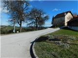 3
3 4
4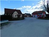 5
5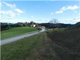 6
6 7
7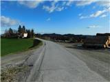 8
8 9
9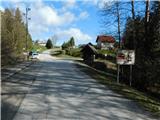 10
10 11
11 12
12 13
13 14
14 15
15 16
16 17
17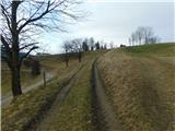 18
18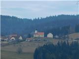 19
19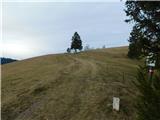 20
20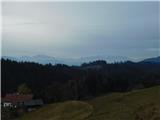 21
21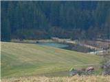 22
22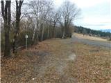 23
23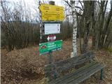 24
24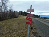 25
25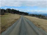 26
26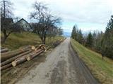 27
27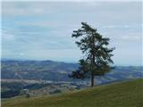 28
28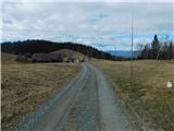 29
29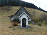 30
30 31
31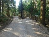 32
32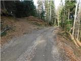 33
33 34
34 35
35 36
36 37
37 38
38 39
39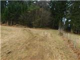 40
40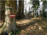 41
41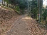 42
42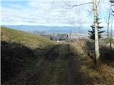 43
43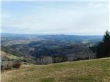 44
44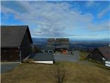 45
45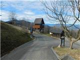 46
46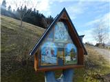 47
47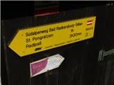 48
48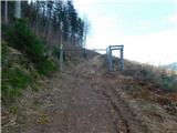 49
49 50
50 51
51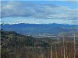 52
52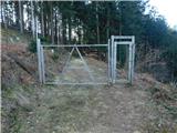 53
53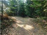 54
54 55
55 56
56 57
57 58
58 59
59 60
60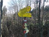 61
61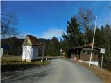 62
62 63
63 64
64 65
65 66
66 67
67 68
68 69
69 70
70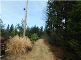 71
71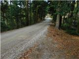 72
72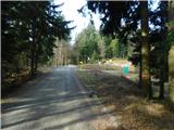 73
73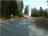 74
74 75
75 76
76 77
77 78
78 79
79 80
80 81
81 82
82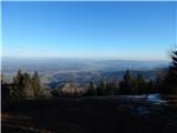 83
83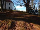 84
84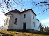 85
85 86
86