Sveti Jurij - Donačka gora (old south path)
Starting point: Sveti Jurij (320 m)
Starting point Lat/Lon: 46.2537°N 15.7384°E 
Path name: old south path
Time of walking: 1 h 30 min
Difficulty: difficult marked way
Difficulty of skiing: no data
Altitude difference: 564 m
Altitude difference (by path): 564 m
Map:
Access to starting point:
From highway Ljubljana - Maribor we go to the exit Dramlje and follow the road ahead in the direction of Šentjur, Rogaška Slatina and Rogatec. In Rogatec signs for Donačka gora point us to the left. Only a little further, we come to the next crossroad, where we continue right again in the direction of Donačka gora. Further, we drive towards the village Sveti Jurij (ahead don't follow the signs for Donačka gora). In the village Sveti Jurij we turn left upwards towards the church of St. Jurij by which we park. We can park already little lower on a parking lot by the road.
Path description:
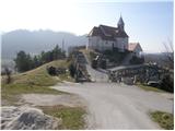
From the church of St. Jurij we continue on the road upwards. After 100 meters of walking, we come to a crossroad, where we continue left. After additional few ten strides of walking, we come to a farm, where a marked footpath turns right upward. The path at first ascends through a meadow, then turns right, where crosses a lane of bushes and then by the cross brings us to the next farm. Here we continue upwards on a marked cart track which over a panoramic slope soon brings us to a crossing. We continue straight in the direction of the mountain hut Rudijev dom and Sveti Donat. After few minutes of additional walking steepness decreases and the path turns left. Next follows a shorter crossing of the slopes towards the west to the church of St. Donat.
By the church to the left (direction west) continues a marked path towards Rudijev dom, and we continue straight (direction north) into nearby forest. At first, we have feeling, that there isn't any path, but when we get to the forest we notice nicely beaten footpath and on a tree also unofficial blazes. Only about a minute ahead the forest ends and the path brings us among fern, from where a nice view opens up on neighbouring Macelj. The path soon returns into the forest, through which it starts ascending steeper. During the ascent beside unofficial blazes for orientation we also get help from individual cairns. Further, the path leads us past several fallen trees, and then we get to some kind of groove on which they drag logs into the valley. Here the footpath for some time ends and the path further becomes a little more demanding.
We continue upwards, where on one of the trees we notice unofficial blaze (gray-white circle). We ascend on more rocky terrain, where we get help from the next cairn, which we can quite quickly overlook. From here the path is for about a minute still gentle, and then it starts ascending on a very steep slope (mainly in wet great risk of slipping). We continue on a barely visible footpath which ascends in few hairpin turns, and we get help from few old almost entirely faded blazes. Higher, we get to a vertical rocky cliff, where the path turns to the left and it brings us to the most difficult part of the path. With the help of arms we ascend through a narrow passage among rocks, above which the path flattens. Further a view opens up on Macelj and Strahinjščica, and the path is for some time only gently ascending. The path soon becomes steeper and it ascends in few hairpin turns, and unofficial blazes end. Here seems logical, that the path goes upwards, but it is not possible, therefore we continue straight. When a little further on the tree we notice white lines, we finally go right. From here on, the path ascends in few more zig-zags, and then it brings us to a paragliding take off point.
From here we continue for approximately one minute and the path brings us on the ridge, where we join the path Frolichova pot (path which leads from the mountain hut Rudijev dom towards Donačka gora). Here we continue right and we quickly get to panoramic peak of Donačka gora (a view opens up on Medvednica, Kamnik Alps, Peca, Uršlja gora, Pohorje...)
The path officially isn't marked anymore and it is for several years abandoned.
We can descend on the path past the mountain hut Rudijev dom, or on demanding path past the eastern peak.
Pictures:
 1
1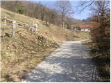 2
2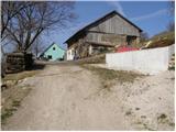 3
3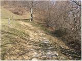 4
4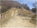 5
5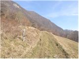 6
6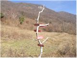 7
7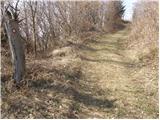 8
8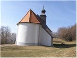 9
9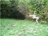 10
10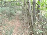 11
11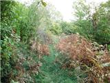 12
12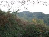 13
13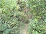 14
14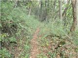 15
15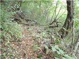 16
16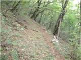 17
17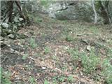 18
18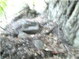 19
19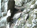 20
20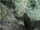 21
21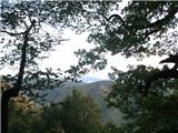 22
22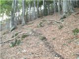 23
23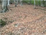 24
24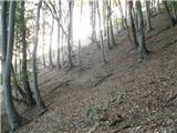 25
25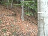 26
26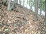 27
27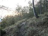 28
28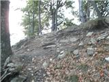 29
29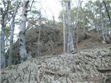 30
30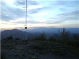 31
31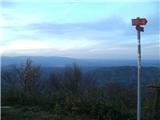 32
32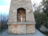 33
33 34
34