Sv.Trojica v Slov. goricah (Ribiška trgovina Som) - Sveta Trojica v Slovenskih goricah
Starting point: Sv.Trojica v Slov. goricah (Ribiška trgovina Som) (238 m)
Starting point Lat/Lon: 46.56719°N 15.86913°E 
Time of walking: 25 min
Difficulty: no data
Difficulty of skiing: no data
Altitude difference: 53 m
Altitude difference (by path): 55 m
Map:
Access to starting point:
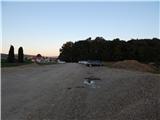
We leave the Pomurska motorway at the Sveta Trojica exit, then follow the signs for Lenart v Slovenskih goricah and Sveta Trojica, quickly leave the road towards Lenart and turn right towards Sveta Trojica, where we park at the beginning of the settlement on a large parking lot near the fishing shop Som.
Path description:
From the parking lot, we continue in the direction of Trojiško jezero (formerly Gradiško jezero), to which we arrive after a minute or two of walking. Here we continue straight, so we walk on the right side of the lake. We continue on the macadam road which leads us along the lake, and for a short time we veer away from the lake a little to the right. When we return to the lake, a nice view opens up towards Lenart v Slovenskih goricah and Pohorje in the background. Further on, we go past Brunarca, then we arrive at the three-sided chapel, where we leave the path along the lake and continue right in the direction of the Pomurska planinska pot. Next follows an ascent on 186 stairs, and then we arrive at the church of the Holy Trinity, which is situated on the highest point of the settlement Sveta Trojica v Slovenskih goricah.
Description and pictures refer to the condition in August 2020.
On the way: Brunarca (238m), Tristrana kapela (237m)
Pictures:
 1
1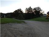 2
2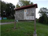 3
3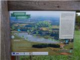 4
4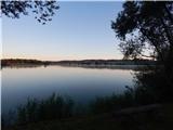 5
5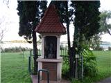 6
6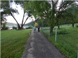 7
7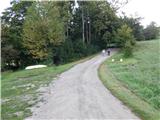 8
8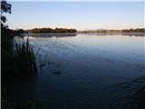 9
9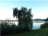 10
10 11
11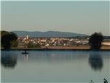 12
12 13
13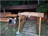 14
14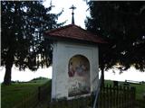 15
15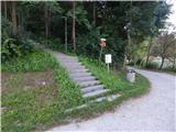 16
16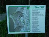 17
17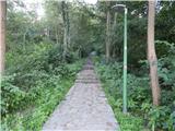 18
18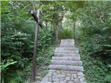 19
19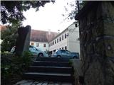 20
20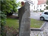 21
21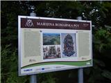 22
22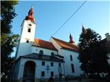 23
23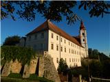 24
24