Teichalm (Angerwirt) - Gerlerkogelhütte
Starting point: Teichalm (Angerwirt) (1195 m)
Starting point Lat/Lon: 47.34213°N 15.47796°E 
Time of walking: 30 min
Difficulty: easy marked way
Difficulty of skiing: no data
Altitude difference: 39 m
Altitude difference (by path): 80 m
Map:
Access to starting point:
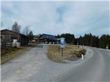
From the border crossing Šentilj we continue driving on the highway towards Gradec / Graz and forward towards Linz and Salzburg. We soon leave Highway A9 and continue driving slightly to the right in the direction of Vienna/Wien on the highway S35. We exit the highway at the Frohnleiten exit, then follow the signs for Weiz and Rechberg. After the settlement Tulwitz, we turn left towards Teichalm. Next follows an ascent through a few more settlements, and then the road flattens, and we reach the Teichalm plateau, where we drive to the Almgashof Angerwirt inn, where the described path begins. Both parking spots are privately owned. The parking lot at the starting point is intended for guests of the inn and the nearby holiday structure.
Path description:
From the starting point, where there is also a crossroads, we head onto an asphalt road in the direction of the Gerlerkreuz cross and initially walk along the main road towards the settlement Fladnitz. When the road, which slightly ascends, enters the foreststruk forest, we veer slightly right onto a footpath that initially runs parallel to the road before gradually moving away from it. A little higher, we leave the forest, cross a grazing fence, and continue along a cart track that then ascends diagonally to the left. Higher up, we pass an older cottage, then at the second building, we briefly step onto a macadam road, where we turn right onto a rougher macadam road marked with signs for Gerlerkogelhütte. The road quickly turns into a cart track, leading us through an increasingly panoramic area. A little further, the path flattens and enters a strip of forest, where it merges with one of the paths from lake Teichalmsee.
Here, we veer slightly left and, upon crossing a grazing fence, leave the strip of forest. We continue left along the fence to the Gerlerkogelkreuz cross, where there is a marked junction.
Here, an unmarked path to Gerlerkogel branches off to the right, with about 10 minutes of ascent, but we continue straight and begin descending. A little lower, the path turns right, and to the left below us, we already see the cottage Gerlerkogelhütte, which we quickly reach.
The description and images reflect the conditions in October 2023 and February 2024.
Pictures:
 1
1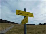 2
2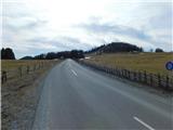 3
3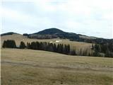 4
4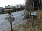 5
5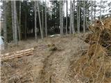 6
6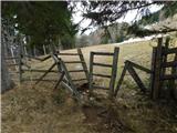 7
7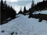 8
8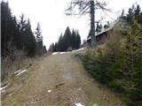 9
9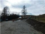 10
10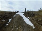 11
11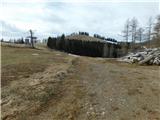 12
12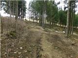 13
13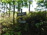 14
14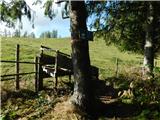 15
15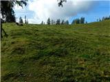 16
16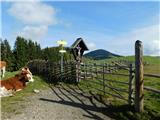 17
17 18
18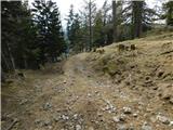 19
19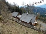 20
20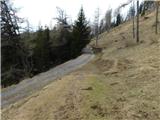 21
21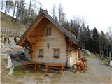 22
22