Teichalm (Teichalmsee) - Hochlantsch
Starting point: Teichalm (Teichalmsee) (1172 m)
Starting point Lat/Lon: 47.35034°N 15.46031°E 
Time of walking: 1 h 40 min
Difficulty: easy marked way
Difficulty of skiing: no data
Altitude difference: 550 m
Altitude difference (by path): 560 m
Map:
Access to starting point:
From the border crossing Šentilj, we continue driving on the highway towards Graz and further towards Linz and Salzburg. We soon leave highway A9 and continue driving slightly to the right in the direction towards Vienna / Wien, continuing on the expressway S35. We leave the mentioned expressway at the exit for Mixnitz, then from the roundabout we take the exit in the direction of Teichalm. We also continue to follow the signs for Teichalm. At the end of the settlement St. Erhard, we turn right once again towards Teichalm, then we begin to ascend steeply. When we reach the mountain pasture Breitalm, we gradually begin to descend, but we follow the road to the parking lot at lake Teichalmsee.
Path description:
From the parking lot, we walk to the inn Almgasthof Zum Teichwirt, where we notice the first yellow hiking signposts. We head on the path in the direction of the summit Hochlantsch, and behind the buildings the path splits.
We choose the slightly right path in the direction of the summit Hochlantsch (slightly left Rote Wand, Schüsserlbrunn, Guter Hirte...), where in a gentle ascent to the edge of the forest we continue on a grassy cart track. At the edge of the forest, signs direct us left onto a footpath, which ascends first along the edge of the forest and then through the forest. Higher up, we cross a few cart tracks and forest roads, and the path occasionally leads us also through some panoramic sections, of which there are more and more higher up. A little further on, we reach a larger grassy slope, from which a nice view opens up mainly towards the south.
Here the marked path to Hochlantsch turns slightly to the left and continues in a gentle diagonal ascent. Higher up, the path becomes steeper again, and when we reach the ridge, a nice view opens up towards the north on the mountain group Fischbacher Alpen. We continue slightly left of the ridge, and the path ascends in the last part through a belt of dwarf pines. When we reach the ridge again, the path past the hut Steirischer Jockl joins from the left, but we steeply ascend over rocks to the nearby summit, where a larger cross stands.
Description and pictures refer to the condition in September 2022.
Pictures:
 1
1 2
2 3
3 4
4 5
5 6
6 7
7 8
8 9
9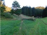 10
10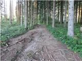 11
11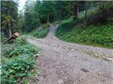 12
12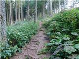 13
13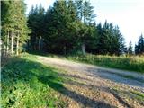 14
14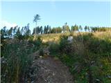 15
15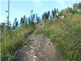 16
16 17
17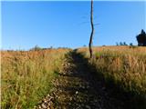 18
18 19
19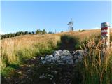 20
20 21
21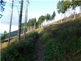 22
22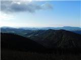 23
23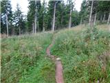 24
24 25
25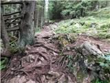 26
26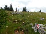 27
27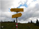 28
28 29
29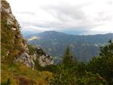 30
30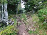 31
31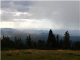 32
32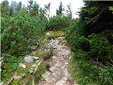 33
33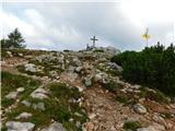 34
34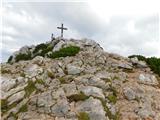 35
35 36
36 37
37