Starting point: Dolina Kot (950 m)
| Latitude/Longitude: | 46,4157°N 13,8977°E |
| |
Walking time: 4 h 55 min
Difficulty: difficult pathless terrain
Elevation gain: 1588 m
Elevation difference along the route: 1595 m
Map: Triglav 1 : 25.000
Recommended equipment (summer):
Recommended equipment (winter): ice axe, crampons
Views: 18.145
 | 2 people like this post |
Access to starting point:
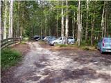
We drive to Mojstrana, then follow the signs for the Kot and Krma valleys. At Kosmačev preval we leave the road leading further towards Krma, Radovna and Bled and continue driving right onto the side road in the direction of Kot valley. Follow the gravel road to the alpine direction signs at the end of the drivable road in Lengarjev rovt.
Route description:
From the end of the road we continue along the wider marked path in the direction of Staničev dom and Kredarica, which gently ascends through the forest. After a few minutes we reach the Kotarica scree field, which we cross transversely to the other side, where the trail reappears.
This is followed by some easy walking through the forest, but after about half an hour the path quickly becomes quite steep and due to the often slippery ground also dangerous for slipping, especially on the descent, so extra caution is needed on this section. On this part, a few pegs help us at the more difficult spots. Higher up the steepness eases and the path leads us to the spring Pri studenčku, which dries up in dry periods.
Here a unmarked path branches left towards Macesnovec, but we continue straight across the torrent gully, and after the gully we cross a short secured but not particularly difficult section. This is followed by an ascent through a belt of dwarf pines, higher up we enter an increasingly rocky terrain, where we can already see a large boulder ahead. Here the PP trail (Planica - Pokljuka trail) unobtrusively crosses our path, but we ascend with ever better views to the aforementioned boulder called Debeli kamen.
At Debeli kamen the dwarf pines occasionally end completely and we continue through increasingly high-alpine terrain, mostly ascending on scree. On this section we get a nice view back to Ladja (Ladja is a prominent sheer promontory or peak covered with dwarf pines rising above Kot valley), and then we ascend to a marked junction where the climbing path to Vrbanove špice, or Lojze Rekar's path, branches right.
We continue on the left path in the direction of Triglav, Rjavina and Dom Valentina Staniča pod Triglavom, where the steepness eases and the path leads along the left side of the Pekel cirque.
Here first a marked very difficult secured path to Rjavina branches left, but we ascend transversely above the cirque along the northwest slopes of Rjavina. As we approach Dovška vrata a bit further on, a passage opens to the left onto the Rjavina ridge, or rather the passage leads us directly to the mentioned gates, from where a marked ridge path leads to Rjavina, but we continue straight in the direction of the marked path to Dom Valentina Staniča.
Further on we mostly ascend moderately through high-alpine terrain, following such path all the way to Dom Valentina Staniča pod Triglavom, from where we have a nice view of Triglav and the surrounding peaks.
We continue in the direction of Triglav and Triglavski dom at Kredarica (left Rjavina via ridge path, Krma valley, slightly right Vrata valley, right Begunjski vrh, Cmir and Visoka Vrbanova špica) but the path soon turns slightly left and continues south towards nearby Rž. When we reach the scree slopes below Rž the path turns right and ascends transversely across the scree, where later a passage opens left towards the summit of Rž.
We head towards the mentioned passage, following a faint trail. The small path that branches left from the marked path leads us after a short steep ascent across scree and higher a small gully onto the Rž ridge. Here we continue left and follow the "path" along and occasionally beside the ridge to the summit of Rž.
In the upper part cairns help find the passages, in the lower part they are often toppled due to avalanches.
Starting point - Pri studenčku 1:25, Pri studenčku - Debeli kamen 1:20, Debeli kamen - Pekel 0:45, Pekel - Dom Valentina Staniča 0:40, Dom Valentina Staniča - Rž 0:45.

Photos:
 1
1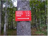 2
2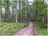 3
3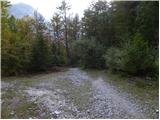 4
4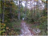 5
5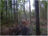 6
6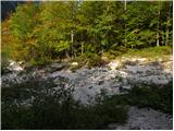 7
7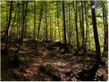 8
8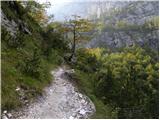 9
9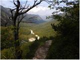 10
10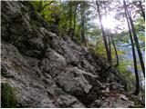 11
11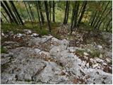 12
12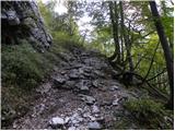 13
13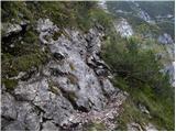 14
14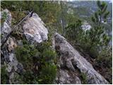 15
15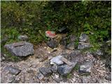 16
16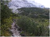 17
17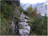 18
18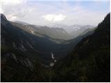 19
19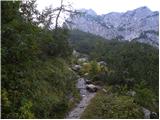 20
20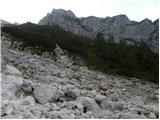 21
21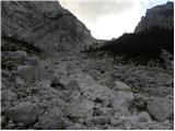 22
22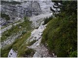 23
23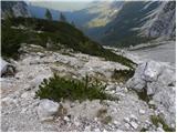 24
24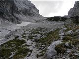 25
25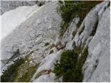 26
26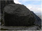 27
27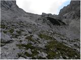 28
28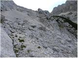 29
29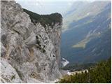 30
30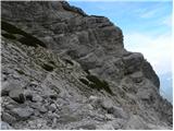 31
31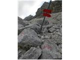 32
32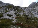 33
33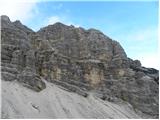 34
34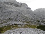 35
35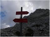 36
36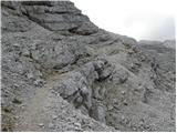 37
37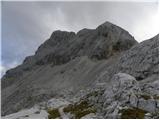 38
38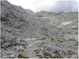 39
39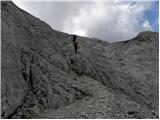 40
40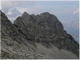 41
41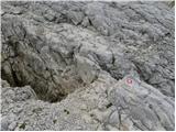 42
42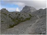 43
43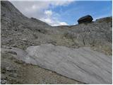 44
44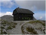 45
45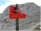 46
46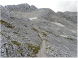 47
47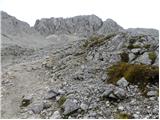 48
48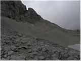 49
49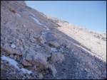 50
50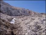 51
51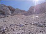 52
52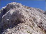 53
53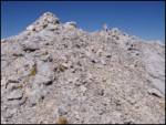 54
54
Discussion about the trip Dolina Kot - Rž
|
| Gost17. 08. 2007 |
I would go only to Koča pri Staniču. I'm interested if the path from Dolina Kot to Koča pri Staniču is exposed anywhere.
Thanks for the answer.
|
|
|
|
| Gost29. 08. 2007 |
You have some unnecessary cables. The path is nice.
|
|
|
|
| hribi31. 08. 2007 |
Thanks for the encouragement, I'll definitely go next opportunity
|
|
|
|
| bo_zl10. 08. 2019 |
Rightfully neglected mountain, which is 18th among the highest Slovenian peaks. Orientation doesn't cause problems. Views from the top are magnificent. Good choice for those who like peace.
|
|
|
|
| tango21. 09. 2020 |
Despite not the most promising weather forecast, my wife and I decided to conquer Rž. The approach over scree, i.e. when we turn left from the Staničev dom-Kredarica path, is concretely steep, on the ridge we were greeted by really dense fog and we turned back, practically at the summit, and for consolation jumped to Visoka Vrbanova špica, which was still in the sun. Back to Kot the path under Debeli kamen, after crossing the stream bed, was extremely slippery and we spent more time descending than ascending, and to finish, it properly soaked us from the spring to the car. Still, a great day!
|
|
|
To post a comment you must log in:
If you do not yet have a username, you must first
register.