Starting point: The Krma Valley (930 m)
Starting point Lat/Lon: 46.3851°N 13.9071°E 
Time of walking: 2 h 50 min
Difficulty: difficult marked way
Difficulty of skiing: more demanding
Altitude difference: 1035 m
Altitude difference (by path): 1065 m
Map: TNP 1:50.000
Access to starting point:
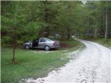
We leave Gorenjska highway at exit Hrušica and follow the road ahead in the direction of Kranjska Gora. Just a little before the village Dovje the road which goes to Mojstrana (Vrata, Kot and Krma) branches off to the left. We follow the road ahead in the direction of village Radovna and the valleys Krma and Kot. The relatively steep road then runs past the sign TNP, behind which the road soon flattens and it brings us to a crossroad, where a macadam road into a valley Kot branches off to the right. We continue straight on the road which starts descending. In the middle of the descent, a road into a valley Krma branches off to the right (straight Radovna). A little further, we come to the next crossing, where we continue right in the direction of Krma. Macadam road then brings us to the mountain hut Kovinarska koča, and we follow it further. Occasionally a little rough road then brings us to a parking lot in front of the gate.
Path description:
Already about 50m before the parking lot a marked path on Lipanca branches off to the left upwards. We go on the path which after the initial three minutes gentle walk starts to ascend steeply. After few minutes of walking, the path brings us below a cliff on which we notice a sign, that the path on which we will be ascending was built in the year 1952. The path ahead is steeply ascending through the forest to a little more demanding passage, where we get help from iron spikes, less steep stairs and a steel cable (undemanding). The path then brings us into dwarf pines and ahead we follow it to a mighty torrent gully. To the gully at first we descend a little and on the other side, we diagonally ascend on a steep slope. The passage gully is after heavy rains difficult or even not possible, but because the slopes are steep water quickly drains. The path ahead is then ascending through the forest, still steep upwards. The path is getting closer and closer to the steep slopes and rocky cliffs. When the forest becomes quite thinner path ascends even steeper. The path for a short time becomes so steep, that we have to use the hands a little. This part is in wet dangerous for slipping, in dry it doesn't pose a greater risk. The path then brings us below the steep rocky cliff, where mainly in spring time there is a high risk of falling stones. Crossing below the cliffs we make almost horizontal, after that the path ascends again. Again there's a steel cable for help (undemanding), which brings us on grassy slopes. Further, we again cross to falling stones exposed slopes and soon after that, we come on a less steep part of the path. Further, we are ascending on an increasingly panoramic path mostly among dwarf pines and thin forest to a crossing, where we go right in the direction of Mrežce and Lipanski vrh (left Brda and Debela peč). The path then in a gentle ascent crosses scree below the cliffs of unnamed peak and after few minutes brings us on a ridge, where we are again at the crossing. We continue right on a ridge, where we notice a sign for Lipanski vrh. The path is then mostly ascending among dwarf pines on the more and more steep upper slope of Lipanski vrh, which we reach without any bigger problems.
From Lipanski vrh we continue on a secured ridge in the direction of Mrežce. The path with the help of fixed safety gear runs on a ridge downwards to the notch between Lipanski vrh and Mrežce. Follows few steps of descent, and then with the help of fixed safety gear on undemanding upper slope we ascend to the summit.
Pictures:
 1
1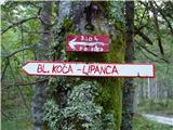 2
2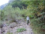 3
3 4
4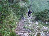 5
5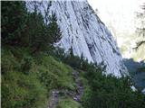 6
6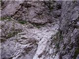 7
7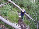 8
8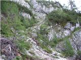 9
9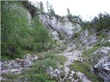 10
10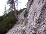 11
11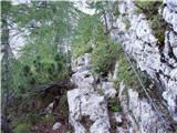 12
12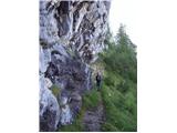 13
13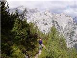 14
14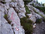 15
15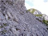 16
16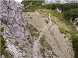 17
17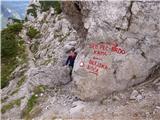 18
18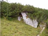 19
19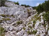 20
20 21
21 22
22 23
23 24
24