Tolminske Ravne - Vrh Krnic (on mule track and over Globoko)
Starting point: Tolminske Ravne (924 m)
Starting point Lat/Lon: 46.2294°N 13.7715°E 
Path name: on mule track and over Globoko
Time of walking: 4 h 10 min
Difficulty: easy marked way, easy unmarked way
Difficulty of skiing: no data
Altitude difference: 972 m
Altitude difference (by path): 1060 m
Map: TNP 1:50.000
Access to starting point:
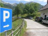
We drive to Tolmin, then continue driving in the direction of Žabče and Zadlaz (the turn-off from the main road is located on the left bank of the Tolminka). When we arrive in Žabče, at the smaller crossroads we continue slightly to the right in the direction of the settlement Zadlaz. In the settlement Zadlaz-Žabče the road temporarily descends, crossing Zadlaščica over a bridge, then it again starts to ascend steeply on a narrow but all the time asphalted road. After approximately 12 km from the main road we arrive at the marked parking lot in Tolminske Ravne, where we park.
Path description:
From the parking lot, we head onto the path in the direction of the Koča na planini Razor mountain hut and Planina na Kalu mountain pasture. Initially we walk along a cart track continuing from the nearby house, leading us across a panoramic meadow. On the other side of the meadow we cross a grazing fence and the path takes us to a marked junction, where we continue along the lower right cart track (slightly left to Planina na Kalu).
Further on we walk along the cart track, which descends slightly to the right, then levels out and continues for a few minutes without major changes in elevation. After a concrete trough the path splits once again, and we choose the lower gentle path (slightly left steep path), which continues along a wide cart track. A little further ahead, after crossing a grazing fence, the cart track turns into a mule track, from which we soon go slightly left onto a marked footpath that cuts a longer bend of the mule track. After a few minutes of ascent we return to the mule track, reaching it just at a small junction. We choose the upper right path, which ascends diagonally to the right and soon turns sharply left. Further on we ascend gently to moderately along the mule track, which leads us diagonally to the left, gradually transitioning to fairly steep slopes where the passage is not demanding as the path is consistently quite wide. When the higher slope flattens, the mule track turns slightly right and brings us out of the forest onto the southwestern part of Planina Razor. From here follows a short moderate ascent and the path brings us to the cheese cottage and about a minute further to the Koča na planini Razor mountain hut.
From the hut we continue in the direction of Globoko, Vogel, Vrh nad Škrbino... along the path that crosses a strip of forest, then splits on a gentle grassy slope.
From the junction we continue right (straight to Vrh nad Škrbino and Dom na Komni) and begin to ascend moderately. The path soon returns to the forest and brings us to the next junction.
From the junction we continue left in the direction of Globoko (slightly right Vogel) along the path that quickly takes us out of the forest. Once out of the forest we ascend along a mule track that initially occasionally leads through strips of scrub or dwarf pines, then gradually transitions to steeper, mostly grassy slopes. Ahead the path ascends moderately in a few zigzags, then follows a somewhat longer diagonal ascent to the right. Here the slope gradually becomes steeper, and the path, continuing along the mule track, brings us higher to an old concrete bunker, a little further to a small emergency bivouac containing a few benches. From the bivouac follows a few minutes of panoramic ascent, then we reach the main ridge of the Spodnje Bohinjske gore at the Globoko saddle.
From Globoko we descend to the Bohinj side along a path well arranged with logs, so the descent causes no difficulties, and a little lower a steel cable assists (easy). After a few minutes of descent we arrive at a marked junction, where we continue right in the direction of Vogel (left to Konjsko sedlo and Komna, straight down we can descend into Žagarjev graben or to Planina Zadnji Vogel).
After the junction we descend diagonally across an initially steep slope, then the path leads us diagonally to the left. Behind a small saddle, we descend in a few steps to the next junction, where we continue right uphill along the path to Vogel (straight to Vogel ski area, Šija...). Follows a short somewhat steeper ascent, then another path from the Vogel ski area joins from the left. Here too we continue right, then in a few steps we step back onto the ridge of the Spodnje Bohinjske gore, where we again continue right along an unmarked path towards Vrh Krnic (left to Vogel 10 minutes).
From the junction follows a short ascent along a technically undemanding ridge and the path brings us to the panoramic Vrh Krnic.
Tolminske Ravne - Planina Razor 1:45, Planina Razor - Globoko 1:45, Globoko - Vrh Krnic 40 minutes.
Description and pictures refer to the condition in 2016 (July).
Pictures:
 1
1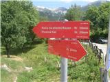 2
2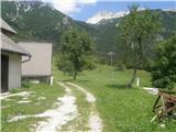 3
3 4
4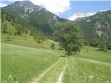 5
5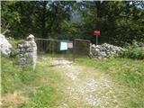 6
6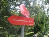 7
7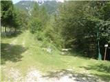 8
8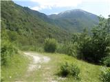 9
9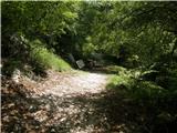 10
10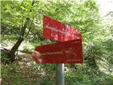 11
11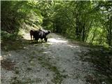 12
12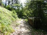 13
13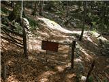 14
14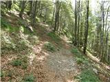 15
15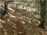 16
16 17
17 18
18 19
19 20
20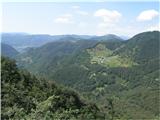 21
21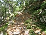 22
22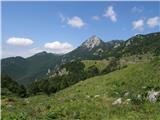 23
23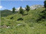 24
24 25
25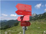 26
26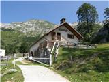 27
27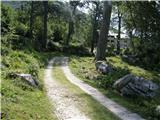 28
28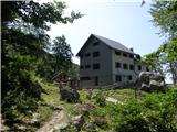 29
29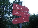 30
30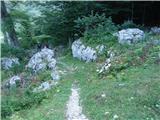 31
31 32
32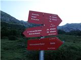 33
33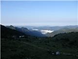 34
34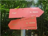 35
35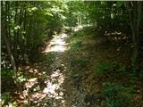 36
36 37
37 38
38 39
39 40
40 41
41 42
42 43
43 44
44 45
45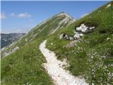 46
46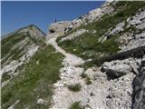 47
47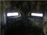 48
48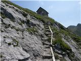 49
49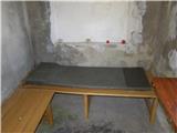 50
50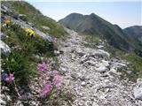 51
51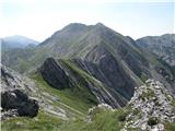 52
52 53
53 54
54 55
55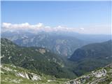 56
56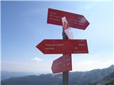 57
57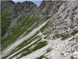 58
58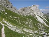 59
59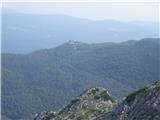 60
60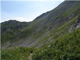 61
61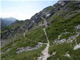 62
62 63
63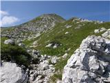 64
64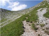 65
65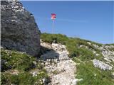 66
66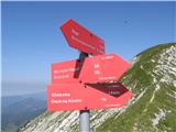 67
67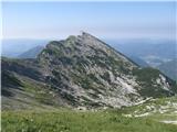 68
68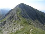 69
69 70
70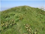 71
71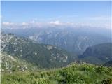 72
72