Tolminske Ravne - Vrh nad Peski
Starting point: Tolminske Ravne (924 m)
Starting point Lat/Lon: 46.2294°N 13.7715°E 
Time of walking: 6 h 10 min
Difficulty: difficult marked way, easy unmarked way
Difficulty of skiing: no data
Altitude difference: 1252 m
Altitude difference (by path): 1525 m
Map: TNP 1:50.000
Access to starting point:
We drive to Tolmin, and then we continue driving in the direction of Žabče and Zadlaz (turn-off from the main road is located on the left bank of Tolminka). When we get to Žabče, at the smaller crossroad we continue slightly right in the direction of the settlement Zadlaz. In the settlement Zadlaz-Žabče the road for some time descends, where we over a bridge crosses Zadlaščica, and then again starts ascending steeply on narrow, but all the time asphalt road. After approximately 12 km from the main road we get to the marked parking lot in Tolminske Ravne, where we park.
Path description:
From the parking lot, we return few steps back to red mountain signposts, which we follow in the direction of the mountain hut Koča na planini Razor and mountain pasture Planina Kal. The path ahead at first leads over a grazing fence, and then we continue on a cart track which continues through a meadow, and from there a nice view opens up on Tolminski Migovec. Cart track soon turns right and it brings us to a rocky fence, where it splits into two parts.
We continue on the left upper cart track in the direction of the mountain pasture Planina na Kalu (slightly right mountain hut Koča na planini Razor), which is then ascending gently. A little higher, at the older water storage we continue right, and then we cross a torrent. We soon reach the next crossing, where the path branches off to the right towards Škrbina, and we continue on the left cart track, following the signs for mountain pasture Kal and Tolminski Migovec.
An old mule track further for some time continues by or a little right from the nearby torrent, and then at the smaller cairn from a mule track, the path which continues by a torrent branches off slightly to the left and leads further towards the saddle between the peak Javor on the left and Grušnica on the right, and we still stick to mule track.
Higher, we reach the next marked crossing, where another path branches off to the right towards the mountain pasture Razor, and we continue left and we short time continue in only gentle ascent. A minute or two ahead we leave the gentle path and we continue slightly right in the direction of the mountain pasture Planina na Kalu (straight we get to the before mentioned saddle, from which we can continue on Javor or in the village Čadrg, and meanwhile there is another turn-off towards the mountain pasture Planina na Kalu). After a shorter little steeper ascent we return on a mule track, where we also join the path from Čadrga.
We continue right and we are ascending on a mule track all the way to the mountain pasture Planina na Kalu, where right from a small saddle stand some old cottages.
At the cottages, where another path from mountain pasture Razor joins, we slightly ascend and quickly reach a marked crossing, where the path branches off to the right to Tolminski Migovec. We continue left in the direction of Prehodci and Krn, and further walk on a mule track. The path becomes less steep and heads north, offering a nice view of the Tolminka valley from the path. The path then leads us to steeper slopes on the southwest side of Tolminski Kuk, where fixed safety gear is available at some spots for assistance. The fixed safety gear ends, and the path brings us to the chapel of the Mother of God Hud Klanec, beside which there is a bench. From here, there is a breathtaking view of the Tolmin valley and the peaks above it. At the chapel, there is also an inscription box and a stamp.
From the chapel, the slope becomes slightly less steep, and the path mostly descends gently, crossing slopes covered with dwarf pines towards the northwest. Later, the path descends more noticeably in longer zig-zags and leads through a lane of forest. Just before mountain pasture Dobrenjščica, we reach a crossing.
At the crossing, we continue straight on a marked path, where signs direct us to Prehodci and Krn. To the left, an unmarked mule track leads downward to the nearby mountain pasture Dobrenjščica. Our path descends slightly on a steeper slope, and for a short section, we are assisted by a steel cable. This path soon rejoins the mule track, which passes by mountain pasture Dobrenjščica.
Further, we cross slopes again, and the path passes a crossing where a path branches off to the left downward to the nearby spring Čaramonka. We continue crossing slopes, with dwarf pines and short lanes of forest alternating along the path. When we reach steeper slopes on the southwest side of Mahavšček, the path begins to ascend more steeply. Occasionally, the slope is very steep, and steel cables are provided for assistance at some spots. The path generally follows a relatively wide mule track, so the ascent does not pose significant challenges. Higher up, the slope becomes less steep, and the path briefly passes through a lane of forest before continuing mostly alongside dwarf pines. This path leads us to a marked crossing, where a path branches off to the right towards Dom na Komni.
We continue left towards Prehodci, and from the crossing, the path initially ascends more steeply for a short time. Further, the path becomes less steep and continues mostly alongside dwarf pines all the way to Prehodci, where there is a marked crossing.
We continue straight in the direction of Krn (left to mountain pasture Polog) and proceed on a gently sloping, scenic path. A little further from the right joins another path from the lake Krnsko jezero, and we still continue in the same direction. The path ahead from the plateau terrain again brings us on a steep east slopes, from which a nice view opens up on Tolmin side (area is called Na Tminskem). After that, the path turns a little to the right and gradually brings us in smaller high mountain valley. Here it starts ascending steeper and after approximately 20 minutes of additional walking brings us to a large monument to fallen in the 1st world war.
Here we continue right on a marked path, which ascends diagonally by the foot of Mali Peski. Higher, the path brings us to numerous remains of the 1st world war, and then it slightly ascends and brings us on a small saddle between Mali Peski and Vrh nad Peski (and a little more to the right are Veliki Peski). We continue on a marked path, from which soon unmarked path branches off to the right on Vrh nad Peski (direction "V. Peski"). The path ahead in few minutes ascends on a smaller grassy saddle, and then continues on the more and more panoramic and occasionally also quite steep path. This panoramic and relatively steep path, we then follow all the way to the top of Vrh nad Peski, and we reach it after few minutes of additional walking.
Tolminske Ravne - Planina na Kalu 1:30, Planina na Kalu - Planina Dobrenjščica 1:30, Planina Dobrenjščica - Prehodci 1:30, Prehodci - Vrh nad Peski 1:40.
Pictures:
 1
1 2
2 3
3 4
4 5
5 6
6 7
7 8
8 9
9 10
10 11
11 12
12 13
13 14
14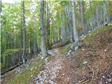 15
15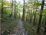 16
16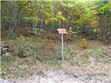 17
17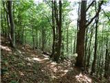 18
18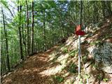 19
19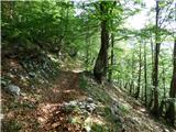 20
20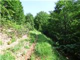 21
21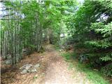 22
22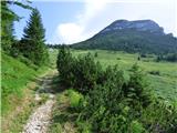 23
23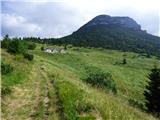 24
24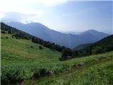 25
25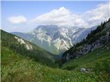 26
26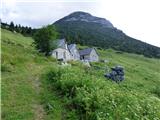 27
27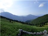 28
28 29
29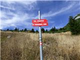 30
30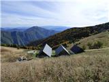 31
31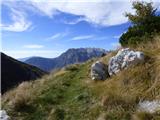 32
32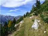 33
33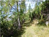 34
34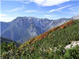 35
35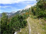 36
36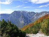 37
37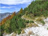 38
38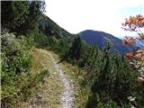 39
39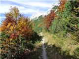 40
40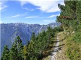 41
41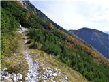 42
42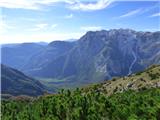 43
43 44
44 45
45 46
46 47
47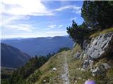 48
48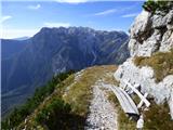 49
49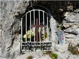 50
50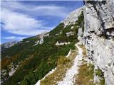 51
51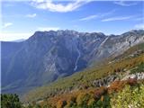 52
52 53
53 54
54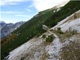 55
55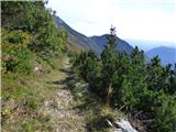 56
56 57
57 58
58 59
59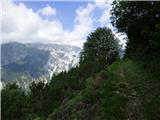 60
60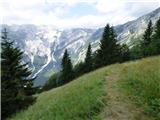 61
61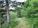 62
62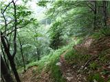 63
63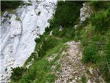 64
64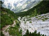 65
65 66
66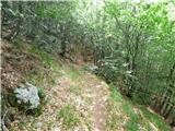 67
67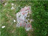 68
68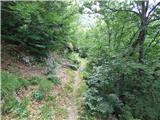 69
69 70
70 71
71 72
72 73
73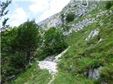 74
74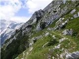 75
75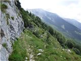 76
76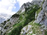 77
77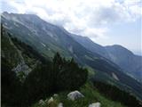 78
78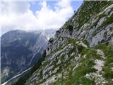 79
79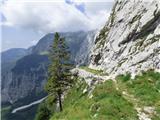 80
80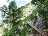 81
81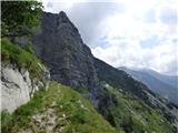 82
82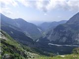 83
83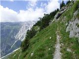 84
84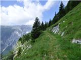 85
85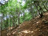 86
86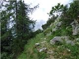 87
87 88
88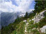 89
89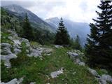 90
90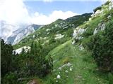 91
91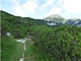 92
92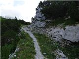 93
93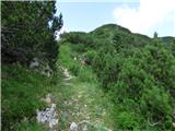 94
94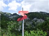 95
95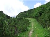 96
96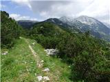 97
97 98
98 99
99 100
100 101
101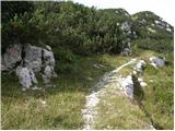 102
102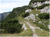 103
103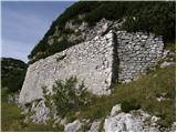 104
104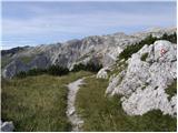 105
105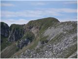 106
106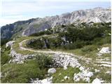 107
107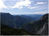 108
108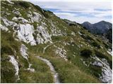 109
109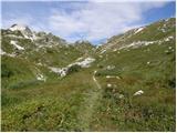 110
110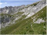 111
111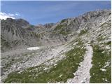 112
112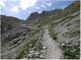 113
113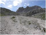 114
114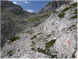 115
115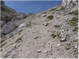 116
116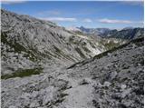 117
117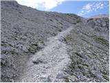 118
118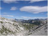 119
119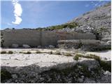 120
120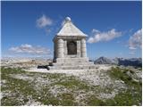 121
121 122
122 123
123 124
124 125
125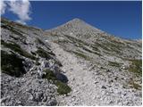 126
126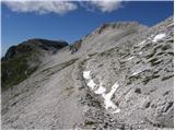 127
127 128
128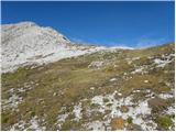 129
129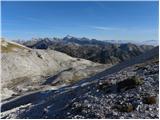 130
130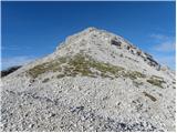 131
131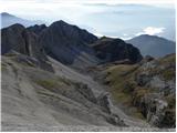 132
132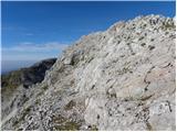 133
133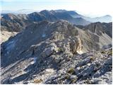 134
134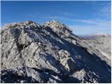 135
135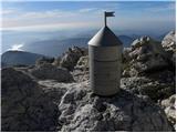 136
136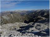 137
137