Tolminske Ravne - Žabiški Kuk (on mule track)
Starting point: Tolminske Ravne (924 m)
Starting point Lat/Lon: 46.2294°N 13.7715°E 
Path name: on mule track
Time of walking: 3 h 45 min
Difficulty: easy unmarked way
Difficulty of skiing: no data
Altitude difference: 920 m
Altitude difference (by path): 970 m
Map: TNP 1:50.000
Access to starting point:
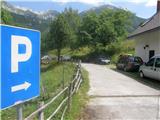
We drive to Tolmin, and then we continue driving in the direction of Žabče and Zadlaz (turn-off from the main road is located on the left bank of Tolminka). When we get to Žabče, at the smaller crossroad we continue slightly right in the direction of the settlement Zadlaz. In the settlement Zadlaz-Žabče the road for some time descends, where we over a bridge crosses Zadlaščica, and then again starts ascending steeply on narrow, but all the time asphalt road. After approximately 12 km from the main road we get to the marked parking lot in Tolminske Ravne, where we park.
Path description:
From the parking lot, we go on the path in the direction of the mountain hut Koča na planini Razor and mountain pasture Planina na Kalu. At first, we walk on a cart track which continues from the nearby house and leads us through a panoramic meadow. On the other side of the meadow, we cross a grazing fence and the path brings us to a marked crossing, where we continue on the lower right cart track (slightly left mountain pasture Planina na Kalu).
Further, we walk on a cart track which is slightly descending towards the right, and then it flattens and few minutes continues without large changes in altitude. After concrete trough path once again splits, and we choose the bottom gentle path (slightly left steep path), which continues on a wide cart track. A little further, after the crossing of grazing fence, cart track changes into a mule track, and from there we soon go slightly left, on a marked footpath which cuts a longer turn of a mule track. After few minutes of the ascent, we return on a mule track, which we reach right at the smaller crossing. We choose the upper right path, which is diagonally ascending towards the right, and soon turns sharply to the left. Further, we are gently to moderately ascending on a mule track, which leads us diagonally towards the left, and gradually passes on pretty steep slopes, where passage isn't demanding, because the path is all the time pretty wide. When higher slope flattens, mule track turns a little to the right and brings us out of the forest on the southwest part of the mountain pasture Razor. From here follows a short moderate ascent and the path brings us to cheese cottage and about a minute ahead also to the mountain hut Koča na planini Razor.
From the mountain hut, we continue in the direction of Globoko, Vogel, Vrh nad Škrbino on the path which crosses a lane of a forest and then on a gentle grassy slope splits.
From the crossing, we continue right (straight Vrh nad Škrbino and Dom na Komni) and we start moderately ascending. The path quickly returns into the forest and it brings us to the next crossing.
Again we continue right in the direction of Vogel (left Globoko) and gradually we start ascending steeper. We quickly leave the forest and then we start ascending on a gradually steeper slope. With nice views on Tolminsko, we higher reach southwest broad ridge of Vrh Krnic, where the path for some time flattens and it turns left. The path ahead is ascending diagonally and leads us above Krnica and on slopes of Vrh Krnic. After the crossing of smaller valley, where unmarked footpath branches off to the left, which leads on the saddle between the mentioned peak and Vogel, the path passes on slopes of Vogel, where it ascends diagonally on a steep slope. Higher, we reach the ridge of Vogel, and we continue right on an unmarked footpath which in few steps descends to the saddle between Vogel and Žabiški Kuk. The path ahead for some time leads on the ridge of Žabiški Kuk, after that when ridge becomes precipitous, the footpath avoids it on the right side. Further, we are ascending diagonally on a footpath, where at orientation we get help from cairns. Higher, we bypass on the right side a bigger cave, which is situated just by the ridge and behind it on the left is located survey point 1881, which is the highest point of the ridge of Žabiški Kuk, and a peak is situated a little further at an altitude 1844 meters. After the survey point 1881 the path which bypasses the highest point, returns on the ridge and there on occasionally exposed ridge we continue moderate descent to the top at an altitude 1844 meters.
Tolminske Ravne - Planina Razor 1:45, Planina Razor - Žabiški Kuk 2:00.
Description and pictures refer to a condition in the year 2016 (July).
Trip can be extended to: Vogel
Pictures:
 1
1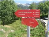 2
2 3
3 4
4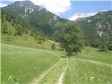 5
5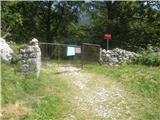 6
6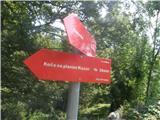 7
7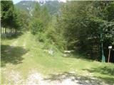 8
8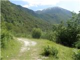 9
9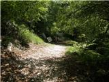 10
10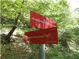 11
11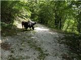 12
12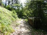 13
13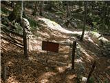 14
14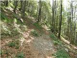 15
15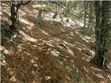 16
16 17
17 18
18 19
19 20
20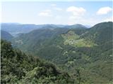 21
21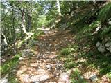 22
22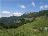 23
23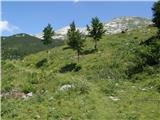 24
24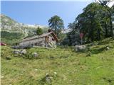 25
25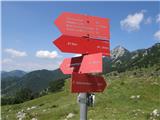 26
26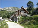 27
27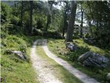 28
28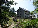 29
29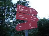 30
30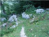 31
31 32
32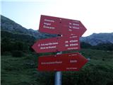 33
33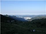 34
34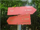 35
35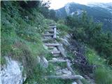 36
36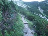 37
37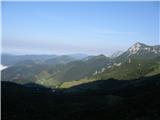 38
38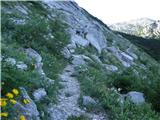 39
39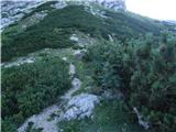 40
40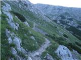 41
41 42
42 43
43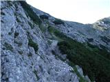 44
44 45
45 46
46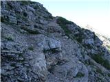 47
47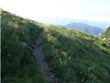 48
48 49
49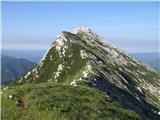 50
50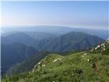 51
51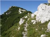 52
52 53
53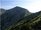 54
54 55
55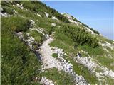 56
56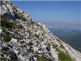 57
57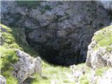 58
58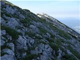 59
59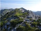 60
60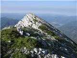 61
61 62
62 63
63 64
64 65
65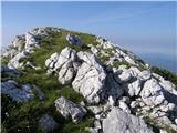 66
66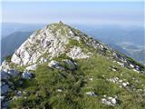 67
67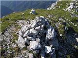 68
68 69
69