Travna Gora - Koča na Kamnem griču
Starting point: Travna Gora (950 m)
Starting point Lat/Lon: 45.7361°N 14.6442°E 
Time of walking: 45 min
Difficulty: easy marked way
Difficulty of skiing: easily
Altitude difference: 66 m
Altitude difference (by path): 140 m
Map:
Access to starting point:
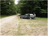
We drive on a regional road from Ljubljana towards Kočevje or vice versa. At the village Žlebič we will notice signs for Nova Štifta and Sodražica, which point us to the right (and from Kočevje and Ribnica left). Ahead we drive to the village Lipovščica, where a sign for Nova Štifta points us left upwards on an ascending road. The road then quickly brings us to Nova Štifta, where we notice signs for Travna Gora. Further, we are ascending on a macadam road which higher brings us to the mentioned village. We continue driving in the direction of the mountain hut on Travna Gora, from where we continue on the right road which soon brings us to the parking lot near the signposts (second footpath, at first one are only blazes and caption on a tree, and at the second footpath are also signposts. Starting points are to each other distant approx. 500m).
To the starting point, we can get to also from the direction of road Hrib-Loški Potok - Sodražica. From the mentioned road, from marked turn off is to the mountain hut Dom na Travni Gori approximately 5 km of the macadam.
Path description:
From the parking lot, we go on the path in the direction of the mountain hut Koča na Kamnem griču. The path is at first ascending on gentle and usually quite muddy cart track which already after few minutes steeply ascends. When the steepness decreases we come on badly marked crossing, where we continue right. We continue walking on wider, but poorly marked cart track which after a short descent changes into a macadam road, and it quickly brings us to the next crossing. We continue left on a worse macadam road in the direction of Kamni grič. On smaller turning point the road changes into a cart track, and here we continue straight (badly marked) on a pleasant cart track which out of the forest brings us on nice grassy slopes. On the other side of the meadow, we come at the marked crossing, where we continue right in the direction of the mountain hut, to which we have 5 more minutes of ascent on a moderately steep cart track which is ascending over earlier mentioned meadow.
Pictures:
 1
1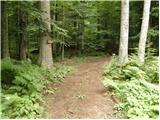 2
2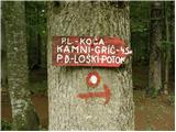 3
3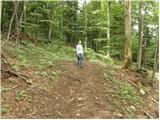 4
4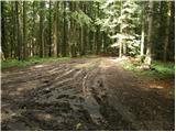 5
5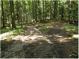 6
6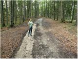 7
7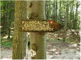 8
8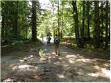 9
9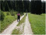 10
10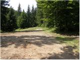 11
11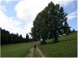 12
12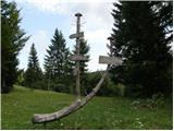 13
13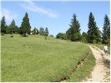 14
14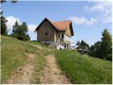 15
15 16
16