Trdkova - Tromejnik / Dreiländerecke / Harmashatar (Ježkova pot - by road)
Starting point: Trdkova (288 m)
Starting point Lat/Lon: 46.8621°N 16.1116°E 
Path name: Ježkova pot - by road
Time of walking: 20 min
Difficulty: easy marked way
Difficulty of skiing: no data
Altitude difference: 102 m
Altitude difference (by path): 102 m
Map:
Access to starting point:
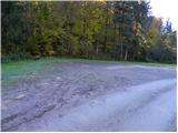
From Pomurska highway we go to the exit Murska Sobota, and then we continue driving towards the border crossing Hodoš. In the settlement Gornji Petrovci we continue left in the direction of the settlement Kuzma. Further, we drive through the village Šulinci, Ženavlje and some other villages, and we follow the road to the beginning of the village Martinje (on signposts - Martinje Trdkova). Here only few 10 meters before the beginning of the village we notice signs for Tromejnik, which point us to the right, on the road on which we quickly get to the village Trdkova. The road then moderately ascends and it brings us to a crossroad by which we notice signs for Tromejnik left and right. We decide for the left road which starts descending steeply. The road then flattens and after few 100 meters of additional driving brings us to the next crossroad, where we continue right (direction Tromejnik). Further, we drive on a gently sloping macadam road which we follow to a marked parking lot at the information boards for Tromejnik.
Path description:
From the parking lot at the tourist log cabin, we continue on the macadam road which is for a short time still ascending gently, and then it brings us to another larger parking lot, after which the road starts ascending steeply. We continue in the direction of Tromejnik and we continue the ascent on a worse road which is steeply ascending through the forest. The path by which we notice numerous learning information boards, higher flattens and turns a little towards the right, where we quickly get to a smaller crossing.
We continue sharply left and we follow a gradually steeper road or cart track to the top of Tromejnik, and we reach it after few minutes of additional walking through the forest.
Pictures:
 1
1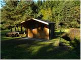 2
2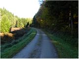 3
3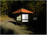 4
4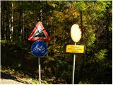 5
5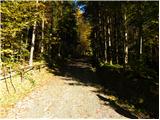 6
6 7
7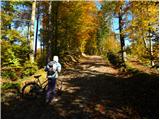 8
8 9
9 10
10 11
11 12
12 13
13 14
14 15
15 16
16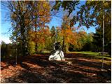 17
17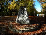 18
18