Učja - Monte Guarda/Skutnik
Starting point: Učja (655 m)
Starting point Lat/Lon: 46.3069°N 13.4014°E 
Time of walking: 3 h 45 min
Difficulty: easy marked way
Difficulty of skiing: no data
Altitude difference: 1066 m
Altitude difference (by path): 1066 m
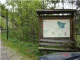
Map: Julijske Alpe - zahodni del 1:50.000
Access to starting point:
From the Tolmin direction we drive through Kobarid towards Bovec. In the village Žaga we turn left towards the border crossing Učja. Approximately 300 meters from the Italian hut of the former border crossing we turn right into the village. In the middle of the village we turn sharply right on the road which brings us to the little church. We can park the car there or on one of the lay-bys by the road.
Path description:
The Mt. Guarda sign (Italian path marking is 733) we notice around 150 meters before the little church on the left. There the footpath starts, which leads us past several older houses and in a few minutes brings us into a young forest. We continue on the well-marked path through mature forest, where a wooden cross stands, and a little later the path also crosses a steel rope (remnant of the cableway for hauling wood).
After a good hour and a half of walking through the forest we come to the northern side of Kal (1297 m). The grassy slope of our ridge presents itself to us, below it the idyllic mountain pasture Kal. The path leads slightly downwards and then ascends again, with the difference that now trees do not surround us. The good mule track rises quite gently along the steep ridge, until we come to the top of the ridge. There a board with signs awaits us. From here to the top of Skutnik it is only another 25 minutes of walking on the varied ridge. On the summit there is a logbook and a metal cross.
Pictures:
 1
1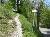 2
2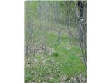 3
3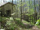 4
4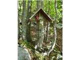 5
5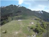 6
6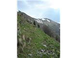 7
7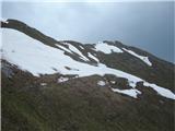 8
8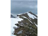 9
9 10
10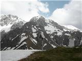 11
11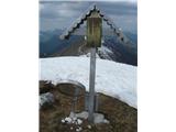 12
12 13
13