Ukova (Jesenice) - Mirca (via Pekova plan'ca)
Starting point: Ukova (Jesenice) (600 m)
Starting point Lat/Lon: 46.4362°N 14.0468°E 
Path name: via Pekova plan'ca
Time of walking: 1 h 20 min
Difficulty: easy unmarked way
Difficulty of skiing: partly demanding
Altitude difference: 425 m
Altitude difference (by path): 425 m
Map: Karavanke - osrednji del 1 : 50.000
Access to starting point:
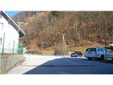
From highway Ljubljana - Jesenice we go to the exit Lipce (Jesenice east), where we turn right towards Jesenice. At the first crossroad with traffic lights on Slovenski Javornik we turn left towards the center of the town. In the second traffic light crossroad (at the secondary school) we turn sharply right back on the road Tomšičeva cesta, past the primary school on the left. Behind the school we drive past pedestrian crossing and we immediately turn in first (narrower) street on the left. When we ascend there for few 10 meters, on the right we see marked parking lot - our starting point.
Path description:
From the parking lot, we continue on the road uphill. After few 10 meters on the left we notice swimming area Ukova, and on the right road which branches off uphill towards the north in the forest.
We go there, and we follow it short time, i.e. to the right turn, in front of which on the same side there is fenced water catchment. On other - left side we step on the path which cuts double turn of the road which we left. Here we also run into the first blaze. We quite quickly again cross the road, and we step on the path which starts ascending towards the north. After a little higher it turns left, it joins the cart track, where we get to a signpost "Pristava Jelenkamen". We cross the cart track and we continue by the left side of the signpost, on a short logging trail, uphill towards the west. Here on the trees we notice the first blazes (path Čez sedem grabnov), which we don't follow, but we cross the marked path and the logging trail, which are ascending slightly to the right, and we ascend on a forest slope at the left side of the logging trail. From here further we will by our path on the trunks of the trees notice a lot of marks (white lines), which are quite frequent all over the hillside, so we don't let them get confused. We continue on a steeper hill on the path which a little higher turns left and it brings us on a less steep terrain. Here the path is vanishing, and we go immediately right through the forest uphill, where higher, after few minutes of an ascent we get to a logging trail. We go right and we walk on a logging trail for a short time, to its crossing at the beginning of mostly spruce forest, where we continue left. Terrain flattens, and among spruces we soon get to the remains of cottage made of bark (so-called) "kožar'ca" (currently covered by blue polyvinyl). This, from the south side partly grassy plain in the middle of the forest locals call "Pekova plan'ca". From the remains of the cottage we continue left towards the south, to the edge of the slope, from where we can partly see into the valley and towards Mežakla. Here we turn right, and we continue towards north-west, on a pleasant path by the edge of the slope. Soon from the left joins the path from the valley, and we continue straight. After this path through the forest in an arc turns slightly to the right and a little higher brings us to a somewhat steeper ascent, where it continues to more or less run along the edge of the southwestern slope of the hill. Higher, on a grassy part, a view opens up slightly towards the Julian Alps with Triglav, and by the path, we also come across an improvised bench, where we can rest. Only a little higher, the path moves away from the edge, turns slightly to the right, and for a short time crosses the southeastern slope towards the north. Before it brings us to the eastern, more shady slope, the path turns almost perpendicularly left towards the summit (straight or slightly left - a barely noticeable transverse path on the steep eastern slope). A little higher, the path again brings us to the southwestern edge of the hill, where a view opens up slightly towards the valley and Mežakla on the left, and a few meters from the path also towards Golica, Krvavka, and Črni vrh on the right. After a few minutes of moderate ascent along the path by the edge, it brings us to the summit of Mirca, where we come across a cairn. A partial view into the valley and towards the Ljubljana Basin can be enjoyed about 20 meters before the destination, near the spot where a slightly larger beech tree grows by the steep edge on the left. Only a few meters left of this, and just as much lower, a view of the Ljubljana Basin is offered on the steep slope.
Pictures:
 1
1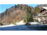 2
2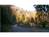 3
3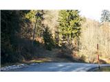 4
4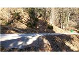 5
5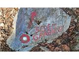 6
6 7
7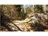 8
8 9
9 10
10 11
11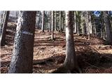 12
12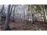 13
13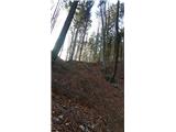 14
14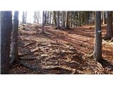 15
15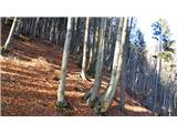 16
16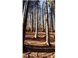 17
17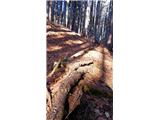 18
18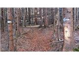 19
19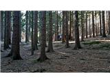 20
20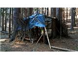 21
21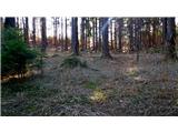 22
22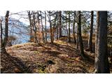 23
23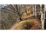 24
24 25
25 26
26 27
27 28
28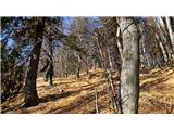 29
29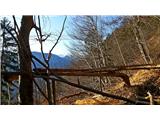 30
30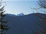 31
31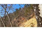 32
32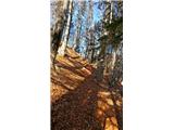 33
33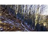 34
34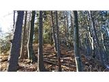 35
35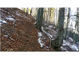 36
36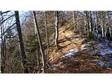 37
37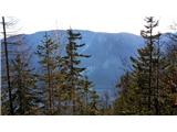 38
38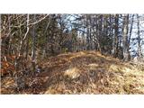 39
39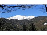 40
40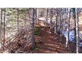 41
41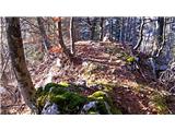 42
42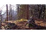 43
43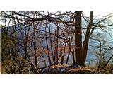 44
44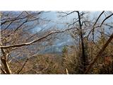 45
45 46
46