Unternberg - Schöberlriegel (via Kampstein)
Starting point: Unternberg (825 m)
Starting point Lat/Lon: 47.57888°N 16.01951°E 
Path name: via Kampstein
Time of walking: 4 h 20 min
Difficulty: easy unmarked way
Difficulty of skiing: no data
Altitude difference: 879 m
Altitude difference (by path): 985 m
Map:
Access to starting point:
Leave the A2 motorway Graz - Vienna / Wien at the Aspang Markt exit and follow the road to the mentioned place. When we arrive in the town, we follow the signs for the Mariensee settlement, at the end of the town we go straight towards St. Corona am Wechsel. Further on, we begin to climb more steeply, but we follow the road to the Unternberg settlement, where we park at the parking lot next to the Familienskiland St. Corona am Wechsel ski area.
Path description:
From the parking lot, we return slightly back through the settlement, then go right towards the west, initially passing a few more houses. Soon we reach the ski slope trail, where numerous downhill bike paths run in the summer months. On this section, carefully follow the hiking trail signs, and extra caution is needed when crossing the tracks. Higher up, follow the signs to the Kampstein summit and Herrgottschnitzerhütte hut, after a while we leave the ski area, and at junctions continue following the signs to the Herrgottschnitzerhütte hut. When the path levels out higher up, it is just a few minutes' walk to the Herrgottschnitzerhütte hut.
Before the hut, go right in the direction of Gipfelkreuz and Kampsteinerschwaig and return to the forest. Through the forest we climb moderately, at a few junctions follow the markers, in the last part of the ascent the path levels out even more and we follow the easy path all the way to the indistinct summit. At the highest point of the summit there is a thermometer, a minute further on there are also a few benches and a cross.
The path continues westwards and begins to descend moderately. A few minutes lower we reach the edge of a pasture, from where we have a nice view of the highest peaks of the Wechsel range. A little further the forest ends and after an easy grassy section we quickly reach the Kampsteiner Schwaig hut.
We bypass the hut on the left side and follow the signs for Hochwechsel, the path ahead first climbs gently through a grassy area surrounded by sparse forest. When the path returns to the forest, we bypass the Frauenalpe summit on the right side and begin descending towards the west. Lower down the path stops descending, and when we start ascending again we reach a junction at the Schwarzer Herrgot cross, from where we continue left towards Feistritzer Schwaig (straight to Arabichl).
This is followed by about 15 minutes of gentle ascent to the left and the cart track leads us to the Feistritzer Schwaig alpine pasture.
We bypass the buildings on the right side and continue walking along the easy cart track, from which another path soon branches off to the right towards the Arabichl summit, but we continue straight and enter the forest. A few minutes further, after a short easy descent, we reach a gravel road which we start ascending, the path leading along the upper edge of the forest. We follow the path that crosses the slopes to the left in a gentle ascent to the junction at the Dreiländereck saddle, from where we head left towards the Hochwechsel summit and the Mönichkirchen settlement (here a path joins from the right that goes over the Arabichl summit and is somewhat longer than ours, as well as the path starting from the Feistritzsattel pass) and begin traversing upwards, such a path brings us after a few minutes to an unmarked junction, where we continue along the slightly right unmarked path (slightly left leads the marked path to Hochwechsel), which continues through a belt of young spruce forest. A little further we go transversely right from the grassy path, so that we continue walking again among the spruces, the forest begins to thin out. The followable but unmarked path then brings us in a few minutes of further walking to an indistinct summit, where a larger cairn stands.
Starting point - Herrgottschnitzerhütte am Wechsel 1:30, Herrgottschnitzerhütte am Wechsel - Kampstein 0:30, Kampstein - Kampsteiner Schwaig 0:15, Kampsteiner Schwaig - Schwarzer Herrgot 0:45, Schwarzer Herrgot - Feistritzer Schwaig 0:15, Feistritzer Schwaig - Schöberlriegel 1:05.
Description and photos refer to the conditions in September 2023 and November 2025.
Pictures:
 1
1 2
2 3
3 4
4 5
5 6
6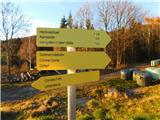 7
7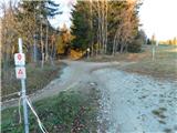 8
8 9
9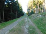 10
10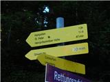 11
11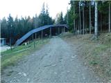 12
12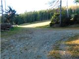 13
13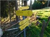 14
14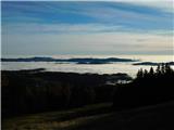 15
15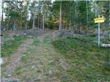 16
16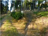 17
17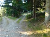 18
18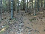 19
19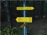 20
20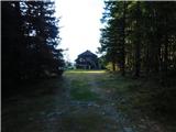 21
21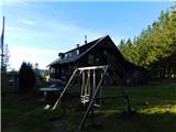 22
22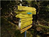 23
23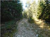 24
24 25
25 26
26 27
27 28
28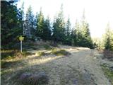 29
29 30
30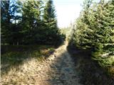 31
31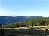 32
32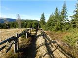 33
33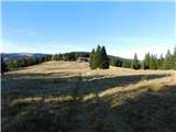 34
34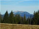 35
35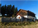 36
36 37
37 38
38 39
39 40
40 41
41 42
42 43
43 44
44 45
45 46
46 47
47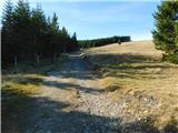 48
48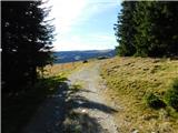 49
49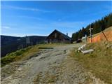 50
50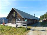 51
51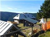 52
52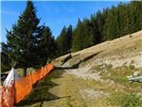 53
53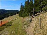 54
54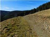 55
55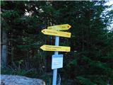 56
56 57
57 58
58 59
59 60
60 61
61 62
62 63
63 64
64 65
65 66
66 67
67 68
68 69
69 70
70 71
71